6.4 km away
Elk Mountain Trail
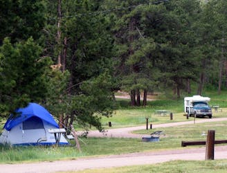
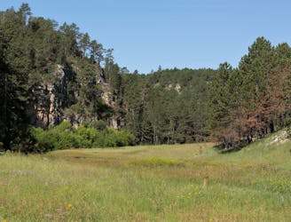
A short, dog-friendly hike around the campground where the towering ponderosa pine meet the lush grasslands.
Easy Hiking
- Distance
- 1.3 km
- Ascent
- 40 m
- Descent
- 40 m
Wander through a mature ponderosa pine forest and enjoy breathtaking views from the park's highest point.
Hiking Easy

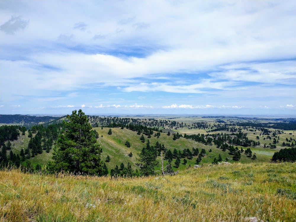
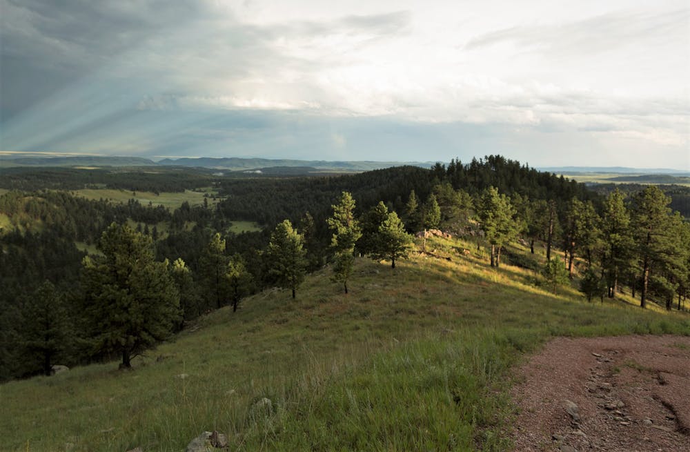
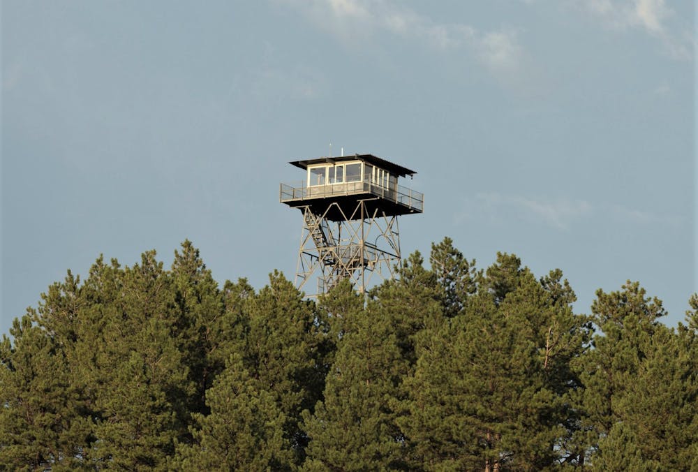
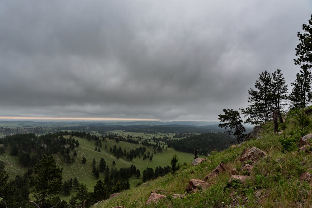
Rankin Ridge is a spectacular short hike to the highest point in Wind Cave NP. The park describes it as an excellent option for families, "or those with little time to explore," and a historic fire tower rests atop the hill, though it has since been closed to the public. After a gentle climb through a stand of mature ponderosa pine, the trail meets the tower, and you'll be awarded breathtaking views reaching as far as Buffalo Gap National Grassland, and even the Badlands on a clear day.
The trailhead for Rankin Ridge is quite small, and there are no facilities. RVs and trailers are also not allowed since there is no room to turn around. If you are in a larger vehicle, the nearby Prairie Vista Trail behind the campground may be a better option. A small overflow lot is also available along the main road, though that will add about 1/4-mile each way to your hike.
According to this source, the fire tower was constructed in 1956 and is just over 50' tall. "The large cab atop it was built as a live-in structure, meaning lookouts used it as a dwelling when on duty," he continues. A short, printed guide is available at the visitor center, should you want to learn more about this specific trail, including its ecology, wildlife, and history.
Easy
Walking along a well-kept trail that’s mostly flat. No obstacles are present.

The trail contains some obstacles such as outcroppings and rock which could cause injury.

Close to help in case of emergency.
6.4 km away
A short, dog-friendly hike around the campground where the towering ponderosa pine meet the lush grasslands.
Easy Hiking
7.1 km away
An easy family-friendly hike through the grasslands along Wind Cave's visitor center.
Easy Hiking
7.7 km away

An easy hike on an old dirt road shouldered by limestone cliffs and ponderosa pine, and known for its birding opportunities.
Easy Hiking
9.8 km away
An out-and-back family-friendly hike popular for birdwatching.
Moderate Hiking

5 routes · Hiking

63 routes · Alpine Climbing · Hiking