3.8 km away
Arbor Hills
A family-friendly hike circling the Outer Loop to the main Lookout Tower in Arbor Hills.
Moderate Hiking
- Distance
- 3.6 km
- Ascent
- 45 m
- Descent
- 45 m
A great greenway loop in Plano.
Hiking Easy

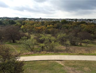
The Legacy Trail is a paved greenway trail in Plano, Texas, just north of Dallas. This scenic path runs through a greenbelt along White Rock Creek, providing a welcome dose of nature in an otherwise suburban landscape.

One of the best places to park a car and access the trail is Windhaven Meadows Park. The route shown here begins on the Legacy Trail and creates a clockwise loop by utilizing the Preston Ridge Trail and Bluebonnet Trail. Unfortunately, there is a short section of the loop that follows roads, but the vast majority of it is on non-motorized greenway trails.
While these greenways are very popular with road bikers, they also provide a great spot for a peaceful walk or run without having to worry about vehicle traffic.
Easy
Walking along a well-kept trail that’s mostly flat. No obstacles are present.

The path is on completely flat land and potential injury is limited to falling over.
Close to help in case of emergency.
3.8 km away
A family-friendly hike circling the Outer Loop to the main Lookout Tower in Arbor Hills.
Moderate Hiking

8 routes · Hiking