1 m away
Permian Reef
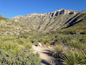
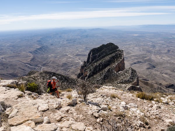
An absolutely stunning hike high above McKittrick Canyon.
Difficult Hiking
- Distance
- 12 km
- Ascent
- 700 m
- Descent
- 700 m
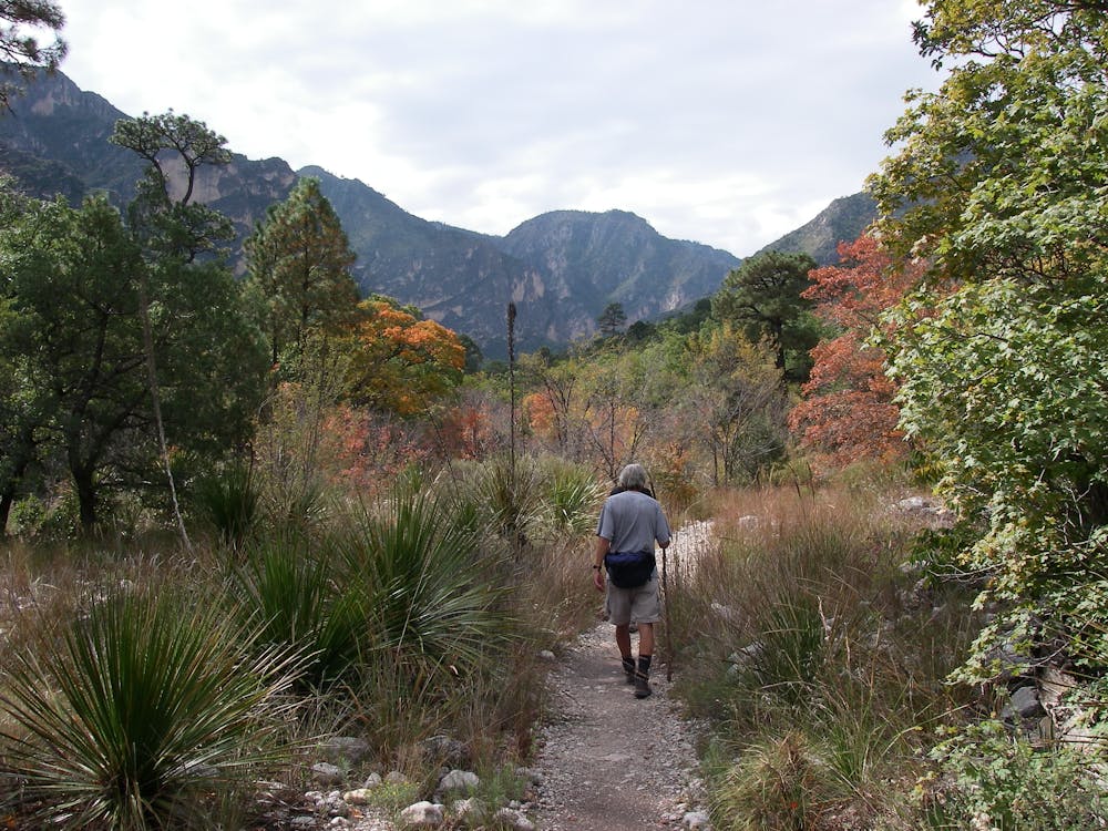
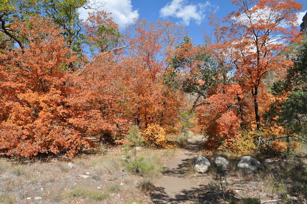
An out-and-back hike on the McKittrick Canyon Trail to "The Notch," a stunning overlook.
Hiking Difficult

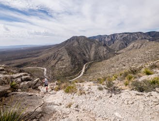
This hike to McKittrick Ridge is one of the most epic undertakings in the Guadalupe Mountains. It is also one of the most versatile hikes in the park, since there are multiple landmarks that could serve as the destination for your hike. As mapped, the destination for this route is a campground on the ridge, but be sure to obtain the appropriate backcountry camping permits before you hit the trail. Other day trip destinations include the historic Pratt Cabin (4.8 miles round-trip), Grotto (6.8 miles round-trip), and Notch (9.9 miles round-trip).
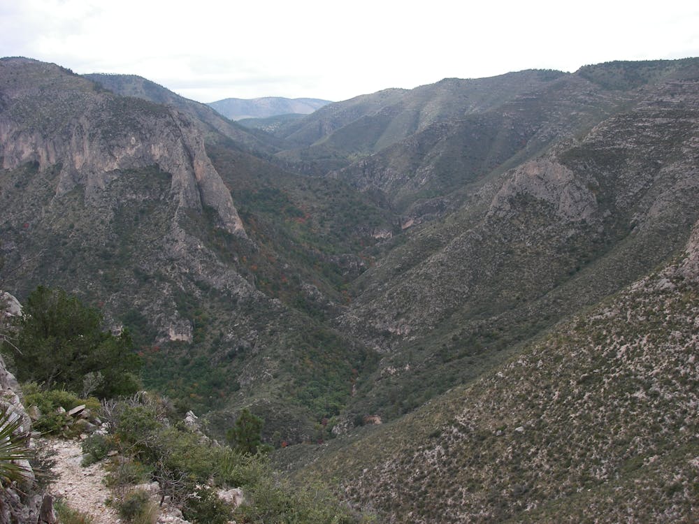
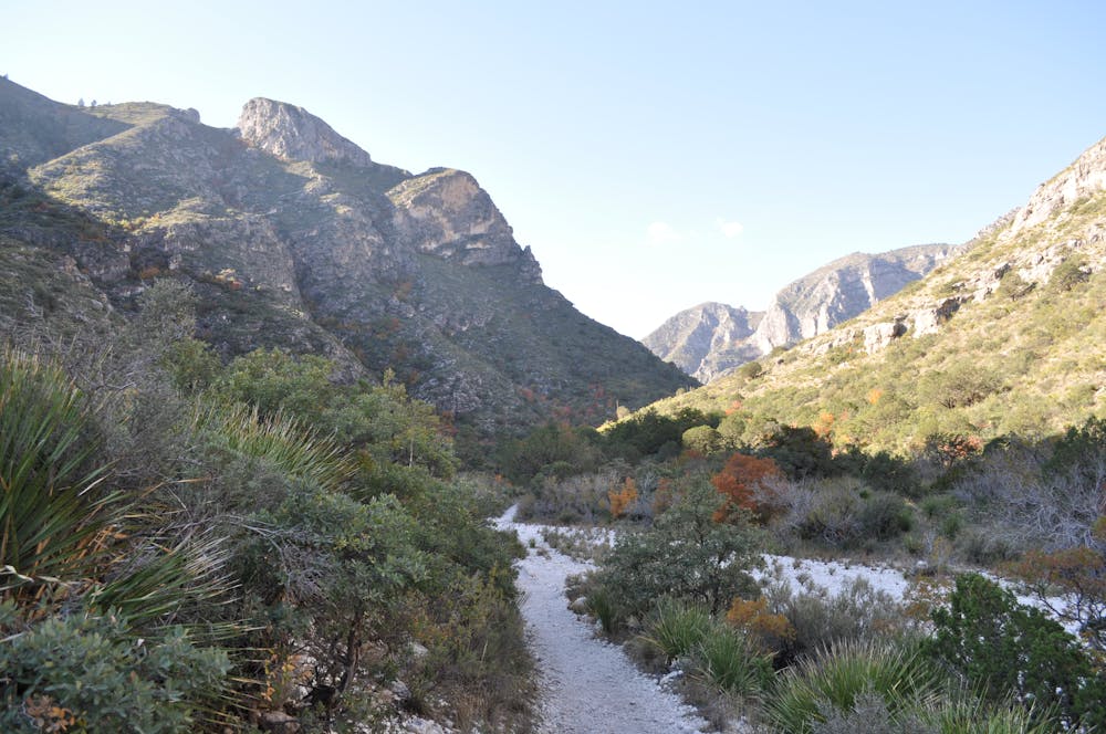
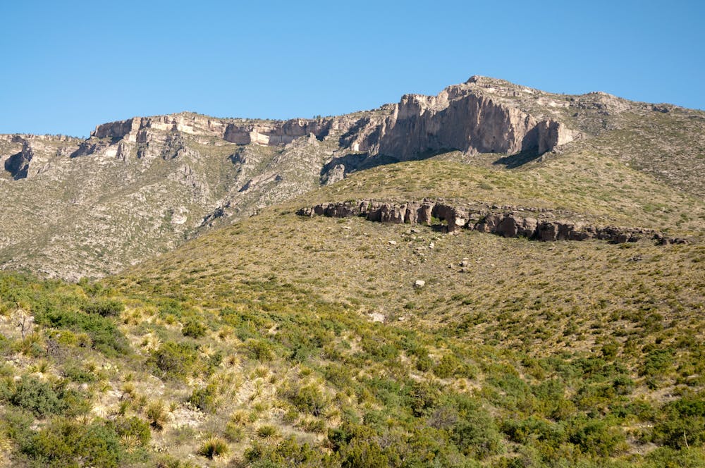
If you continue to the end of this mapped route, you will be standing at nearly 7,800' at the McKittrick Ridge Backcountry Campground. From the trailhead, you will climb nearly 2,700' over a distance of 7.6 miles, a challenging but rewarding endeavor should have the endurance. With proper planning, you could also plan a point-to-point to either Dog Canyon or Pine Springs, which would require you to stage a vehicle at one of the other trailheads.
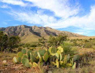
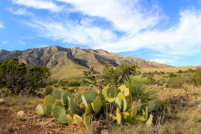
For a shorter, family-friendly hike highlighting the ecology and desert plant life of the Permian Reef, consider the McKittrick Nature Trail instead. This short 1-mile hike is easy-to-moderate, and can be completed in less than an hour.
For more detailed information about the stops along this hike, check out this trail guide which offers a thorough history of both Pratt Cabin and the Grotto.
Difficult
Hiking trails where obstacles such as rocks or roots are prevalent. Some obstacles can require care to step over or around. At times, the trail can be worn and eroded. The grade of the trail is generally quite steep, and can often lead to strenuous hiking.

Some trail sections have exposed ledges or steep ascents/descents where falling could cause serious injury.
Little chance of being seen or helped in case of an accident.
1 m away
An absolutely stunning hike high above McKittrick Canyon.
Difficult Hiking
1 m away
A short hike highlighting local wildlife, plants, and geology.
Moderate Hiking
7.9 km away

An easy, short walk from the Dog Canyon Campground where you can "discover the plants and animals of a meadow in the secluded north section of the park."
Easy Hiking
9 km away
A short hike through a desert oasis with two stunning springs, a riparian woodland, and plenty of wildlife.
Moderate Hiking
10 routes · Hiking
4 routes · Hiking