1 m away
McKittrick Canyon Trail -> McKittrick Ridge Backcountry Campground
An out-and-back hike on the McKittrick Canyon Trail to "The Notch," a stunning overlook.
Difficult Hiking
- Distance
- 23 km
- Ascent
- 936 m
- Descent
- 936 m
An absolutely stunning hike high above McKittrick Canyon.
Hiking Difficult

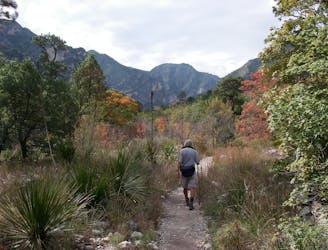
While the rest of the visitors to McKittrick Canyon are hiking the flat McKittrick Canyon Trail to the historic Pratt Cabin, the adventurous hiker will head up the Permian Reef Geology Trail!
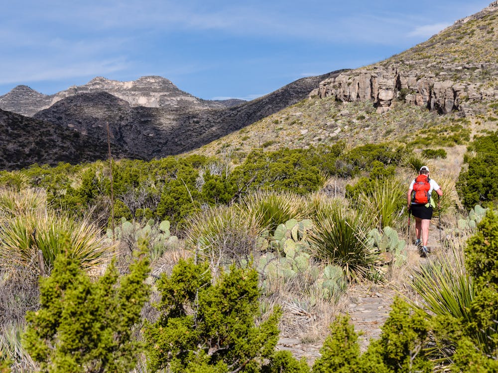
This gorgeous trail is known mostly to geology buffs, as it is marked with 28 numbered signs that correspond to geology information. Even if geology is not your thing, this route is highly recommended for its views and the trail clinging to steep canyon walls.
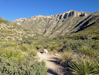
The hike begins directly behind the McKittrick Canyon Visitor Center, and immediately deviates from the other system trails. The early part of the trail climbs steadily upwards, providing expansive views of the canyon trails and the many hikers down below as they travel the massive wash. Seeing so many people on the McKittrick Canyon Trail makes the solitude of the Permian Reef Trail even more appreciated.
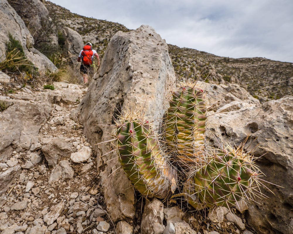
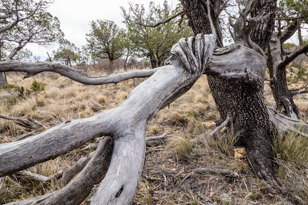
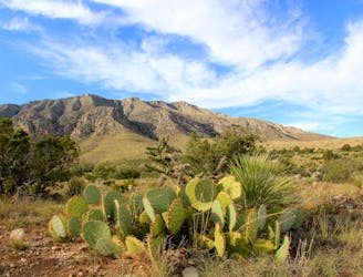
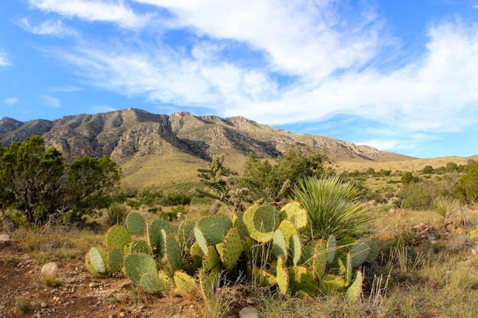
The Guadalupe Mountains area is known for its Alligator Junipers, which are named for their unique bark pattern. Be on the lookout for the various cacti along the trail; they are quite lovely.
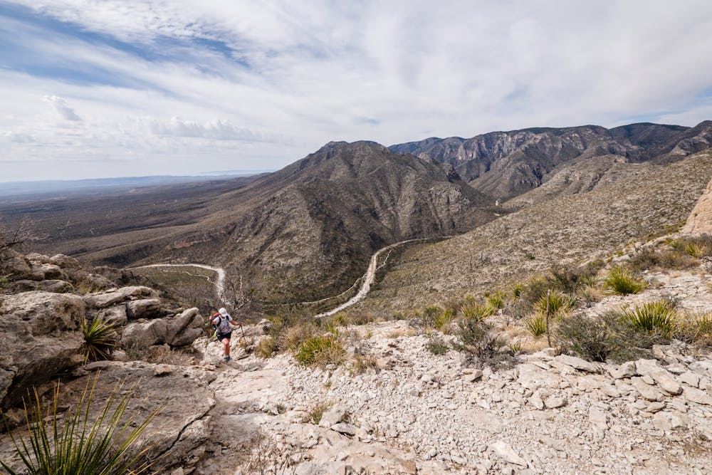
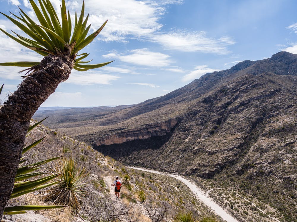
The views change every time the trail switchbacks and travels around yet another prominence. It is impossible to hike the Permian Reef Trail without being in awe of the trail designers and builders. Their work allows hikers to traverse precarious cliffsides in relative security. That being said, this is probably not the best route choice for those with a fear of heights!
The well-built trail and the distracting views make the 3.5-mile, 2,000' ascent feel quite easy. Soon, the trail tops out and the terrain flattens on Wilderness Ridge.
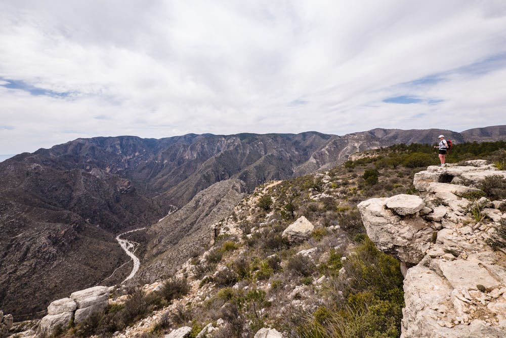
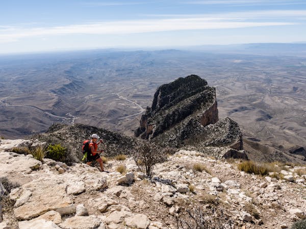
Once on top of the ridge, which is really a massive plateau, another 1.5 miles along the mostly flat top takes trekkers to an impressive overlook. It is definitely recommended to make this the destination before turning around to head back. Take some time to survey the vast lands below Wilderness Ridge from the overlook. If desired, another ½-mile will get you to the New Mexico-Texas border!
The Permian Reef trail begins behind the McKittrick Canyon Visitor Center, which is about 7 miles northeast of the Pine Springs Visitor Center on Hwy 62/180. The turnoff to McKittrick Canyon is signed; parking and the Visitor Center is 3.5 miles up the road. Important note: Access to the Visitor Center and trailhead is only possible between 8am and 6pm MST during Daylight Saving Time. Before and after, there is a locked gate at the highway intersection.
Difficult
Hiking trails where obstacles such as rocks or roots are prevalent. Some obstacles can require care to step over or around. At times, the trail can be worn and eroded. The grade of the trail is generally quite steep, and can often lead to strenuous hiking.

The trail contains some obstacles such as outcroppings and rock which could cause injury.
Away from help but easily accessed.
1 m away
An out-and-back hike on the McKittrick Canyon Trail to "The Notch," a stunning overlook.
Difficult Hiking
1 m away
A short hike highlighting local wildlife, plants, and geology.
Moderate Hiking
7.9 km away

An easy, short walk from the Dog Canyon Campground where you can "discover the plants and animals of a meadow in the secluded north section of the park."
Easy Hiking
9 km away
A short hike through a desert oasis with two stunning springs, a riparian woodland, and plenty of wildlife.
Moderate Hiking
10 routes · Hiking
4 routes · Hiking