1 m away
West Contrabando Trails: Dome Loop
A rough and rowdy loop through the West Contrabando trails.
Severe Mountain Biking
- Distance
- 18 km
- Ascent
- 276 m
- Descent
- 276 m
Rip down the longest descent in the West Contrabando trail system.
Mountain Biking Difficult

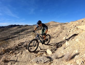
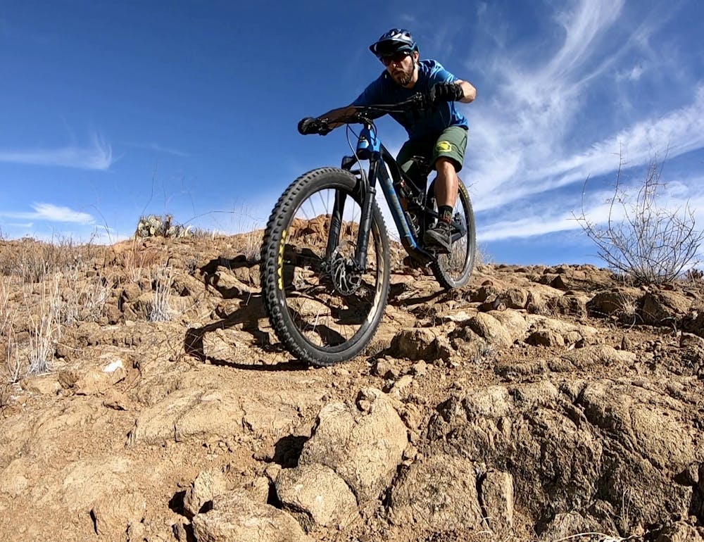
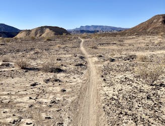
The West Contrabando trailhead offers direct access to arguably the best singletrack mountain bike trails in Big Bend. While you can reach these trails from the East Contrabando Trailhead as well, many people opt to begin at the West trailhead. While the singletrack trails here aren't as buff or as well-defined as what you might have come to expect from popular destinations such as Moab or Sedona, the desert beauty, rough rock gardens, and historic sites make for a fantastic desert mountain biking experience.
This loop through West Contrabando, finishing on the Fresno Divide Trail, is one of the best rides in the region. You'll negotiate some challenging, rocky singletrack, but it's not quite as burly as the Dome Loop (which is found in the interior of the Fresno Divide Loop). However, if you're looking for bonus miles, you can choose to pedal a double loop to hit Dome as well.
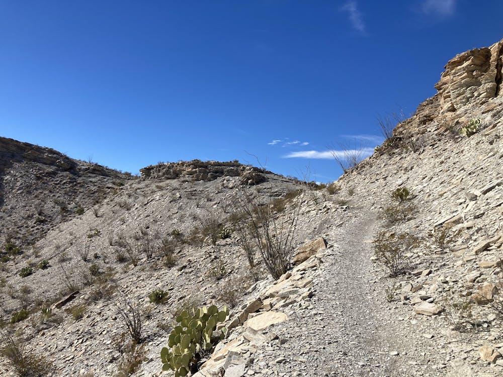
The ride begins on the West Main Trail. To reach it from the trailhead, drop down the dirt road to the gate, and take a right onto the trail. The singletrack here rolls up and down rocky arroyos through the Chihuahuan Desert. You'll cross some wide washes as you work your way to the east. Pass both of the turns for the Dome Trail and instead, take the right turn onto the Waterhole Trail.
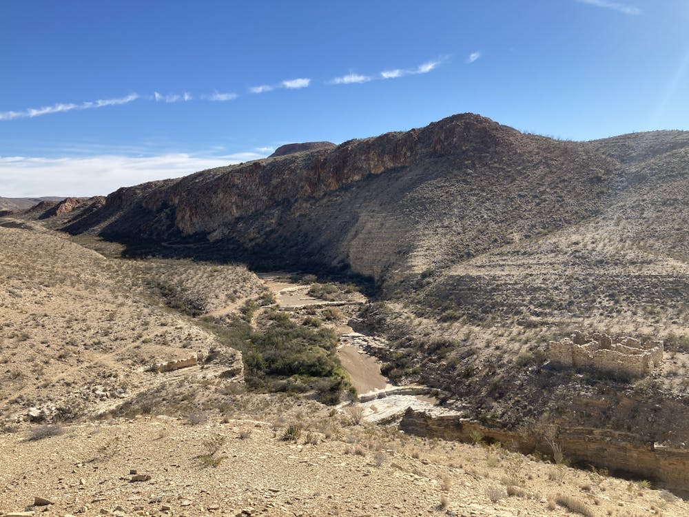
Near the turn onto the Waterhole Trail, you'll get to view an old ranch site situated at the watering hole. The stone walls of an old homestead still rise here today.
The route as mapped turns left onto Buena Suerte Road, passes the exit for the West Main Trail, and then turns left onto the Dome Trail, which leads to Fresno Divide.
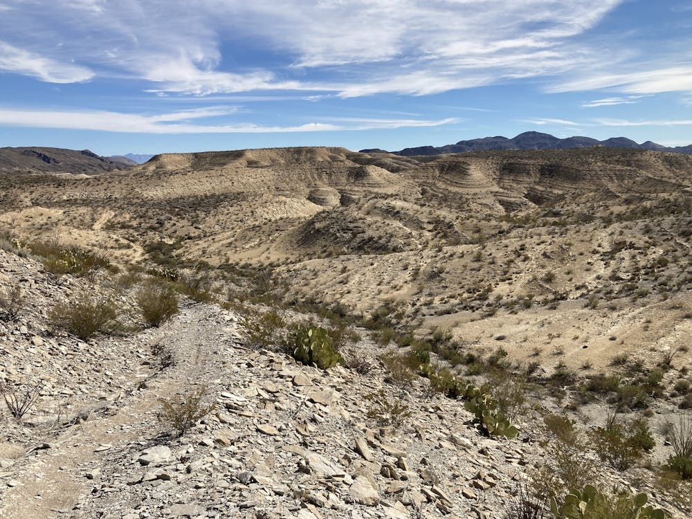
Fresno Divide gets its name from a low divide in the desert ridge which the trail crosses. You'll have to climb a short but steep hill to reach the top of the divide, but the views from here are spectacular! You'll enjoy vistas of the arid Chihuahuan desert spread out all around you. It's incredible how rocky and uninhabitable the area looks... and yet, life still finds a way.
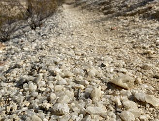
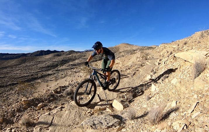
You're at the obvious high point in the trail system, so it's time to rip! The descent down Fresno Divide is long and on a moderate grade, but the trail tread is quite chundery. You won't find any dramatic technical obstacles, but the relentless small rocks and minor ledges are just downright rough. You'll appreciate all of the suspension that you brought with you.
When you can, take a moment to look up from the rough trail and enjoy the views unfolding around you. The vistas to the north and west from this section of trail are wide-open and expansive, providing a much different perspective than you had during the climb up.
Difficult
Mostly stable trail tread with some variability featuring larger and more unavoidable obstacles that may include, but not be limited to: bigger stones, roots, steps, and narrow curves. Compared to lower intermediate, technical difficulty is more advanced and grades of slopes are steeper. Ideal for upper intermediate riders.

The trail contains some obstacles such as outcroppings and rock which could cause injury.

Little chance of being seen or helped in case of an accident.
1 m away
A rough and rowdy loop through the West Contrabando trails.
Severe Mountain Biking
9.1 km away
Pedal flowy trails out to the historic Whit Roy Mine.
Moderate Mountain Biking
9.1 km away
"The Other Side of Nowhere" — a brutal, demanding loop running deep into the most remote corners of Big Bend Ranch State Park.
Severe Mountain Biking
5 routes · Mountain Biking