
10 routes · Alpine Climbing · Hiking
Mount Olympus is one of the most visible and well known peaks along the Wasatch Front.
Alpine Climbing Easy

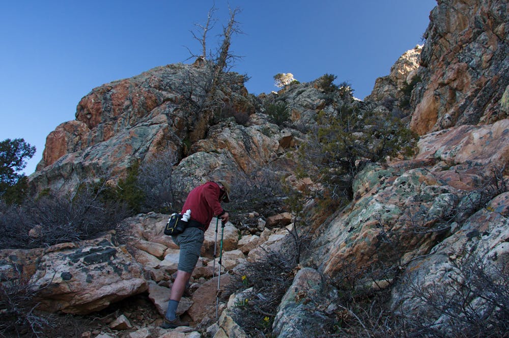
Hiking Mount Olympus is no easy task, the trail is one of the steepest around, it gains 4,000 feet in 4 miles. It is a well maintained trail right until the summit scramble.
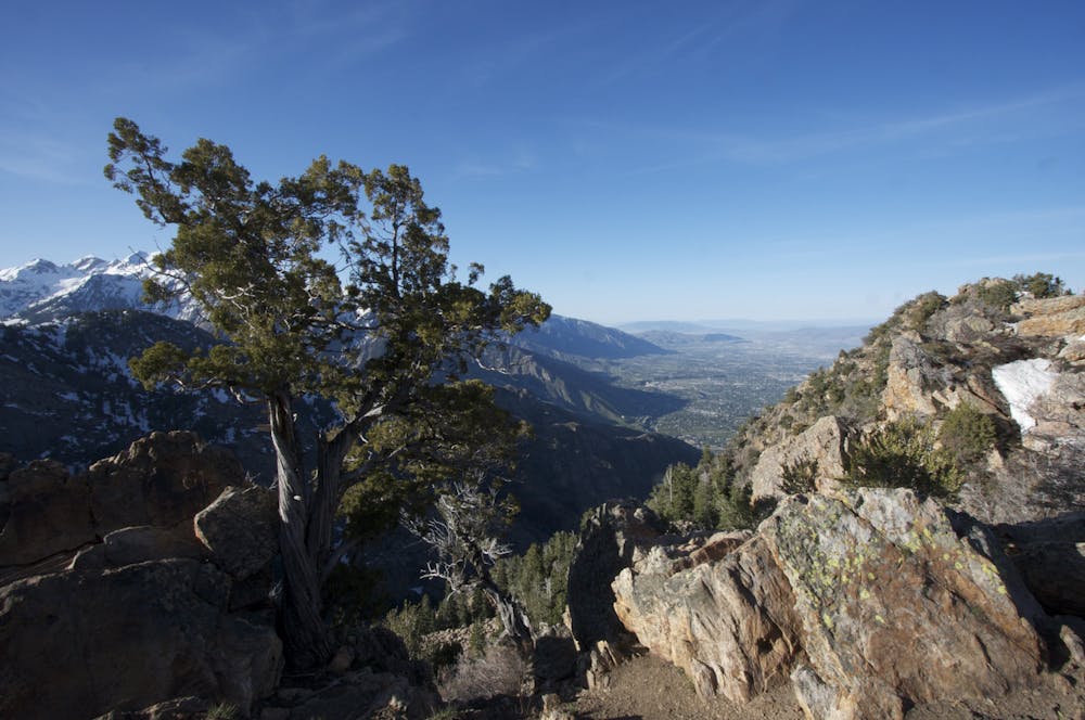
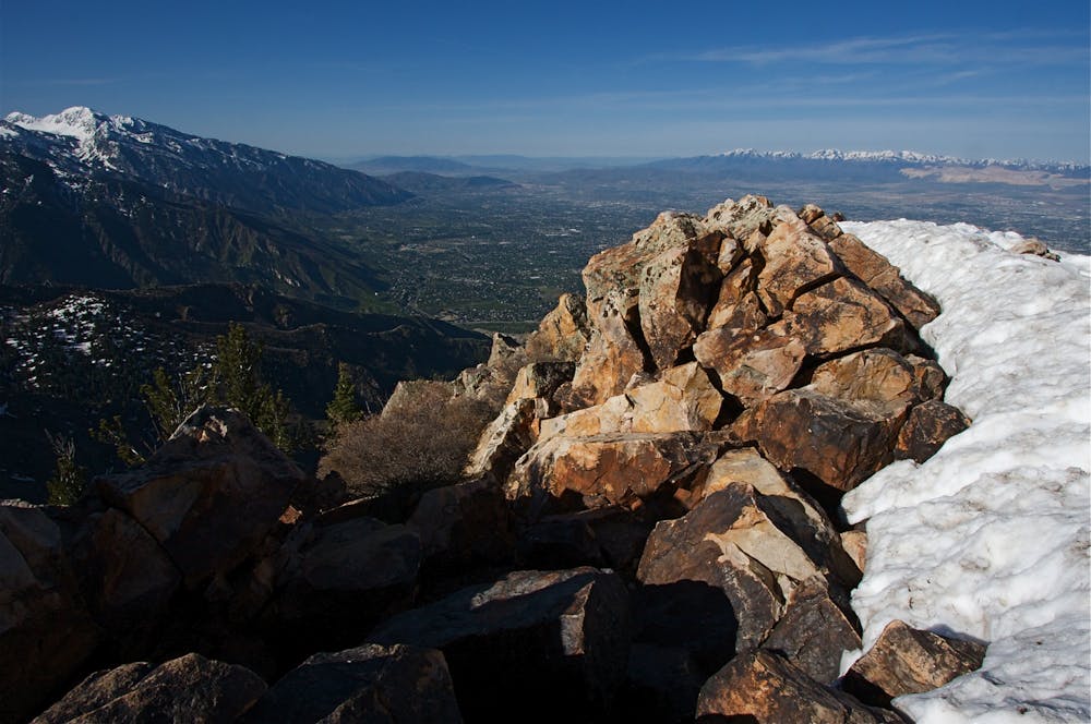
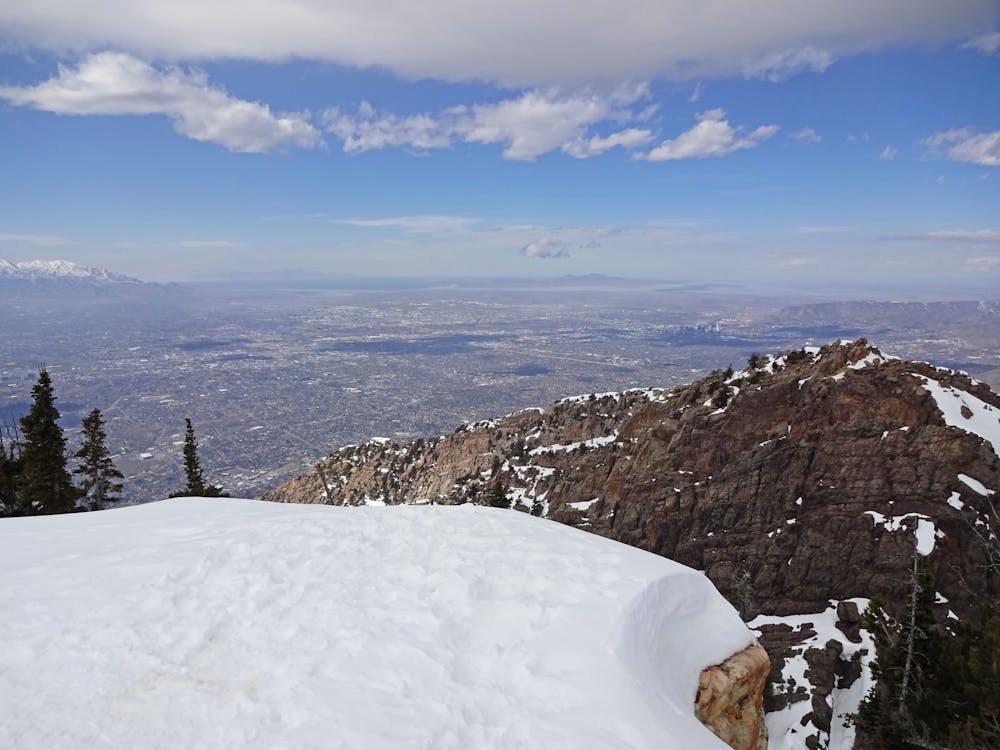
The trail is steep and strenuous and the final rock scramble to the summit puts a nice finish on one of the most difficult hikes in the range. However, the views from the summit more than make up for the effort when the entire Salt Lake Valley sits right under your feet.
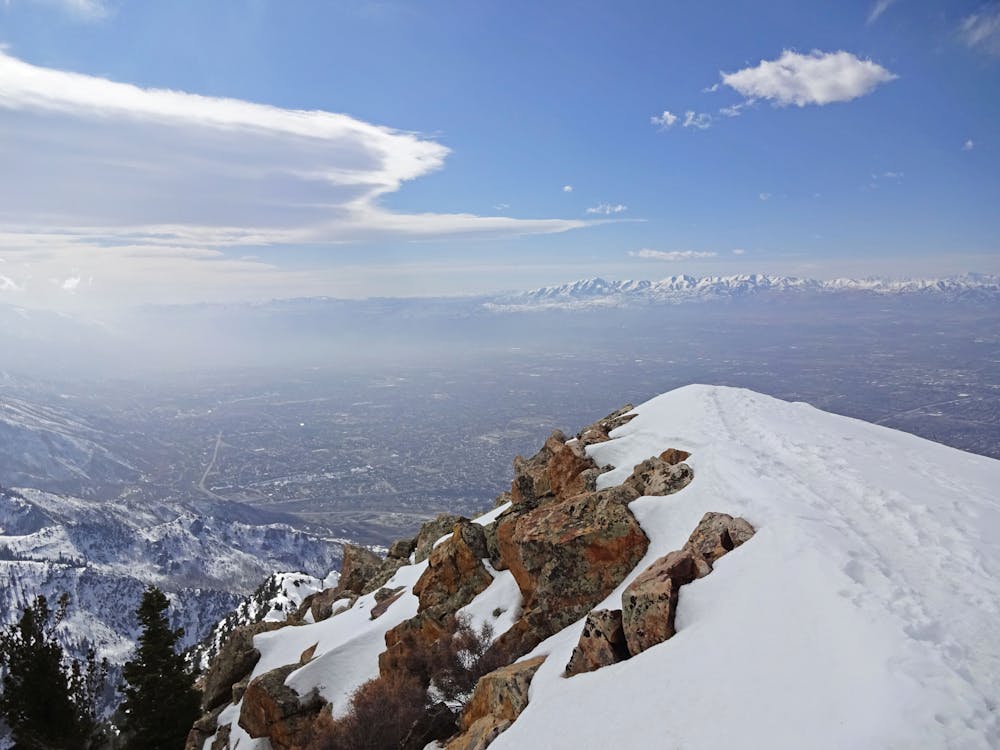
Because it is low elevation and west facing this trail sees traffic almost all year long. Proper footwear and shoe traction can help greatly in the winter months. In the summer the temperatures can soar into the 100 degree range so it's best to get an early start and be off the mountain by 9 or 10am. Evening hikes are a good choice that provide glorious city lights and less encounters with rattlesnakes.
Easy
The ascent involves simple glacier hiking and/or short, straightforward rock scrambles. Equivalent to Alpine F, F+
10 routes · Alpine Climbing · Hiking