
10 routes · Alpine Climbing · Hiking
Arguably the top peak climb in the state of Utah.
Alpine Climbing Easy

"Mount Timpanogos is one of Utah’s most recognizable mountains, and perhaps Utah’s most popular mountain hiking destination,” according to Utah.com. Timpanogos rises to 11,749 feet above sea level, making it the second-highest peak in the Wasatch Mountain Range. While Mount Nebo is technically the highest peak in the Wasatch, it is located far to the south, making Timpagonos the highest mountain near Salt Lake City. Consequently, Timpanogos boasts an impressive 5,269 feet of prominence above the surrounding landscape!
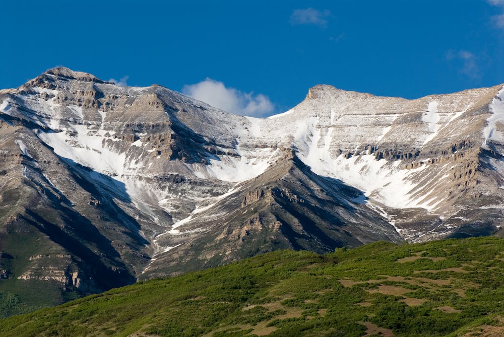

Mount Timpanogos, AKA "Mt. Timp,” is an achievable summit climb when the trails are dry. The route mapped here gains 4,700 feet of elevation over the course of its 14.5-mile length, making it a full day out in the mountains and a formidable challenge, even though it’s relatively non-technical.
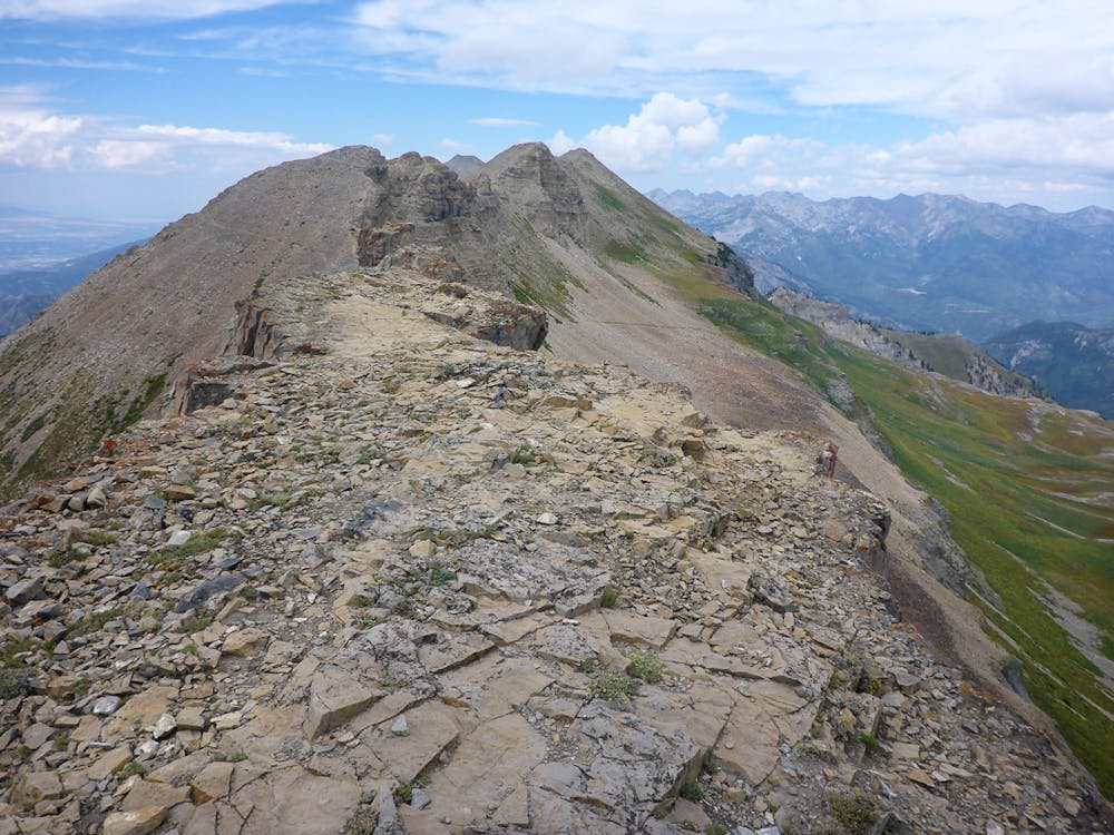
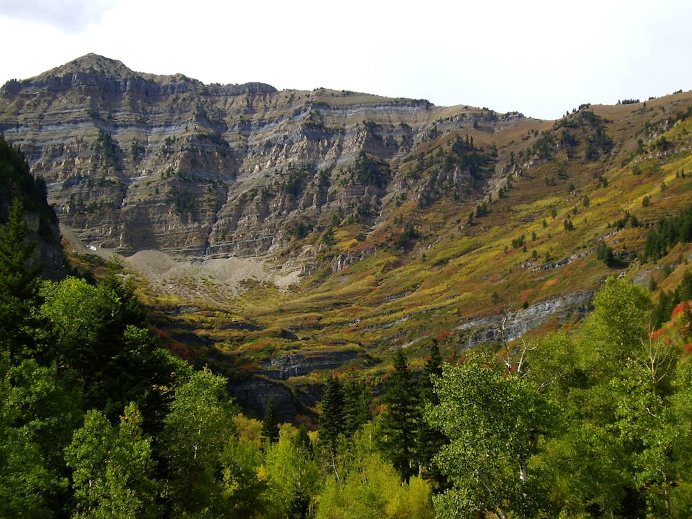
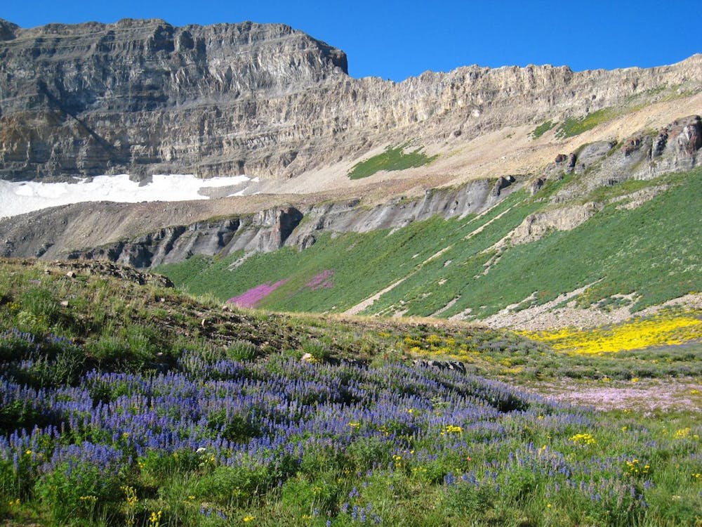
The vast majority of the hike takes place on a well-maintained trail that climbs through the forest, eventually breaking out into alpine meadows filled with wildflowers. Once in the alpine, the trail heads for the visually-impressive ridge of Mt. Timp.
Soon, you’ll reach the saddle on Mt. Timp and enjoy impressive views of the valley far below you. From the saddle, “continue hiking south along the well-marked trail and zig-zag up a steep incline to the top of the mountain,” according to Utah.com.
Once you reach the shack that marks the summit, you can either turn around and hike down the way you came, or continue along the ridge to access a high-speed glissading descent down the snowfield. If you opt to turn around at the summit, this route becomes a “Severe”-level hike instead of an easy Alpine Climbing route.
Even though many online sources loudly proclaim how dangerous the snowfield is, the glissade down the snowfield is the route's highlight for many climbers. To access the snowfield, continue along an exposed ledge on the ridge, as mapped. Then, carefully hike down (or glissade) the snowfield to Emerald Lake. If you are unfamiliar with glissading, ice axes, self-arresting, or over snow travel, heed the warnings and skip this part of the climb.
From Emerald Lake, turn left and hike over a saddle to reach the original trail that you ascended. Sources: https://utah.com/hiking/mt-timpanogos https://en.wikipedia.org/wiki/MountTimpanogos https://www.summitpost.org/mt-timpanogos-ut/151365
Easy
The ascent involves simple glacier hiking and/or short, straightforward rock scrambles. Equivalent to Alpine F, F+

Much of the route is difficult to protect and a fall could be disastrous at certain points.

In the high mountains or remote conditions, all individuals must be completely autonomous in every situation.
10 routes · Alpine Climbing · Hiking