6.6 km away
Yellow Knolls Trail
Hike beneath a series of uplifted yellow hills.
Moderate Hiking
- Distance
- 6.3 km
- Ascent
- 139 m
- Descent
- 139 m
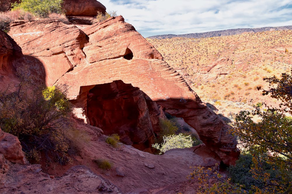
Hike to an arch that resembles an elephant's eye, forehead, and trunk stretching down to the ground.
Hiking Moderate

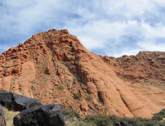
Elephant Arch is one of the most renowned trails near St. George. On this trail, you get to hike to a uniquely beautiful arch. Arches in and of themselves are a relative rarity in this area of Utah. If you view the arch from the right vantage point, you'll be able to pick out the elephant's eye, forehead, and trunk stretching down to the ground.
The approach to the trailhead follows a somewhat rough dirt road, and using a 4x4 truck or SUV to access the trailhead is recommended. If you don't have a suitable vehicle, you'll have to tack on a little extra road walking.
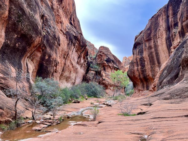
Even from the marked trailhead, you'll begin by following a sandy road until you turn off into an even sandier wash. The soft, shifting sand can make the hike feel a bit longer and more arduous than it actually is.
As you progress along the trail, the rocks and cliffs will get larger and grander until you finally arrive at the beautiful arch at the end!
Many sources note that this is a dog-friendly hike, but be sure to keep your dog on a leash, as desert tortoises can be found in the area.
Sources: https://hikestgeorge.com/hiking-trails/elephant-arch-red-cliffs-desert-reserve/ https://www.femalehiker.com/hikes/hike-elephant-arch-in-st-george-utah/
Moderate
Hiking along trails with some uneven terrain and small hills. Small rocks and roots may be present.

The path is on completely flat land and potential injury is limited to falling over.

Away from help but easily accessed.
6.6 km away
Hike beneath a series of uplifted yellow hills.
Moderate Hiking
8.5 km away
A high-value hike with a stunning overlook above St. George.
Difficult Hiking
9 routes · Hiking