
14 routes · Hiking
In and out of many canyons in the complex terrain of Grand Staircase-Escalante National Monument.
Hiking Severe

From the Hurricane Wash Trailhead, a dirt road cuts across open desert toward the imposing cliff-banded slopes of Fiftymile Mountain. After a set of switchbacks up the lower bench, a more rugged two-track continues the ascent, eventually becoming a pack trail that climbs steeply through the upper tiers.
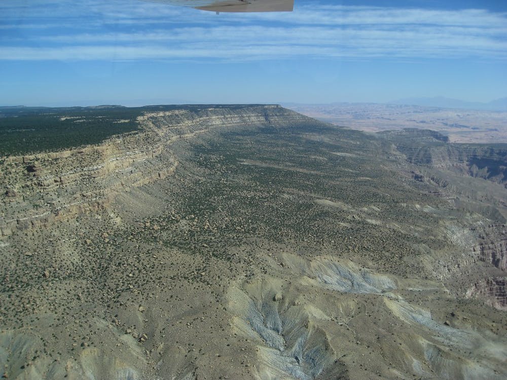
On top is the Kaiparowits Plateau, juniper and sage-covered high country where a labyrinth of canyons form and fall away to the west and south. The trail melts into a web of cattle tracks, which you’ll pick your way through to a branch of Monday Canyon. Along the way, be sure to stop at Mudholes Spring, as it’s likely to be the only good water for many miles.
Monday is a brushy canyon with a couple of dryfall obstacles that can be downclimbed or bypassed. As the canyon gets wider and deeper, the wash becomes more bouldery. Many hikers find alternate paths along the slopes to avoid boulder hopping and more dryfalls in the bottom. Eventually, you will hit Rogers Canyon, a wider valley which usually has uninviting water in the wash, and where more boulder hopping or bypasses are required.
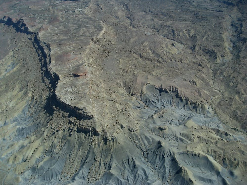
Rogers is separated from Navajo Canyon by hills of blue-gray badlands, which you can cross before the canyons converge to the south. Head up the dry wash in Navajo, which starts out wide and rather featureless but cuts through many colors and formations of rock and sediment farther up.
Eventually, an old two-track leads out of the canyon and joins a wider dirt road. Stick with it for only briefly before dropping into another wash. This leads to Reece Canyon and then Last Chance Canyon, where you’ll finally find good water. In both of these, the going is considerably easier than in the preceding drainages but the scenery no less spectacular. They carve through the Burning Hills, which are not actually named for their yellow and red striations but for an underground coal fire that smolders silently beneath nearby Smoky Mountain.
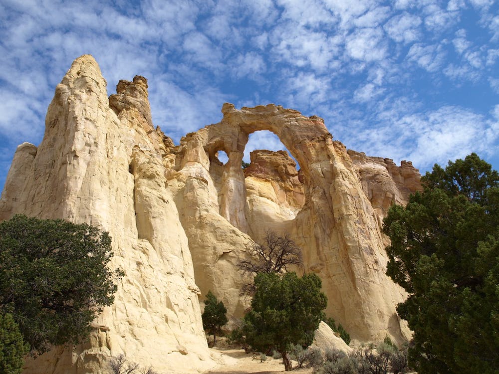
Paradise Canyon is next. It’s a long stroll among green cottonwoods between tall, yellow cliffs, where water sometimes flows in the wash. A jeep road leads out of this canyon then undulates among sunny hillsides, low cliffs, and often-dry creekbeds for quite a few miles. A horizon-spanning ridge of uplifted sandstone, the Cockscomb, lies ahead. The road takes an efficient route over a lower section of the ridge and through a pass called The Gut. On the other side is the photo-famous Grosvenor Arch, near Cottonwood Canyon Road. The section ends a bit farther along the road at the Round Valley Draw intersection.
Sources: http://www.hayduketrail.org/TheRoute.html http://www.hayduketrail.org/Updates.html https://www.little-package.com/blog/2017/11/hayduke-trail-tips http://www.acrossutah.com/wordpress/hayduke-monday-canyon/ http://www.acrossutah.com/wordpress/hayduke-navajo-and-reece-canyons/ https://www.blm.gov/programs/national-conservation-lands/utah/burning-hills-wsa https://caltopo.com/m/5J0S https://caltopo.com/m/6V45
Severe
Hiking challenging trails where simple scrambling, with the occasional use of the hands, is a distinct possibility. The trails are often filled with all manner of obstacles both small and large, and the hills are very steep. Obstacles and challenges are often unexpected and can be unpredictable.

Some trail sections have exposed ledges or steep ascents/descents where falling could cause serious injury.

In the high mountains or remote conditions, all individuals must be completely autonomous in every situation.
14 routes · Hiking