3.4 km away
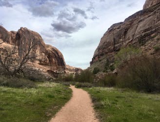
Mill Creek Canyon
An adventurous hike through a canyon with a waterfall, swimming holes, and ancient petroglyphs.
Moderate Hiking
- Distance
- 12 km
- Ascent
- 279 m
- Descent
- 279 m
Hike right from the outskirts of Moab up into a beautiful valley.
Hiking Difficult

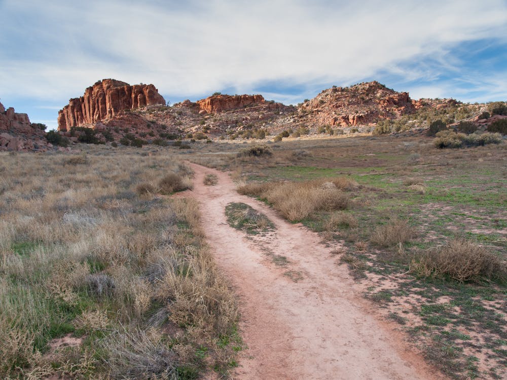
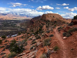
Unlike most of Moab's popular hikes, which require a bit of a drive to reach, the Hidden Valley trail begins right on the edge of town.
The hike begins with a steep climb up a series of difficult, rocky switchbacks that ascend about 600 feet in the first 0.6miles. Once above the switchbacks, the trail mellows out considerably, with the singletrack entering the hidden valley that the trail is named for. From here, the trail winds its way up the valley at a mellow grade.
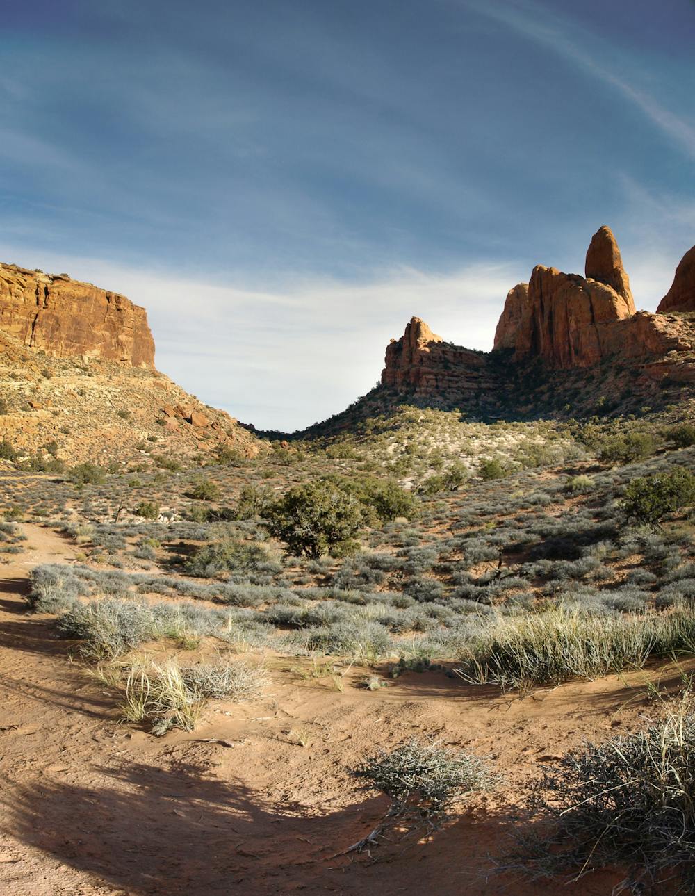
The valley is so named because it's hidden from view if you're standing in Moab below. "Low cliffs hem it on the north while a towering escarpment of sandstone cliffs, capped by rounded domes composed of Navajo Sandstone, form the southern rim of the valley," according to VisitUtah.com. "The valley's flat sandy floor is covered with grass and scattered juniper trees."
Along the hike up the valley, you can opt to follow side trails to view ancient Native American petroglyphs at the base of a cliff to the west. "To find the rock art, follow the trail that begins at the saddle and goes west on the north side of a cliff band then scrambles up to the cliff base," according to VisitUtah. "Go left from the prow of the cliff to find the petroglyphs. Then return to the saddle and follow the Hidden Valley Trail back to the trailhead."
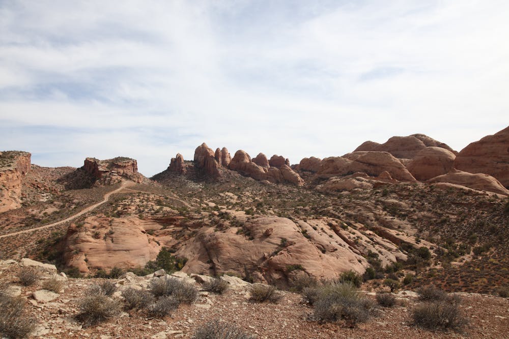
Eventually, you'll climb to the top of a divide, which offers expansive views of the entire Behind the Rocks area, including the area's iconic sandstone fins. If you'd like to extend the hike, you can continue down the west side of the pass to the Moab Rim 4x4 trail. You could even follow the Moab Rim road all the way down to the Colorado River, but realize that unless you've staged a shuttle vehicle there, you'll have to climb back up and over the mountain to get back to Moab.
Difficult
Hiking trails where obstacles such as rocks or roots are prevalent. Some obstacles can require care to step over or around. At times, the trail can be worn and eroded. The grade of the trail is generally quite steep, and can often lead to strenuous hiking.

The trail contains some obstacles such as outcroppings and rock which could cause injury.
Away from help but easily accessed.
3.4 km away
An adventurous hike through a canyon with a waterfall, swimming holes, and ancient petroglyphs.
Moderate Hiking
6.9 km away
Experience death-defying heights and jaw-dropping views from the exposed Portal Trail.
Severe Hiking
8.8 km away
A family-friendly hike with gorgeous views the entire way.
Moderate Hiking
14 routes · Hiking