7.6 km away
Burro Wash
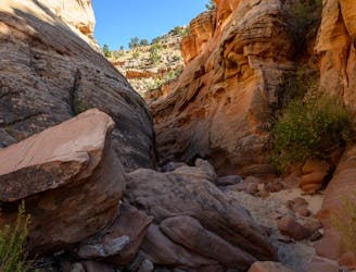
One of the best slot canyon hikes in Capitol Reef National Park.
Severe Hiking
- Distance
- 9.8 km
- Ascent
- 185 m
- Descent
- 186 m
Easy hike in a backcountry setting, along a flowing stream in a remote canyon of Capitol Reef.
Hiking Easy

Pleasant Creek is one of the special places in Utah’s desert where water flows year-round. The stream here babbles over sandstone bedrock and down small cascades through a broad but deep canyon. The waterway is fringed by healthy willows and cottonwoods that provide shade in summer and brilliant color in fall. The rest of the canyon consists of more typical desert vegetation and is hemmed by rock walls rising hundreds of feet in places. It’s a true gem in Capitol Reef National Park but doesn’t get a lot of hikers because of its distance from the highway, and because it has no maintained trail.
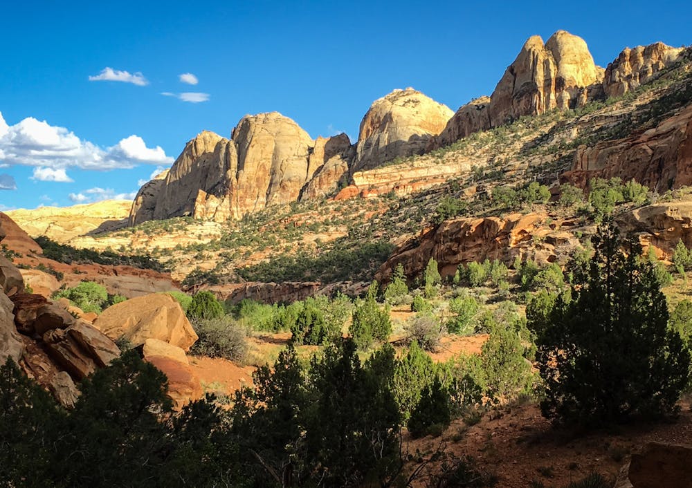
It’s not so hard to get there, though, and the hike is easy if you’re accustomed to a little off-trail navigation, and if you don’t mind getting your feet wet. The route is simply to walk the canyon bottom near the creek, crossing it many times. There is no singular trail, so the track mapped here is just a suggestion. Multiple footpaths crisscross the canyon bottom, so you’ll constantly be choosing your route and deciding where it’s best to cross the stream. Higher ground away from the water is home to biotic soil crusts, which you must make every effort to avoid stepping on. Be sure to always follow previously tracked paths so you don’t stray onto the crusts. They are living organisms which are important for controlling erosion of the soft sands. Though you may see cattle tracks across the soil crusts, try not to follow these because you’ll make the erosion worse.
The hike begins from a small trailhead along the Pleasant Creek Road, an unpaved extension from the Capitol Reef Scenic Drive. This dirt road is passable to most cars under dry conditions. From there, just find a path across the road and just start hiking into the canyon, looking for the various tracks that weave through. You can go any distance down the canyon before turning around. It’s worth it to go at least 2 miles, where the creek uniquely narrows into a swift chute of slickrock. Some distance beyond there, a fence strung across the creek marks the final turnaround point. This is near the eastern park boundary, and private property lies beyond.
Pleasant Creek is perhaps best in the fall when the leaves change, but is also enjoyable on a hot summer day, when the cool water feels refreshing. Just be sure there is no rain in the forecast because pop-up thunderstorms can cause the canyon to flood. Camping in this canyon is allowed with a backcountry permit, and it makes an easy overnight backpacking trip. Certain regulations apply to camping, which you will need to review in planning your trip and agree to when you secure the permit.
Sources: https://www.nps.gov/care/planyourvisit/pleasant-creek.htm https://liveandlethike.com/2015/02/17/pleasant-creek-capitol-reef-national-park-ut/
Easy
Walking along a well-kept trail that’s mostly flat. No obstacles are present.

The trail contains some obstacles such as outcroppings and rock which could cause injury.

Little chance of being seen or helped in case of an accident.
7.6 km away
One of the best slot canyon hikes in Capitol Reef National Park.
Severe Hiking
8 km away
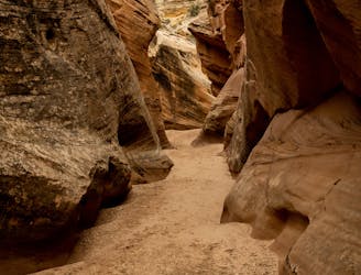
A lesser-traveled slot canyon in Capitol Reef National Park.
Extreme Hiking
8 routes · Hiking

10 routes · Hiking