7.3 km away
Dead Horse Point
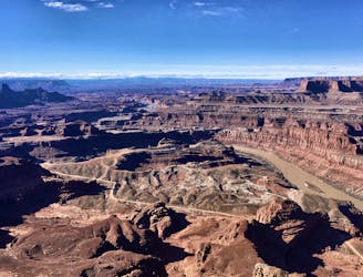
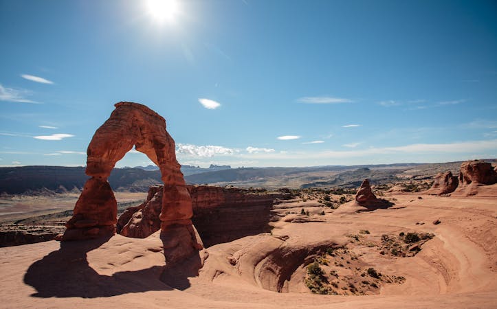
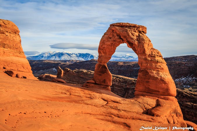
"One of the most photographed scenic vistas in the world!"
Moderate Hiking
- Distance
- 1.7 km
- Ascent
- 33 m
- Descent
- 33 m
A 6-mile loop with a high “Wow!” factor.
Hiking Moderate

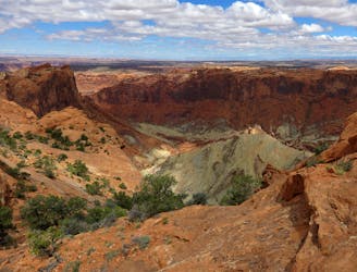
Canyonlands National Park is comprised of three distinct districts: The Needles, The Maze, and Island in the Sky. The northern-most district, Island in the Sky, is closest to Moab, which makes it an easily accessed side trip from Arches National Park. Hemmed in by the Green River and Colorado River Canyons, the views are stunning from many vantage points.
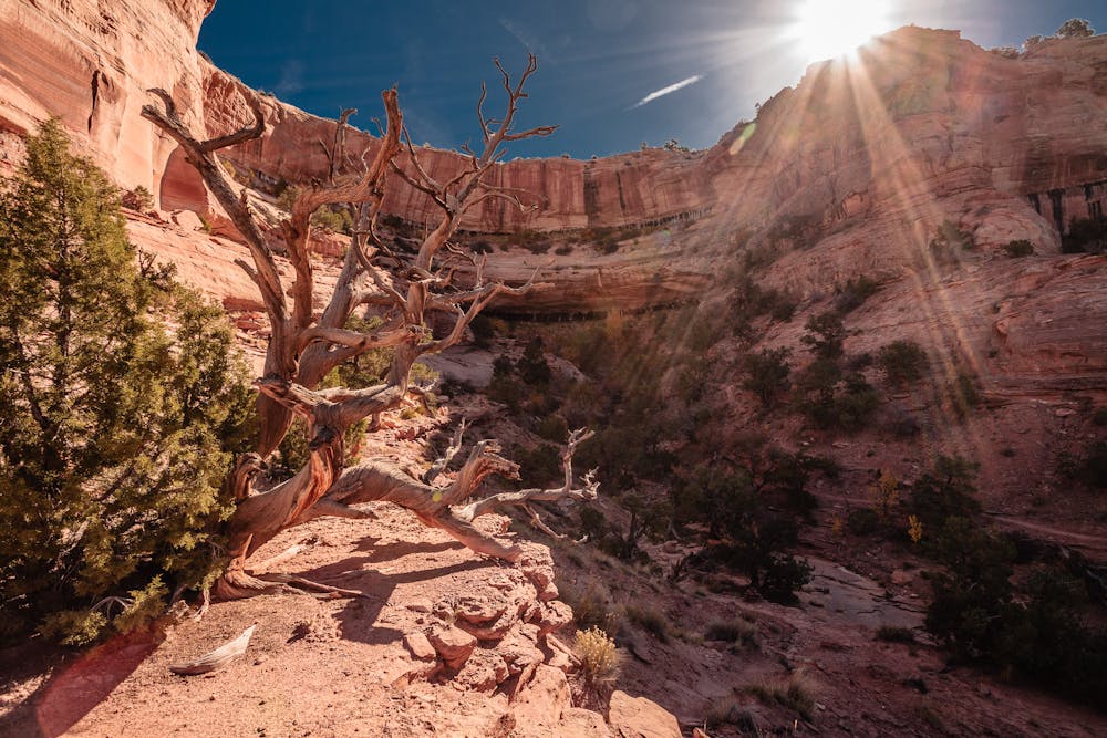
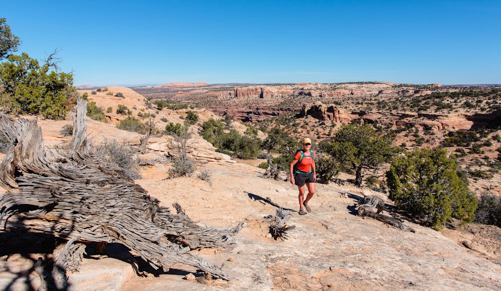
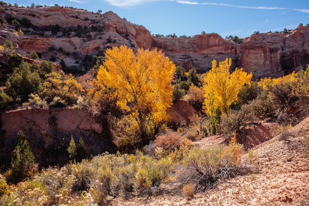
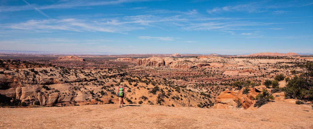
The 6-mile Neck Spring Loop is a fantastic way to experience the splendor of Canyonlands. It travels through several box canyons and offers expansive views from the edge of Taylor Canyon. There is not much elevation gain, but the 6 miles does include a lot of minor ups and downs along the way.
As with any hiking in the Moab area, it is best to venture out in the spring or fall, when the desert temperatures are not so brutally hot. October is a wonderful time to explore Canyonlands, but be aware that it is still hot and you will need sunscreen and lots of water!
This loop is best done counterclockwise and is mostly easy to follow. The only somewhat challenging area is a steep slickrock climb at around 3.5 miles in. Though the trail does take hikers near the actual Neck Spring, it is important to note that it does NOT actually access the spring. One of the most fascinating aspects of the entire Moab area is the cryptobiotic soil, which looks like black, bumpy crust. Absolutely do NOT walk off trail, as doing so can destroy many years of this soil's delicate and vital growth.
Though the trek is only 6 miles, plan on plenty of time to soak in the astonishing environment. Don't even bother to count the number of times you will utter, “WOW!” in wonderment.
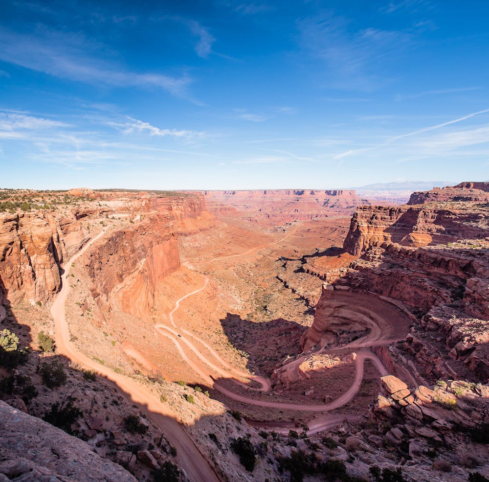
Once back up on the mesa, it will be a bit disconcerting to re-join the people who have driven to more easily accessed viewpoints. From above, the vistas of Shafer Canyon and the dirt road that snakes down it are breathtaking. The Shafer road eventually connects to the well-known 100-mile-long 4WD White Rim Road. Watching jeeps and mountain bikers navigating this beauty of a road is quite enthralling. This road was originally a Native American footpath, then was made into a road for mining, well before Canyonlands became a National Park in 1964.
If there is time for only one Canyonlands adventure, the Neck Spring Loop is an excellent choice!
Moderate
Hiking along trails with some uneven terrain and small hills. Small rocks and roots may be present.

The path is on completely flat land and potential injury is limited to falling over.

Little chance of being seen or helped in case of an accident.
7.3 km away
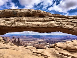
"One of the most photographed scenic vistas in the world!"
Moderate Hiking
8.2 km away
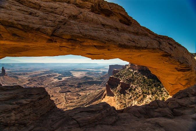
A short, easy hike to a stunning natural arch!
Easy Hiking
8.5 km away
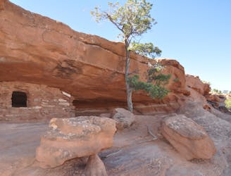
Short scrambles on two slickrock domes, with panoramic views and ancient ruins.
Moderate Hiking
9.7 km away
A short but adventurous trail on sloping slickrock, to the rim of a giant and mysterious crater.
Moderate Hiking
14 routes · Hiking
4 routes · Mountain Biking · Hiking
8 routes · Hiking

10 routes · Hiking