1.3 km away
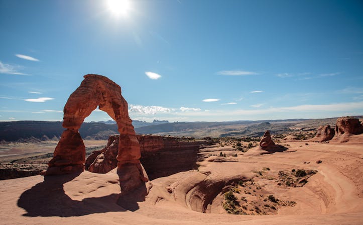
Mesa Arch
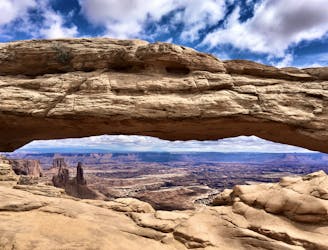
A short, easy hike to a stunning natural arch!
Easy Hiking
- Distance
- 1.1 km
- Ascent
- 29 m
- Descent
- 29 m
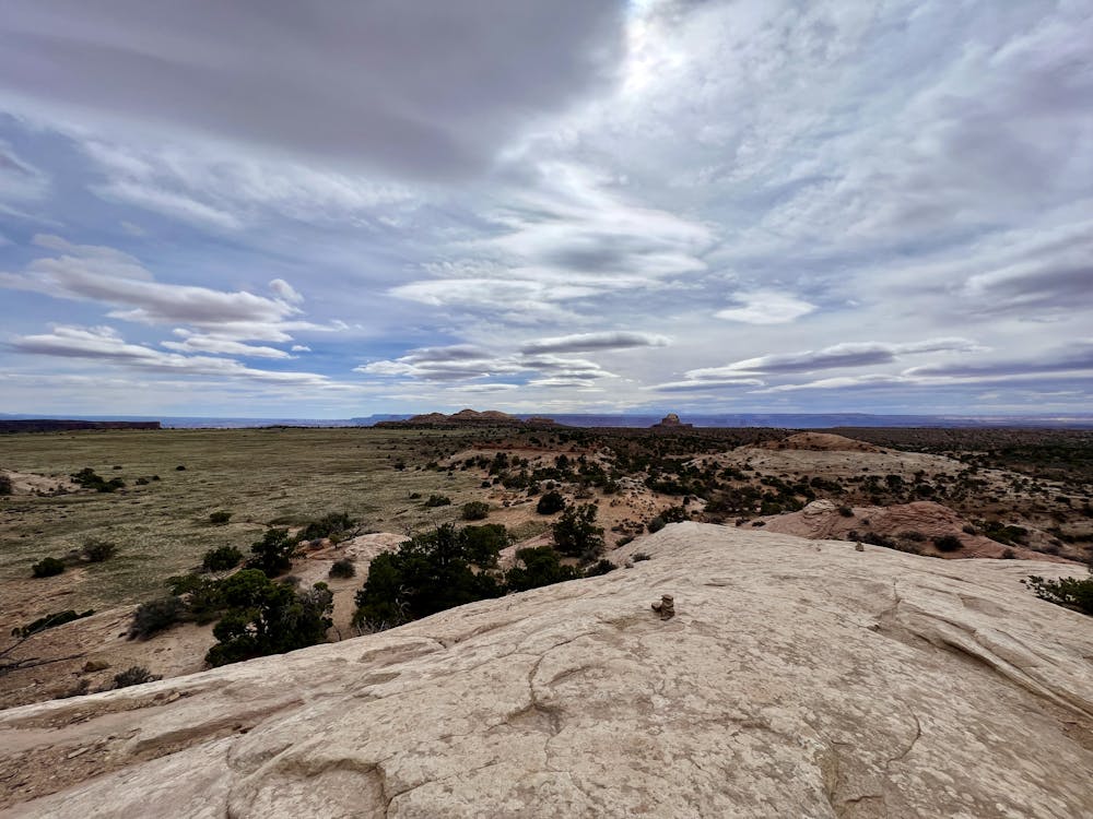
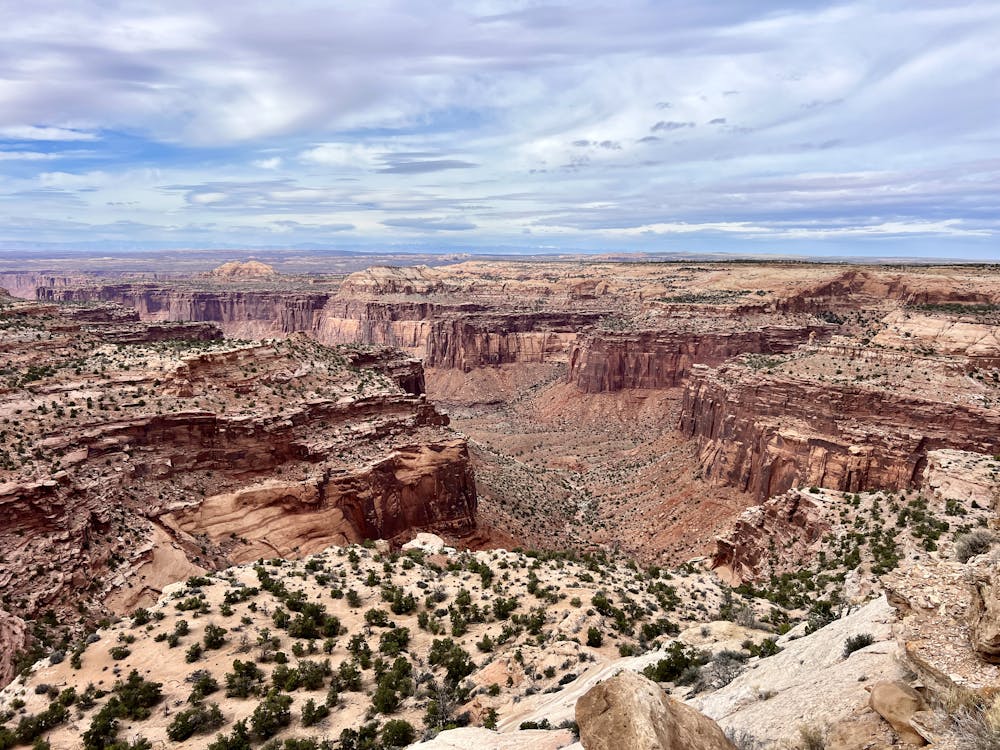
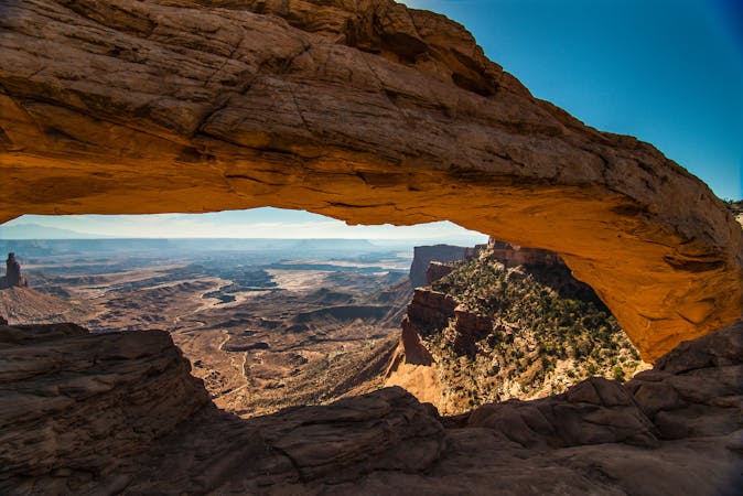
Short scrambles on two slickrock domes, with panoramic views and ancient ruins.
Hiking Moderate

This short but nicely varied trail combines views of the landscape with a glimpse into the past. You can climb a tall mesa to find a panorama over the canyons or circle a smaller mesa to find Native American ruins. A fork in the trail leads either east or west. Go east for a moderate scramble on the taller mesa. Once on top, you can roam around the slickrock dome and find different viewpoints.
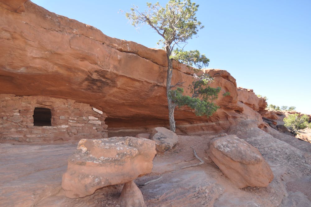
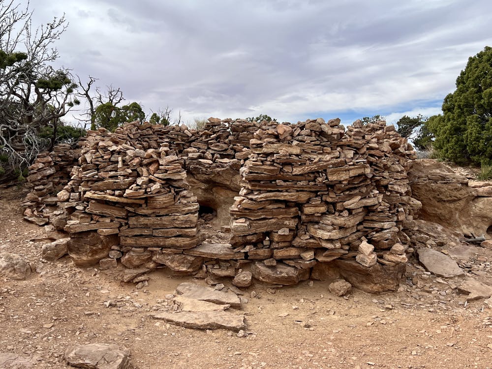
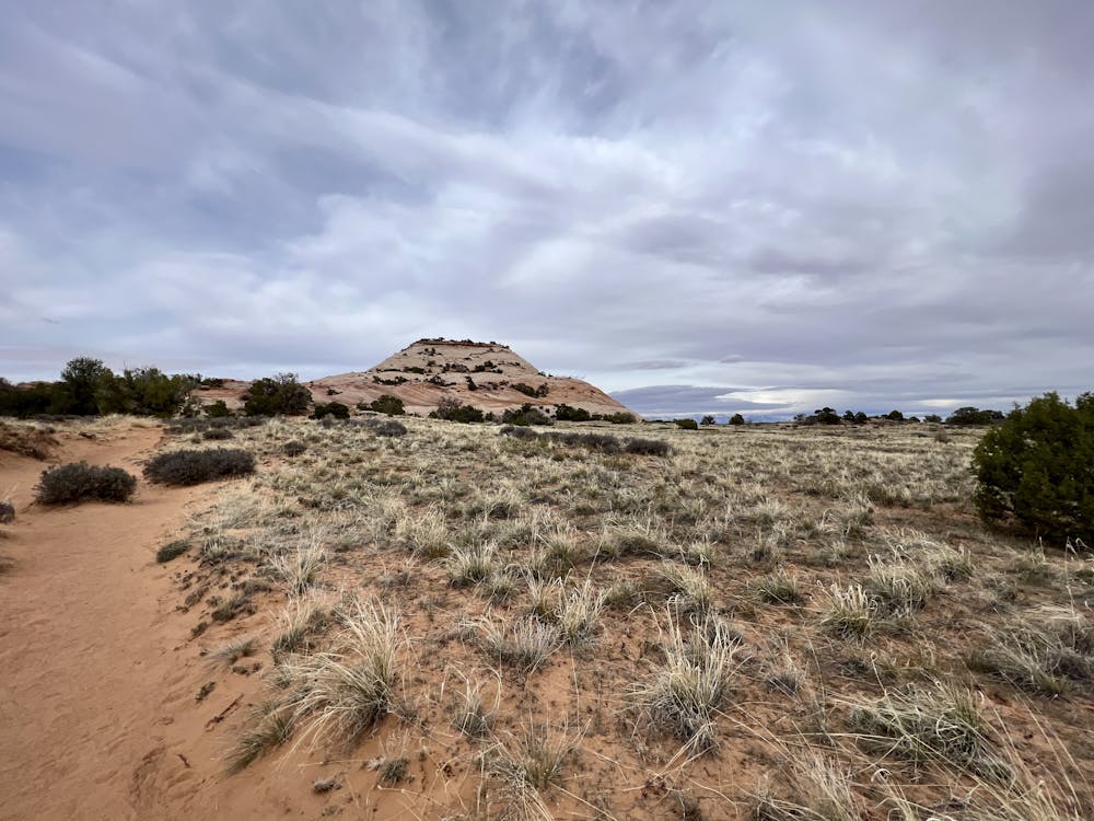
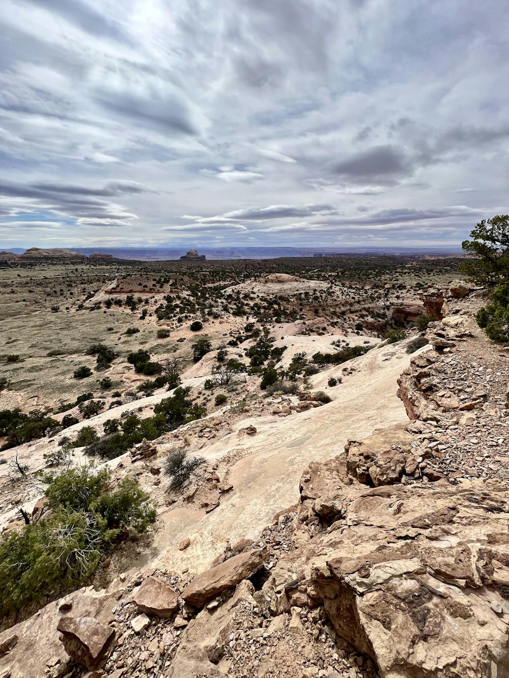
Going west at the fork leads to the smaller mesa. After reaching a highpoint, the trail then dips down to follow ledges around the perimeter, where the ruins are located. These stone walls were built hundreds of years ago as granaries. Be sure to view the ruins from a distance. Do not enter or touch them because they are fragile and irreplaceable.
Sources: https://www.nps.gov/cany/planyourvisit/hiking.htm https://www.earthtrekkers.com/one-perfect-day-in-canyonlands-national-park/
Moderate
Hiking along trails with some uneven terrain and small hills. Small rocks and roots may be present.

Some trail sections have exposed ledges or steep ascents/descents where falling could cause serious injury.

Away from help but easily accessed.
1.3 km away
A short, easy hike to a stunning natural arch!
Easy Hiking
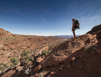
4.6 km away
A full-day trek from the Island in the Sky, down to the White Rim Road, and back up.
Difficult Hiking
4.6 km away
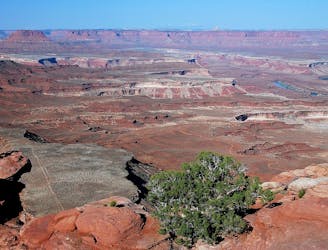
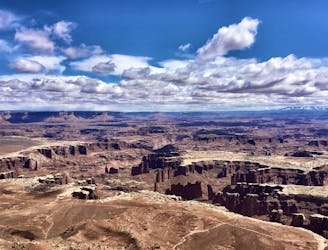
A relaxed hike to a breathtaking viewpoint over Canyonlands.
Easy Hiking
5.3 km away
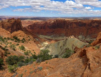
A short but adventurous trail on sloping slickrock, to the rim of a giant and mysterious crater.
Moderate Hiking
8.3 km away
The shortest but steepest route from the mesa top to the White Rim Road.
Difficult Hiking
8.5 km away
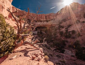
A 6-mile loop with a high “Wow!” factor.
Moderate Hiking
9.4 km away
Enjoy a never-ending array of stunning views along this exposed hike.
Moderate Hiking
14 routes · Hiking
8 routes · Hiking

10 routes · Hiking