5.7 km away
Cottonwood Wash
A lesser-traveled slot canyon in Capitol Reef National Park.
Extreme Hiking
- Distance
- 10 km
- Ascent
- 263 m
- Descent
- 263 m
A winding gorge with multiple sections of slot canyon narrows, requiring scrambling and wading, but no ropes or hardwear to ascend and descend.
Hiking Severe

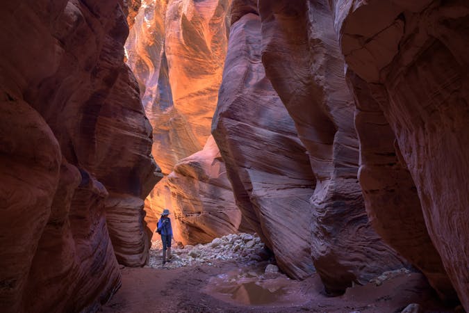
Sheets Gulch is the southernmost of three hikes from Notom-Bullfrog Road that go through classic examples of sandstone slot canyons, and Sheets is arguably the best of the three for its variety of scenery and length of narrows. Though the trailhead lies beyond the end of the pavement, the dirt road remains fine for most cars. The hike begins on Bureau of Land Management (BLM) land and soon enters Capitol Reef National Park.
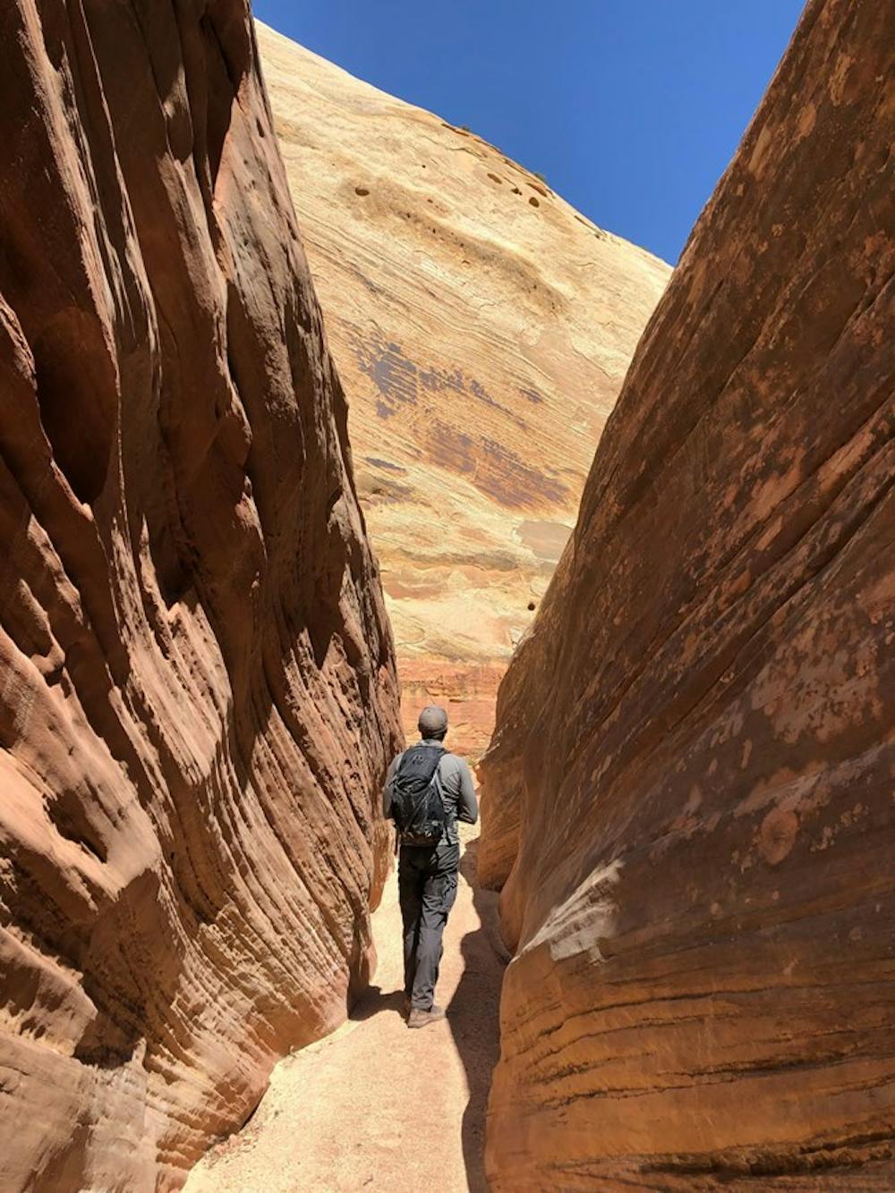
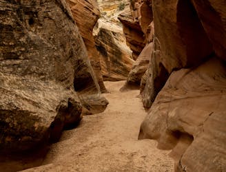
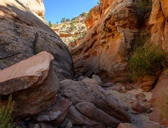
From the dirt pullout with a BLM sign for Sheets Gulch Trailhead, follow the obvious footpath over a hill and into a sandy wash. The scenery is rather unremarkable at first, but after about a mile, the walls start to close in, and the canyon enters a slot through light-red sandstone. The walls undulate in tandem on either side, sometimes only a few feet apart. In this tight corridor are several obstacles, including wedged boulders and possibly pools of water, requiring scrambling and perhaps wading to proceed.
The narrows eventually open up into a wider section, with huge domes of yellowish sandstone appearing overhead. The canyon continues in this fashion, alternating between narrows and broader sections, with unique character to the rocks in each stretch. After the second section of narrows, a tall natural arch can be seen in the yellow cliffs above.
The third and final narrows are the tightest of them all and have the most significant obstacles. Boulder jumbles, log jams, and cold pools should be expected. Eventually, the canyon runs into a 30-foot-tall pouroff over a large pool. This can be surmounted by backtracking to a cairned bypass route, but most hikers turn around here and retrace their steps to the start.
The canyon supposedly gets less interesting above the tall pouroff, but can be followed onward all the way to Tantalus Flats on South Draw Road. The extended trip could be an option for overnight backpackers (backcountry permit required) or for those who set a car shuttle at the other end.
Sources: https://www.nps.gov/care/planyourvisit/burrowash.htm https://liveandlethike.com/2015/02/15/sheets-gulch-capitol-reef-national-park-ut/
Severe
Hiking challenging trails where simple scrambling, with the occasional use of the hands, is a distinct possibility. The trails are often filled with all manner of obstacles both small and large, and the hills are very steep. Obstacles and challenges are often unexpected and can be unpredictable.

Some trail sections have exposed ledges or steep ascents/descents where falling could cause serious injury.
Little chance of being seen or helped in case of an accident.
5.7 km away
A lesser-traveled slot canyon in Capitol Reef National Park.
Extreme Hiking
7.5 km away
One of the best slot canyon hikes in Capitol Reef National Park.
Severe Hiking
8 routes · Hiking
9 routes · Hiking