Valley of the Goblins: Short
Explore this free-roaming hiking area with a short loop itinerary.
Moderate Hiking
- Distance
- 1.8 km
- Ascent
- 26 m
- Descent
- 26 m
Explore this free-roaming hiking area with a longer loop itinerary.
Hiking Difficult
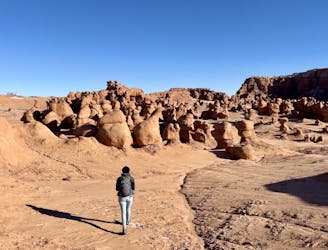
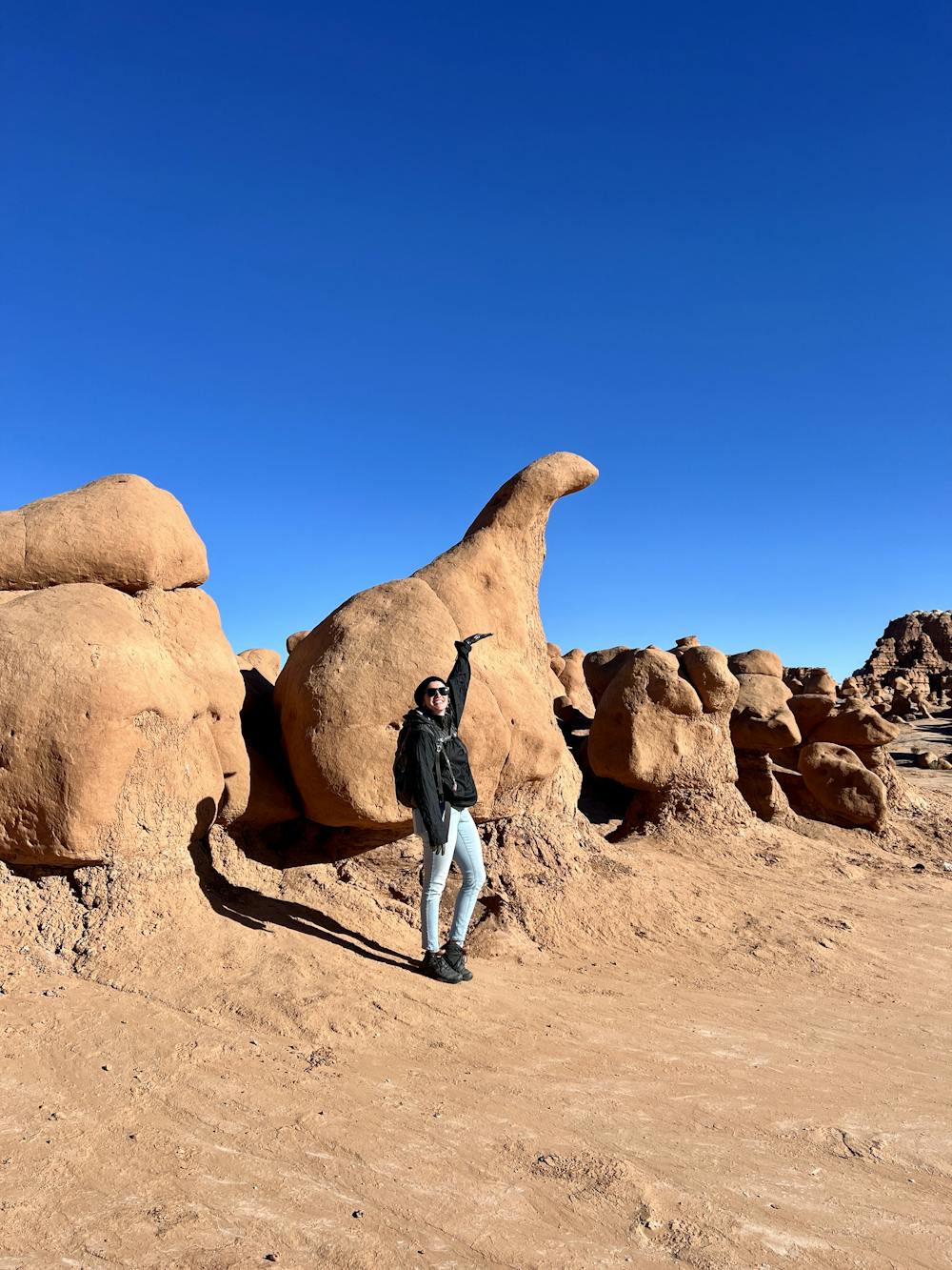
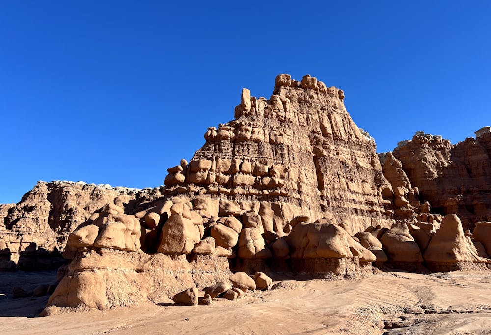
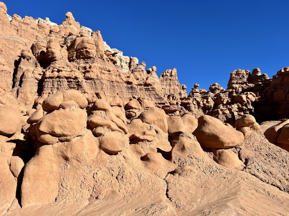
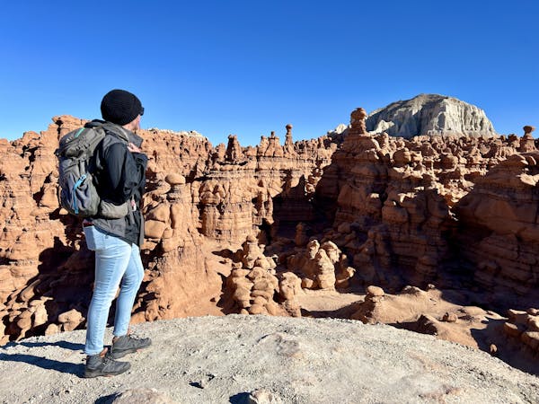
The Valley of the Goblins is an otherworldly landscape that is unique in Utah. In this small valley, thousands of rock hoodoo formations rise from the flat landscape in intricate and intriguing shapes. These hoodoos, known as "goblins," were formed "because of the uneven hardness of sandstone," according to Utah State Parks. "Some patches resist erosion much better than others. The softer material is removed by wind and water, leaving thousands of unique, geologic goblins. Water erosion and the smoothing action of windblown dust work together to shape the goblins," they continue.
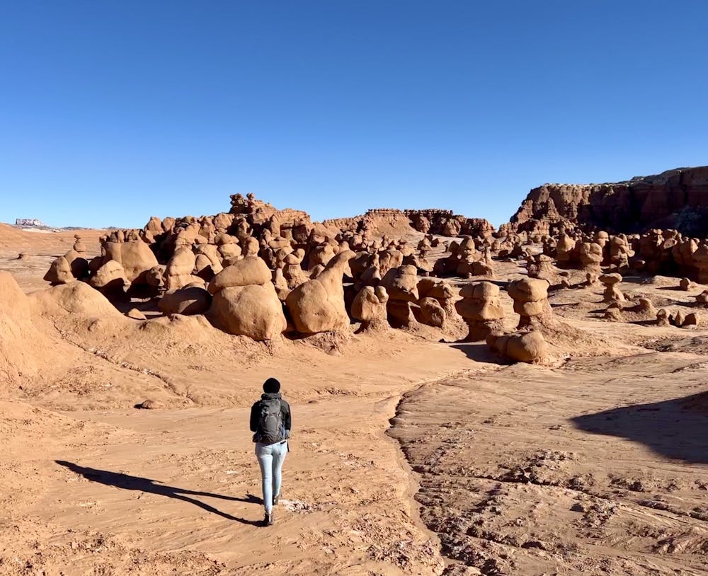
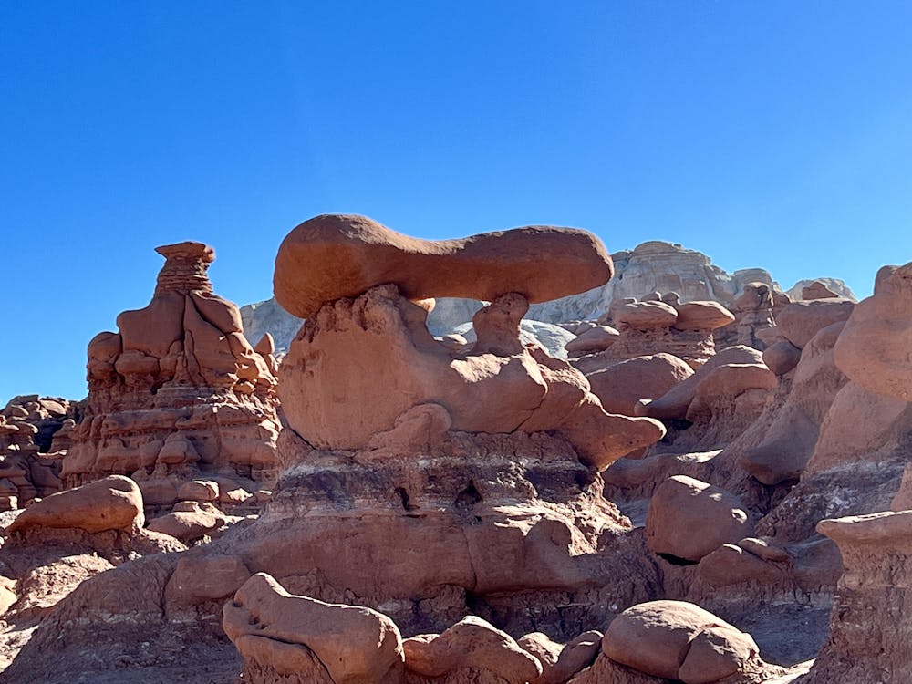

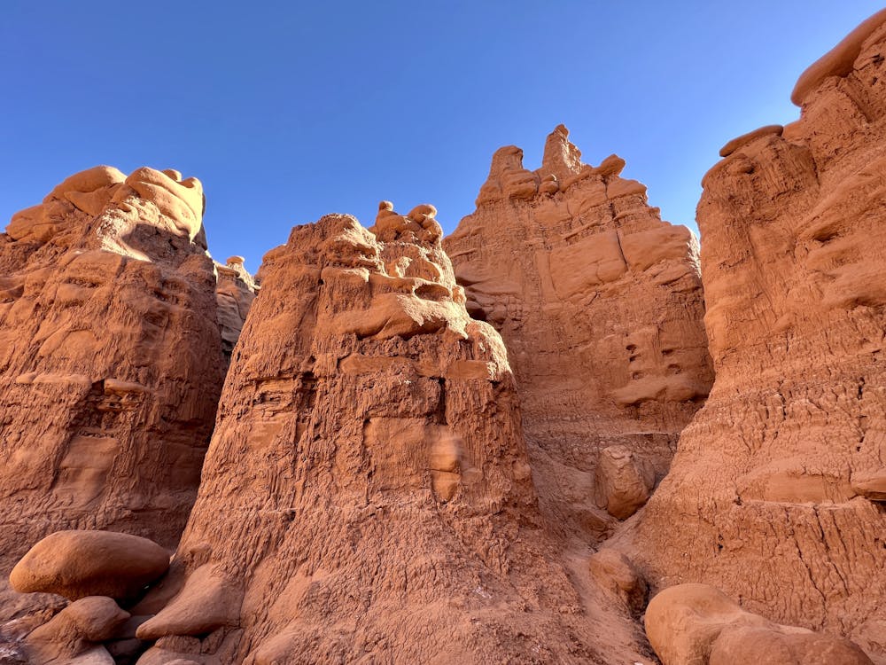
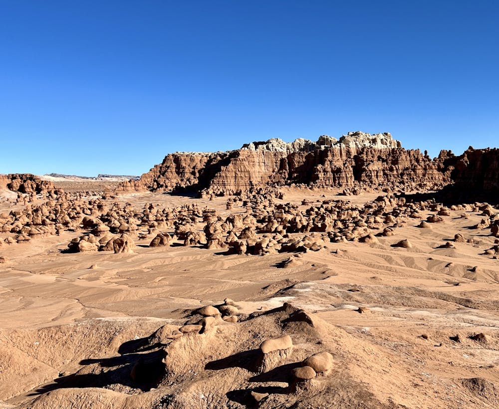
The Valley of the Goblins covers about three square miles, although you can hike even further and connect to several other areas if you so choose. This valley is also unique when it comes to hiking areas, as there aren't any designated routes through the landscape. Instead, the valley "is a free-roaming area that can be explored at your leisure," according to Utah State Parks. You can choose your own adventure and get as up close and personal with the hoodoos as you'd like, hiking through the wide-open valley floor or following drainages into narrow canyons.
With this freedom comes a natural responsibility to treat the landscape and the rock formations with respect. The hoodoos themselves are quite fragile and can topple easily. Please do not touch, push, climb on, draw on, or in any way modify or change the landscape in this valley. Tread softly as you travel, and try to stick to logical paths through the landscape.
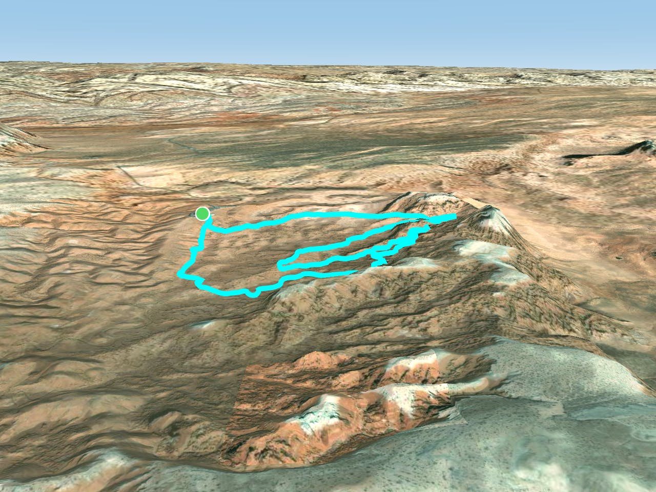
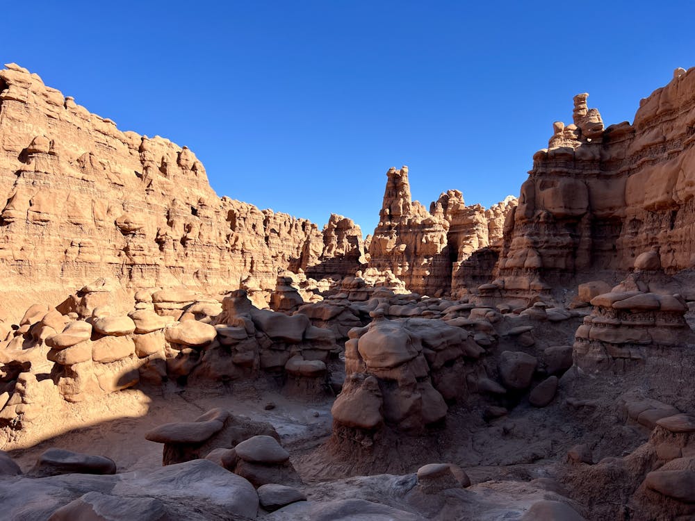
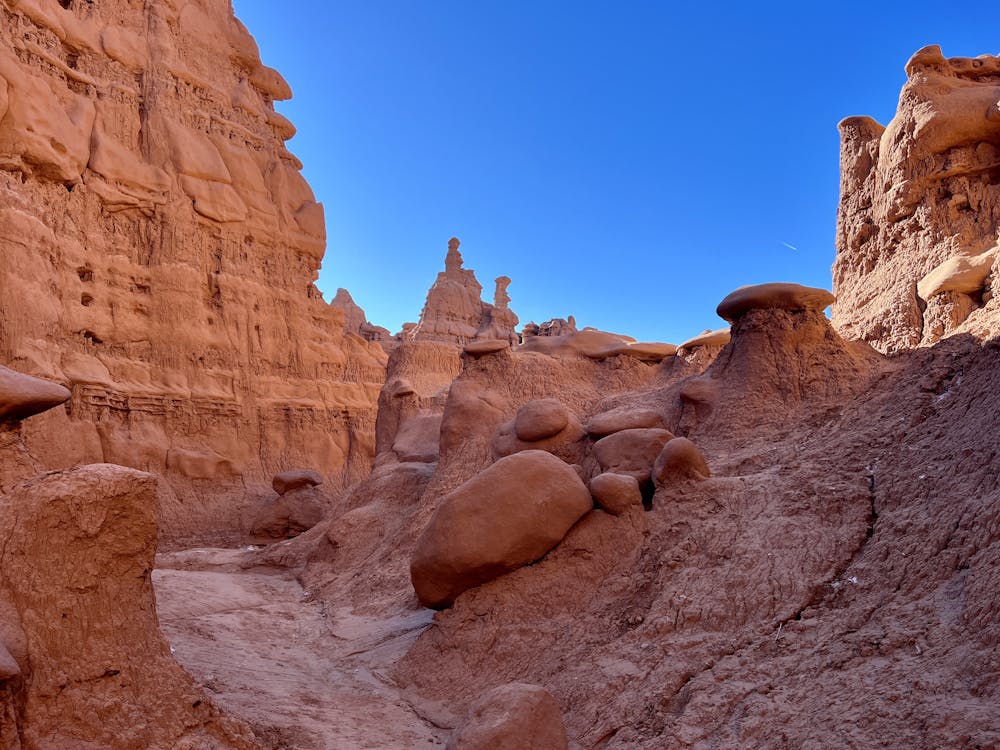
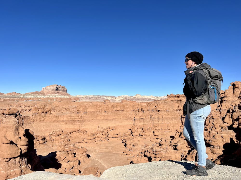
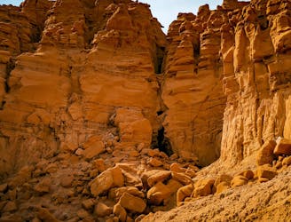
The route shown here is a longer route option that begins by traveling through the main valley and then heads south into the second section of the valley. The footing in the first valley is all easy to negotiate, although there are still a few drainages to cross and short, steep pitches to hike up and over.
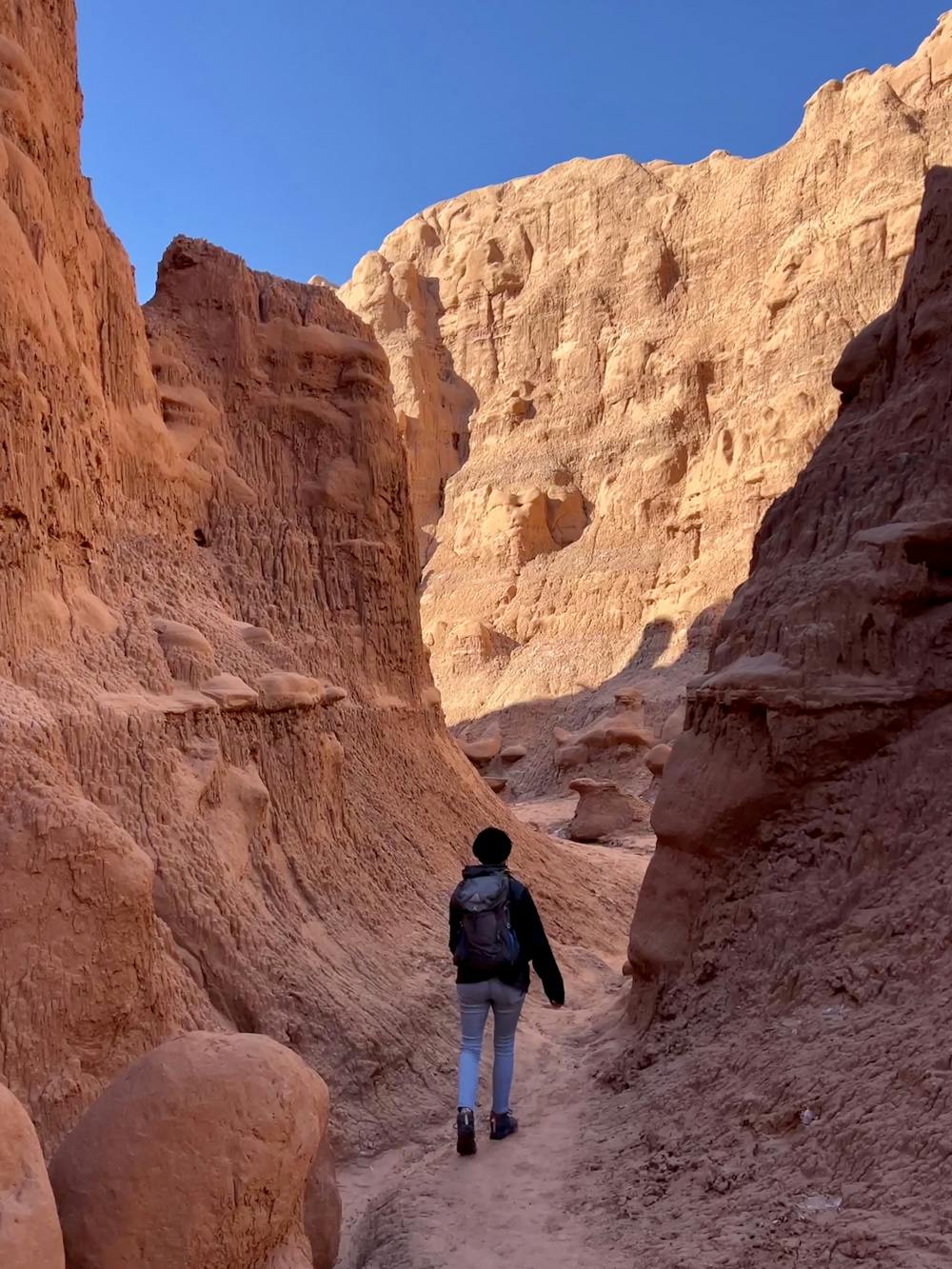
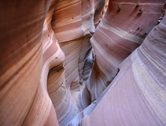
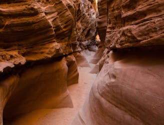
In the second valley, the hoodoos get even taller, which makes for a much more exciting adventure. The route shown here also follows a drainage back into one of the canyons in the hillside, providing a truly spectacular hike! Some sections of the route as mapped are a bit steep and loose, making the hiking a bit more difficult than the first valley. However, most hikers will have no problem negotiating this route.
The route as mapped also climbs to the top of an elevated dome and an elevated ridge, both of which provide surreal views of the surrounding landscape. You won't be able to stop yourself from taking photos!
If you choose to head into the second section of the valley as shown here, make sure you have the region downloaded for offline navigation in FATMAP so you can find your way through the hoodoos. Since the hoodoos here are much taller and can obscure your line of sight, it's easy to get turned around. Offline maps are very useful!
Sources: StateParks.Utah.Gov
Difficult
Hiking trails where obstacles such as rocks or roots are prevalent. Some obstacles can require care to step over or around. At times, the trail can be worn and eroded. The grade of the trail is generally quite steep, and can often lead to strenuous hiking.

The trail contains some obstacles such as outcroppings and rock which could cause injury.
Away from help but easily accessed.
Explore this free-roaming hiking area with a short loop itinerary.
Moderate Hiking
130 m away
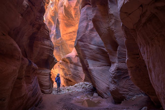
Hike to a spectacular cavernous formation on the edge of Goblin Valley State Park.
Severe Hiking
8.9 km away
One of the easiest and most popular canyons in the San Rafael Swell.
Severe Hiking
8.9 km away
Link two of the most popular canyons in the San Rafael Swell.
Severe Hiking
9 routes · Hiking

10 routes · Alpine Climbing · Canyoning · Hiking
7 routes · Mountain Biking · Canyoning · Gravel Biking · Hiking