130 m away
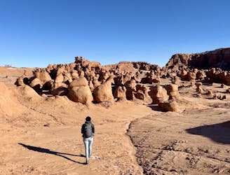
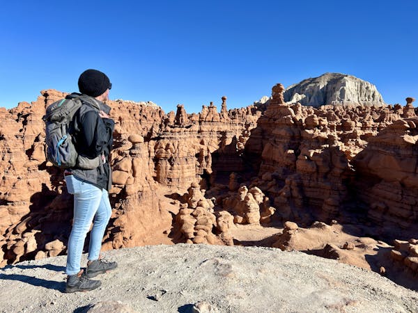
Valley of the Goblins: Long

Explore this free-roaming hiking area with a longer loop itinerary.
Difficult Hiking
- Distance
- 3.5 km
- Ascent
- 61 m
- Descent
- 61 m
Hike to a spectacular cavernous formation on the edge of Goblin Valley State Park.
Hiking Severe

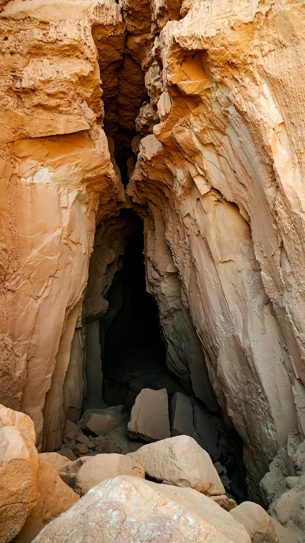
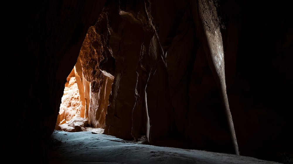
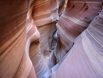
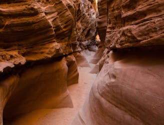
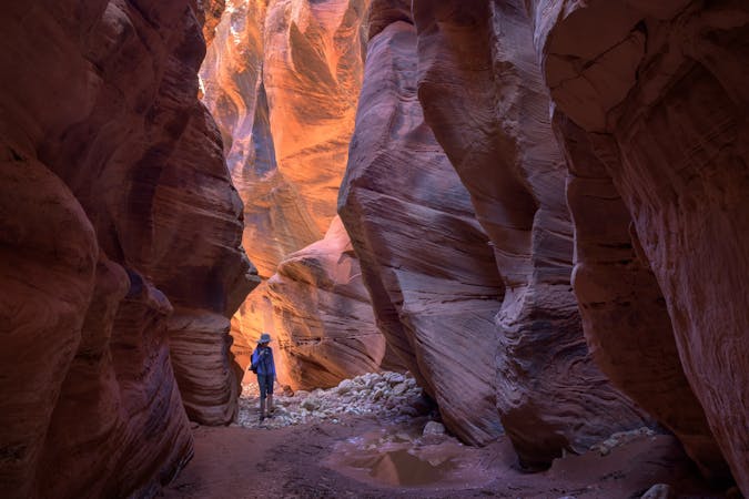
The Goblin's Lair is a "massive cavernous formation" located on Goblin Valley State Park's eastern boundary, according to Utah State Parks. While it's actually a slot canyon blocked by fallen debris and not a true cavern, this unique formation is magnificent and attracts plenty of hikers and rappellers alike.
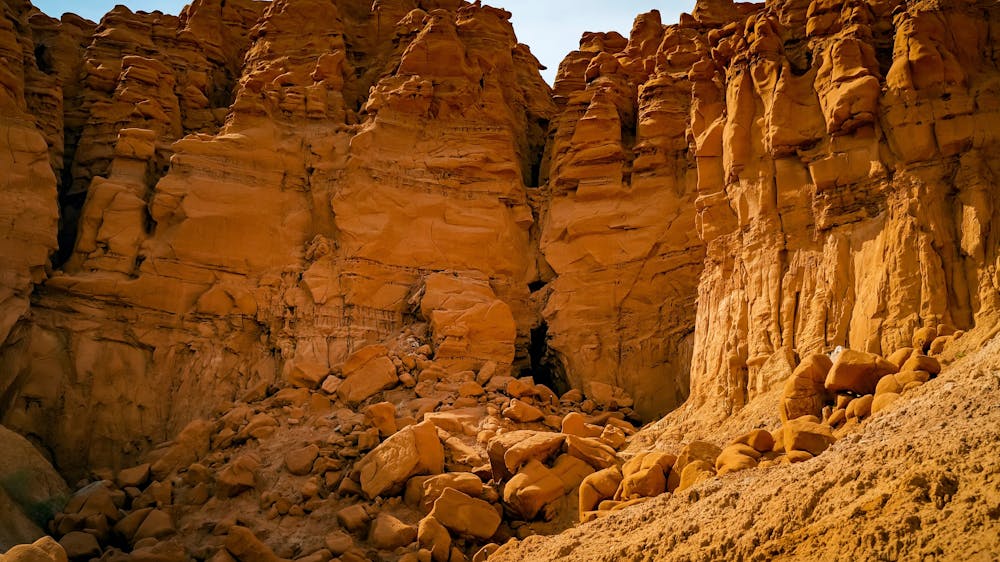
While Goblin's Lair was once a local secret, it is now one of the most famous hikes in the state park. Unlike the Valley of the Goblins, which is just a free-roaming hiking area, there's a dedicated trail leading to Goblin's Lair, which provides hikers with an objective to reach.
The trail leading to the Lair is mellow and non-technical and only warrants an easy or moderate FATMAP difficulty rating. However, to actually reach the Lair and enter inside, you'll have to surpass the final pitch, which is much more technical. This final section requires scree field scrambling and negotiating a stack of boulders and rubble with the use of both hands and feet. This scramble ratchets the difficulty of the hike up considerably, earning it a FATMAP "Severe" rating.
If you want to rappel into the Lair from the top, you'll have to pay for a permit at the visitor's center. The permits are only $2 per person, which goes to the maintenance of the trail and rappel point.
Sources: https://stateparks.utah.gov/parks/goblin-valley/hiking-in-goblin-valley/#The%20Goblin's%20Lair
Severe
Hiking challenging trails where simple scrambling, with the occasional use of the hands, is a distinct possibility. The trails are often filled with all manner of obstacles both small and large, and the hills are very steep. Obstacles and challenges are often unexpected and can be unpredictable.

Some trail sections have exposed ledges or steep ascents/descents where falling could cause serious injury.

Away from help but easily accessed.
130 m away
Explore this free-roaming hiking area with a longer loop itinerary.
Difficult Hiking
130 m away
Explore this free-roaming hiking area with a short loop itinerary.
Moderate Hiking
8.9 km away
One of the easiest and most popular canyons in the San Rafael Swell.
Severe Hiking
9 km away
Link two of the most popular canyons in the San Rafael Swell.
Severe Hiking
9 routes · Hiking

10 routes · Alpine Climbing · Canyoning · Hiking
7 routes · Mountain Biking · Canyoning · Gravel Biking · Hiking