9.6 km away
Bobsled Loop
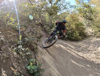
Arguably Salt Lake City's most famous mountain bike trail.
Difficult Mountain Biking
- Distance
- 9.5 km
- Ascent
- 342 m
- Descent
- 343 m
Climb from the outskirts of the city to the top of a mountain!
Mountain Biking Moderate

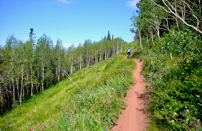
"The Mueller Park Trail epitomizes the metro-to-mountains transition for which the Wasatch Front is famed," according to Utah.com. This 13-mile out-and-back trail begins on the very outskirts of Salt Lake City's northern suburbs and climbs high into the mountains. While the trail is relatively non-technical, it does gain almost 2,200 vertical feet in just over six miles of climbing. Despite being easily-accessible, Mueller Park is not to be underestimated!
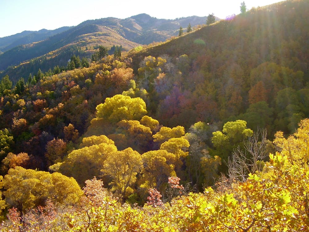
As you begin your climb up the singletrack, "within minutes, the nearby suburban jungle is transformed into a tranquil backcountry ecosystem," according to Utah.com. While you won't find jaw-dropping mountain views on this trail, you will enjoy the "embrace of serene forests. From these woods drift spirited sounds of nature and a rich, earthy bouquet that envelop your senses."
The flowy singletrack switchbacks up the mountainside, running back and forth in a (somewhat futile) attempt to make the grade climbable and achievable. Oh, it is climbable alright… you just need to put in the work to make it happen. While the vast majority of the singletrack consists of hard-packed black dirt, intermittent steep, rocky sections add a mix of challenges to the ride.
Since this trail is so renowned and so easily accessible from the metro area, expect to encounter plenty of trail traffic—especially on the weekends. When descending, be mindful of other trail users, and remember to yield the trail to hikers and all uphill trail users.
Sources: https://utah.com/mountain-biking/mueller-park https://www.utahmountainbiking.com/trails/mueller.htm
Moderate
Mostly stable trail tread with some variability, with unavoidable obstacles 8in/20cm tall or less. Other obstacles such as rock gullies and steep sections may exist. Ideal for lower intermediate riders.

The trail contains some obstacles such as outcroppings and rock which could cause injury.
Away from help but easily accessed.
9.6 km away
Arguably Salt Lake City's most famous mountain bike trail.
Difficult Mountain Biking
5 routes · Mountain Biking