5.3 km away
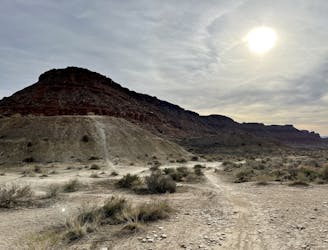
Santa Clara Preserve
This ride gives you a full overview of all the best trails in the Santa Clara Preserve, including a great variety of singletrack.
Severe Mountain Biking
- Distance
- 38 km
- Ascent
- 884 m
- Descent
- 883 m
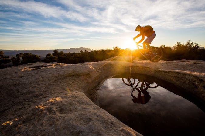
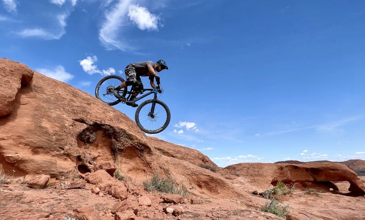
A fantastic mountain bike playground filled with drops and rock rolls.
Mountain Biking Severe

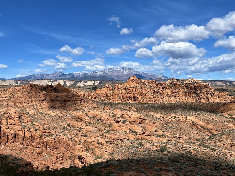
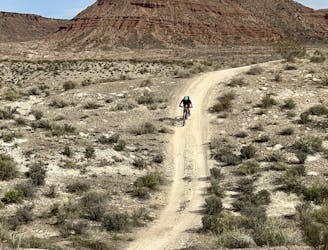
Paradise Rim might not look like an epic ride on the map. Even if you add in a few bonus miles to get up to the Boy Scout overlook, it still only nets ~6 miles in length. But these 6 miles hide a surprisingly fun expert-level mountain bike rip!

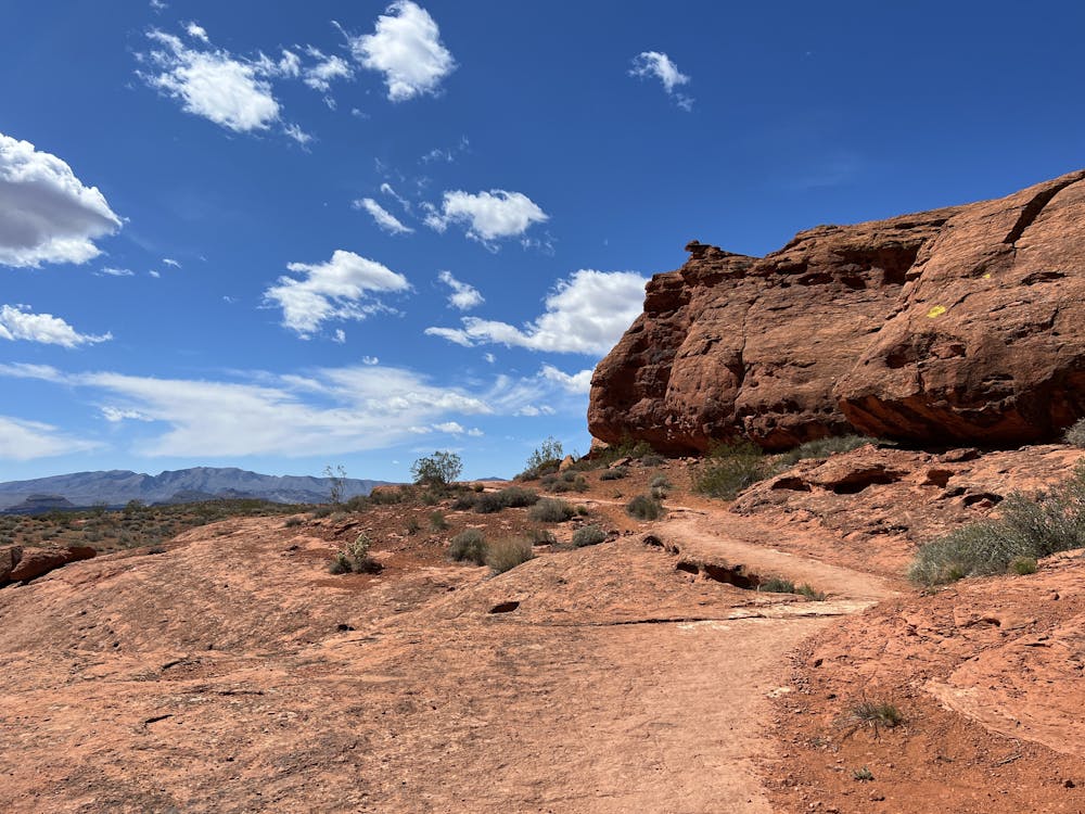
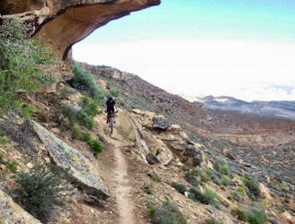
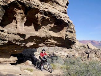
Begin the ride by pedaling out past a couple of rock climbing cliffs to reach the Turtle Wall trail. This incredible line ascends along a flat rock slab that twists and turns along the base of a dramatic red rock cliff wall. While the climbing is easy, this trail is visually stunning and is guaranteed to be a crowd-pleaser. The area is also known for its tortoises, so keep your eyes peeled for a glimpse of these incredible creatures.
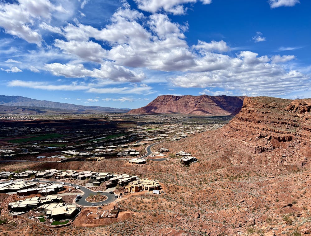
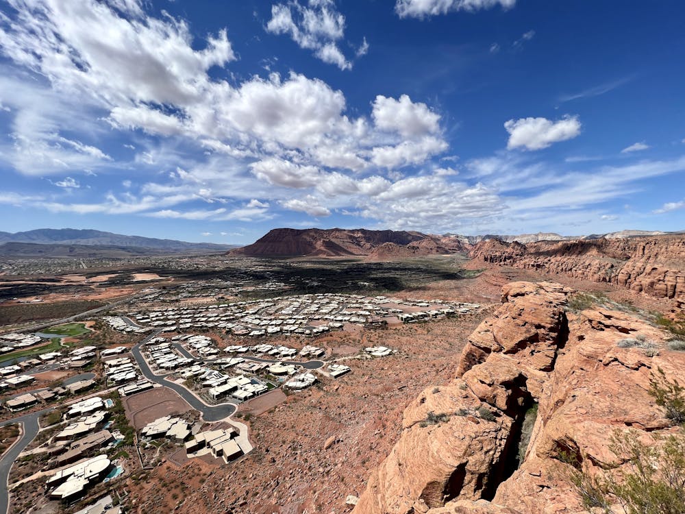
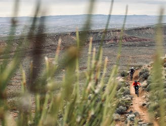
Upon reaching the rim, you'll enjoy a stupendous overlook of the city of St. George below you. This vantage over the valley is absolutely incredible, and it's worth spending a few minutes just absorbing the vista.
Take a right turn for a short out-and-back spur to reach the Boy Scout overlook. While this might seem like an unnecessary spur, the riding is pretty incredible, with fantastic rock features ranging from exposed slickrock slabs to chundery rock garden descents. And if anything, the view from the Boy Scout overlook is even more impressive than the initial viewpoint.
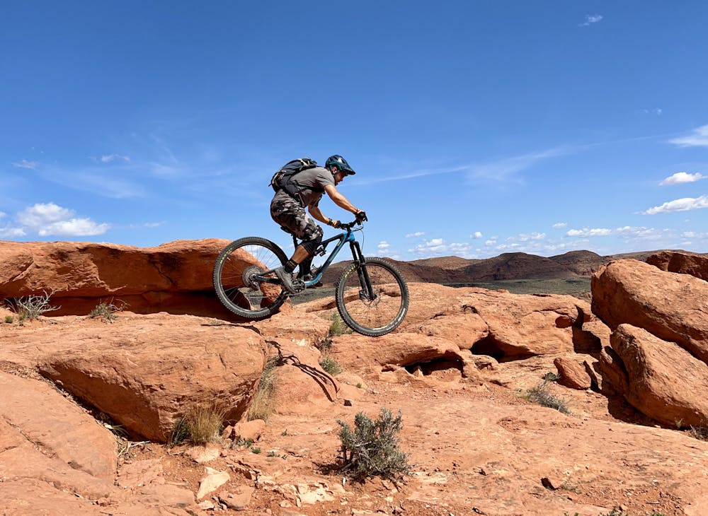
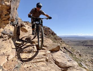
After turning around at the Boy Scout overlook, you'll rip back down the chundery rocks, pass Turtle Wall, and continue along the rim. The descent gets progressively more technical, with dramatically rough rock gardens. If you keep your eyes peeled, there are also some fantastic rock roller alt lines. Be sure to use your imagination to interpret these beautiful red rock slabs!
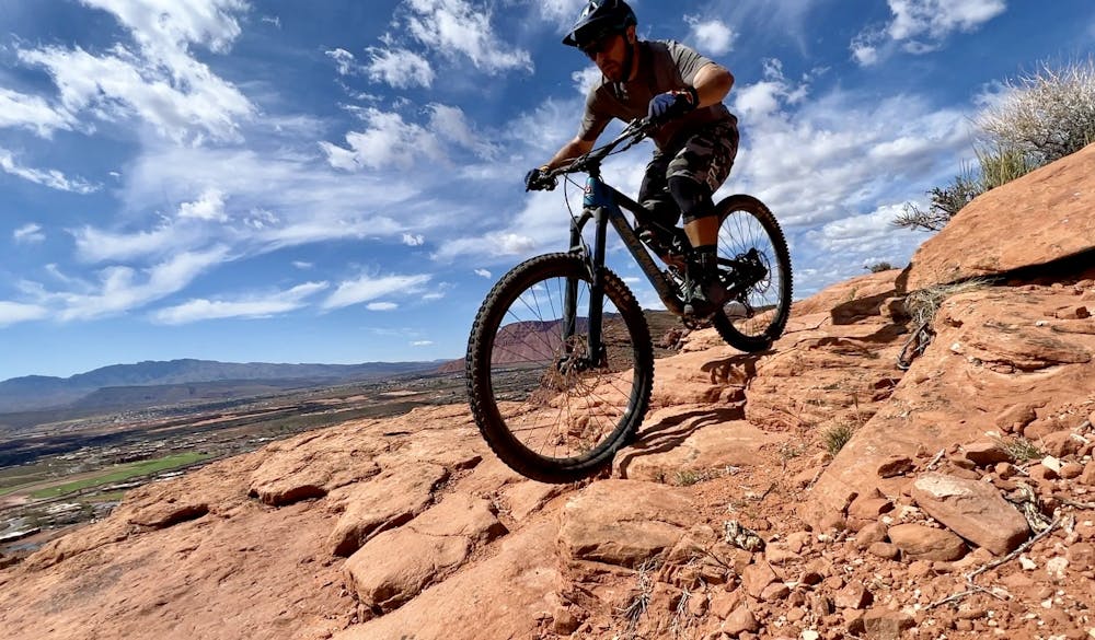
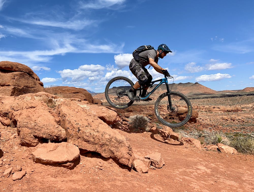
As you continue to descend, more optional ledge drops crop up. These range in size from small two-footers to massive outcrops of bedrock that form 7-10-foot drops, depending on how deep you send them. Many of the drops are in the 3-4-foot height, providing a constant series of huckortunities as you rock and roll down the hillside.
The final stretch of the descent features multiple line options, and especially on your first ride through, you might need to scout a few features and hike back up to try different lines. This short ride is more about playing bikes than covering miles. Feel free to session a few sections over and over again, trying different lines and different challenges as you go. This is a truly special mountain bike playground!
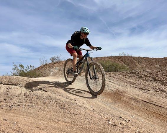
Severe
Widely variable, narrow trail tread with steeper grades and unavoidable obstacles of 15in/38cm tall or less. Obstacles may include unavoidable bridges 24in/61cm wide or less, large rocks, gravel, difficult root sections, and more. Ideal for advanced-level riders.

Some trail sections are extremely exposed where falling will almost certainly result in serious injury or death.

Close to help in case of emergency.
5.3 km away
This ride gives you a full overview of all the best trails in the Santa Clara Preserve, including a great variety of singletrack.
Severe Mountain Biking
5.8 km away
The Barrel/Zen route combines two popular loops to give technically-oriented riders a full smorgasbord of rocky, stunt-laden fun.
Severe Mountain Biking
6.5 km away
Beautiful little-ridden singletrack in Santa Clara Preserve.
Difficult Mountain Biking
6.5 km away
An intermediate-friendly crowd pleaser in Santa Clara Preserve.
Difficult Mountain Biking
6.5 km away
A classic rock-strewn trail high above Santa Clara.
Severe Mountain Biking
9.7 km away
The Bearclaw Poppy downhill is a true choose your own adventure mountain bike experience!
Moderate Mountain Biking
9.7 km away
You'll enjoy miles and miles of flowy trails accessing beautiful views of the wide-open desert landscape on this popular cross country ride.
Moderate Mountain Biking
6 routes · Mountain Biking

37 routes · Mountain Biking

25 routes · Mountain Biking
8 routes · Mountain Biking
9 routes · Mountain Biking
10 routes · Mountain Biking