4 m away
The White Rim
Pedal through the visually-stunning depths of Canyonlands National Park.
Moderate Mountain Biking
- Distance
- 165 km
- Ascent
- 2.1 km
- Descent
- 2.1 km
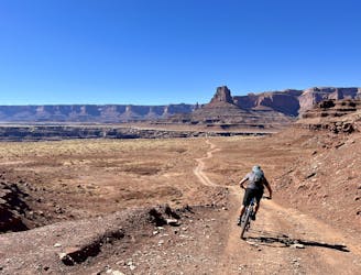
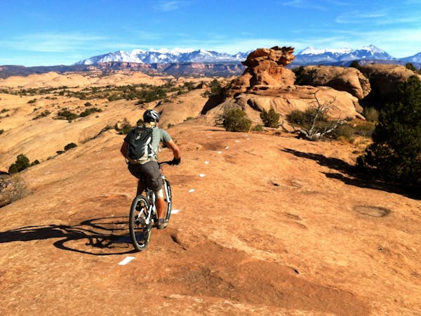
Day 1 of the epic White Rim Trip: running from either Mineral Bottom THD or the beginning of the Shafer Trail to Airport Tower.
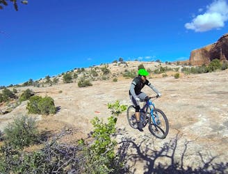
Mountain Biking Easy

You can begin your epic White Rim ride from a plethora of possible locations. The route shown here starts at a fairly large trailhead parking lot at the end of Mineral Bottom Road, which provides parking for riders who want to leave cars here and run their own vehicle support logistics on the White Rim.
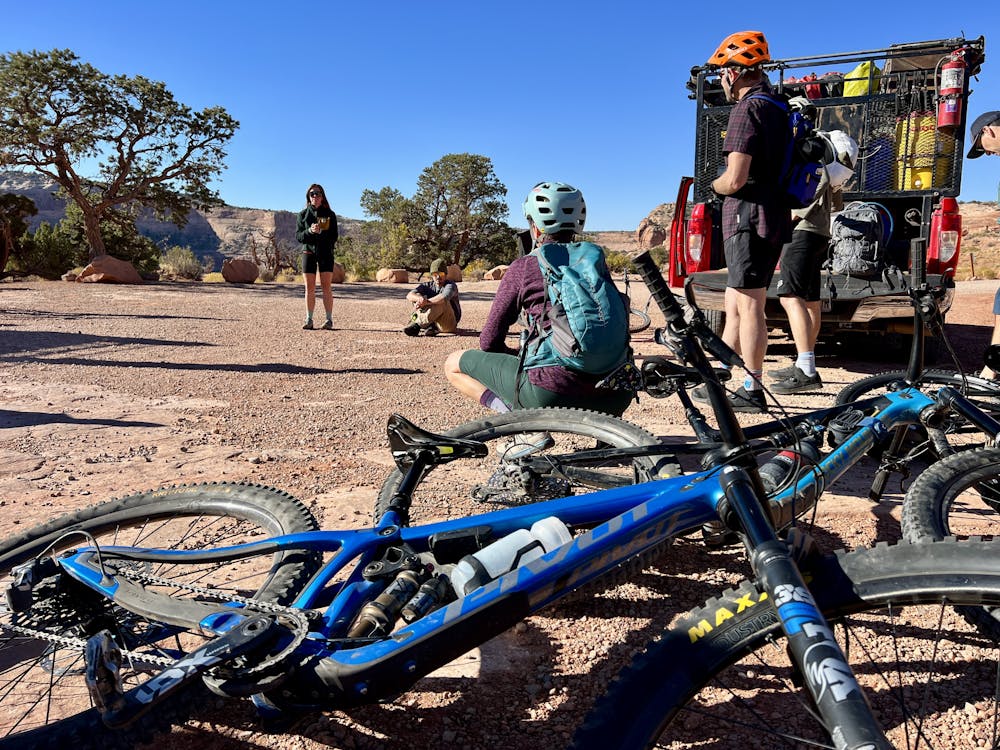
If you opt for the self-service model, Day 1 of the trip will require 25.6 miles of riding with almost 2,000 feet of climbing—but thankfully, 3,400 feet of descending down the incredible Shafer Trail! Unfortunately, you'll have to pedal a bit over 8 miles of pavement to connect from the trailhead to the beginning of the Shafer Trail. But even if you do go this route, you can rest confidently in the assurance that this will be the only pavement you ride for the next four days!
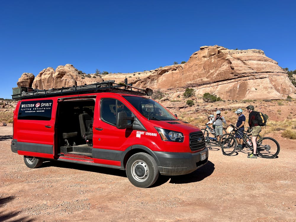
If you choose to use a tour company such as Western Spirit to handle trip logistics, Day 1 becomes dramatically easier: just 16.6 miles of riding with 1,500 feet of climbing and 2,800 feet of descending, and most importantly—no pavement riding!
If using a tour company, Day 1 becomes a mere warm-up day. The short distance and dramatic elevation loss allow you to warm up the legs a bit before diving into the bulk of the mileage on days 2 and 3. Even so, Day 1 is a spectacular riding experience!
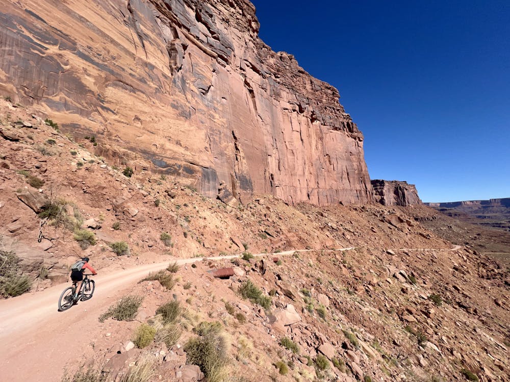
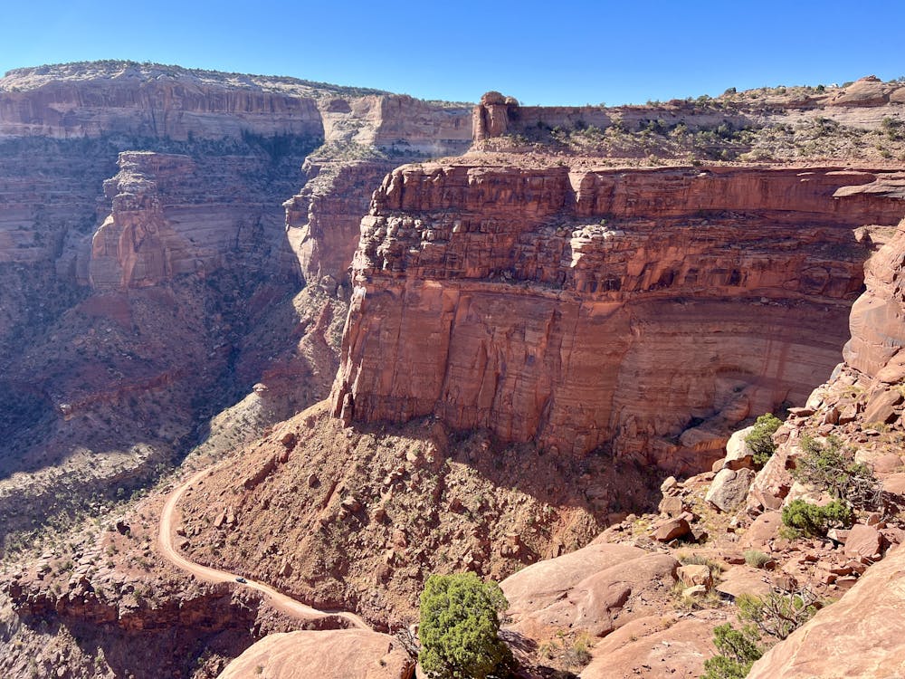
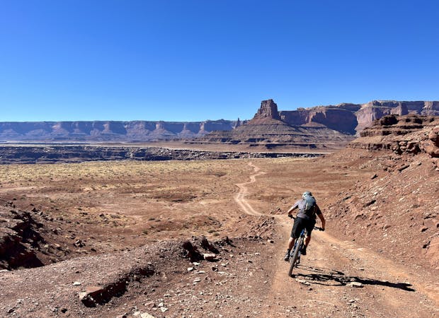
Undoubtedly, the highlight is the first segment of the day: riding along the top of the spectacular Shafer Trail and descending the steep switchbacked road down to the White Rim rock layer. The views from the exposed stretch of the upper Shafer Trail are spectacular! Even though you've just begun riding, be sure to snap some photos, as this is one of the most stunning parts of the entire four-day route.
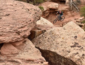
The descent is fast down a steep, well-graded road, but it's generally non-technical. The most challenging part of this section (and the first day generally) is dealing with the vehicle traffic. This is the most trafficked part of the entire four-day journey, and you can expect to pass vehicles both ways on the Shafer Trail.
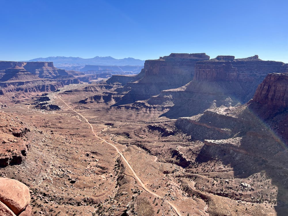
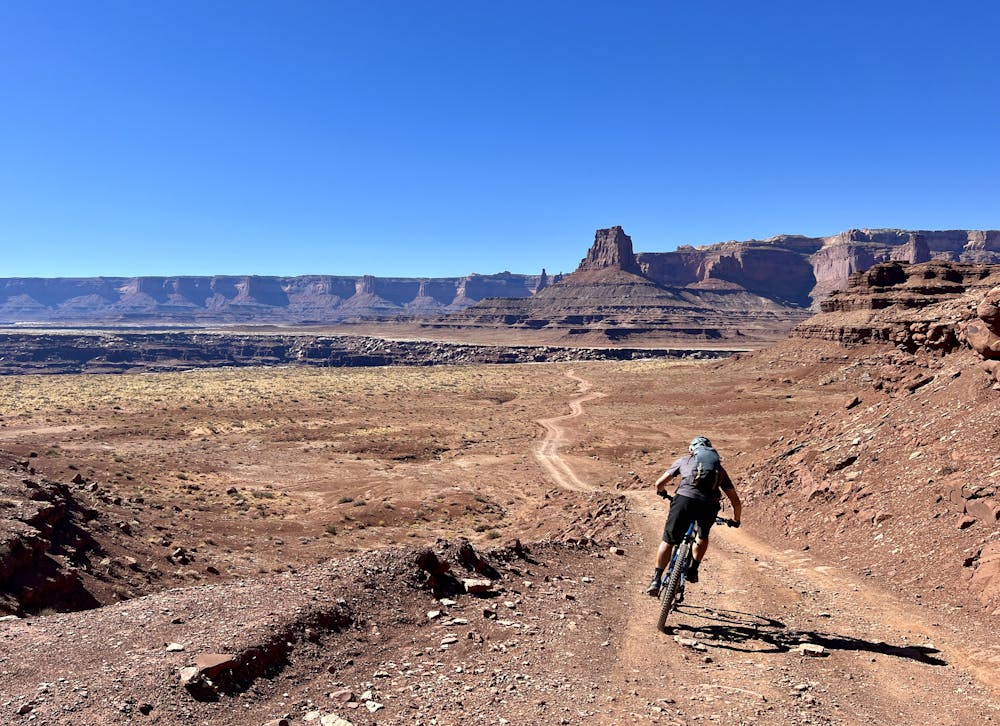
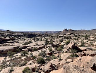
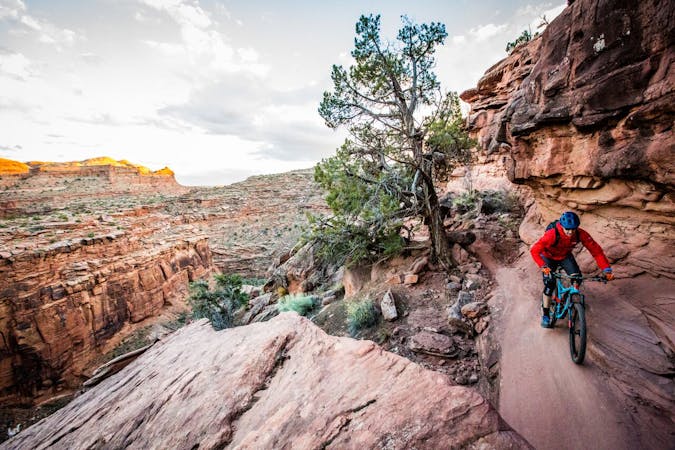
After finishing the descent, you'll begin to settle into a more typical pedaling rhythm that will become familiar over the following days. The White Rim Road offers relatively easy pedaling along undulating terrain, with small climbs and descents. Very rarely will the terrain be totally flat, although Day 1 does have at least one long, exposed, relatively flat section.
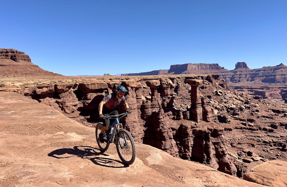
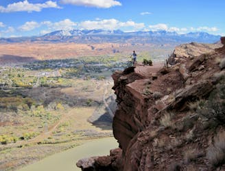
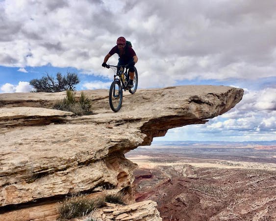
Two notable stopping points on Day 1 are found right next to each other. First up is a spectacular overlook of the Colorado River. Be sure to stop and savor this view, as the Colorado River will be out of site for the rest of the ride. Shortly after, another left turn will lead to Musselman Arch—a beautiful natural bridge formation on the very edge of the White Rim rock formation. Note that you must leave your bike on the dirt road and walk the short distance to the arch. Do not walk onto the arch, no matter how inviting it might appear!
Musselman provides a great lunch spot, with just 8.8 miles remaining to reach your campsite for the night at Airport Tower.
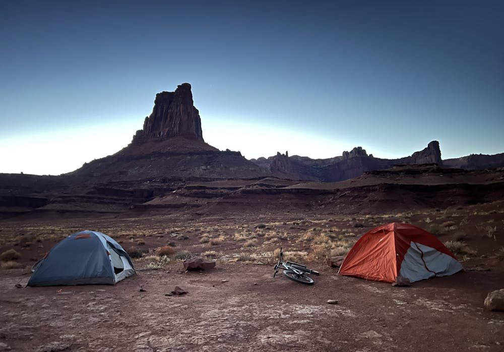
The campsite at Airport Tower provides spectacular views of the eponymous rock formation towering high above. However, there's no shade to be found at this campsite, and the sun can be brutal on hot days.
All of the campgrounds along the White Rim provide pit toilets for human waste, and they're generally well-stocked with toilet paper. As a rule of thumb, there's a pit toilet about every 10 miles along the White Rim road, providing plenty of opportunities to dispose of human waste in a safe and environmentally friendly manner.
Easy
Mostly smooth and non-technical singletrack with unavoidable obstacles 2in/5cm tall or less. Avoidable obstacles may be present. Ideal for beginner riders.

The path is on completely flat land and potential injury is limited to falling over.

Little chance of being seen or helped in case of an accident.
4 m away
Pedal through the visually-stunning depths of Canyonlands National Park.
Moderate Mountain Biking
1.3 km away
A shorter, more accessible version of the full Mag 7 shuttle.
Severe Mountain Biking
1.3 km away
Ride some of the most technical and dangerous mountain bike trails in the world in one massive shuttle route!
Extreme Mountain Biking
4.3 km away
New school Moab singletrack offering superb cross country riding, Moab style.
Moderate Mountain Biking
6.2 km away
Navajo Rocks embodies new school Moab mountain biking at its finest!
Difficult Mountain Biking
5 routes · Mountain Biking
20 routes · Mountain Biking

37 routes · Mountain Biking
4 routes · Mountain Biking

25 routes · Mountain Biking
4 routes · Mountain Biking