5 routes · Trail Running
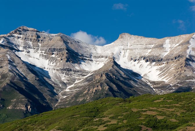
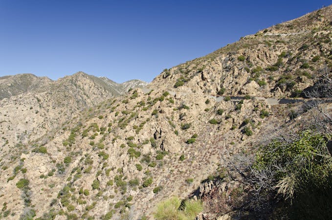
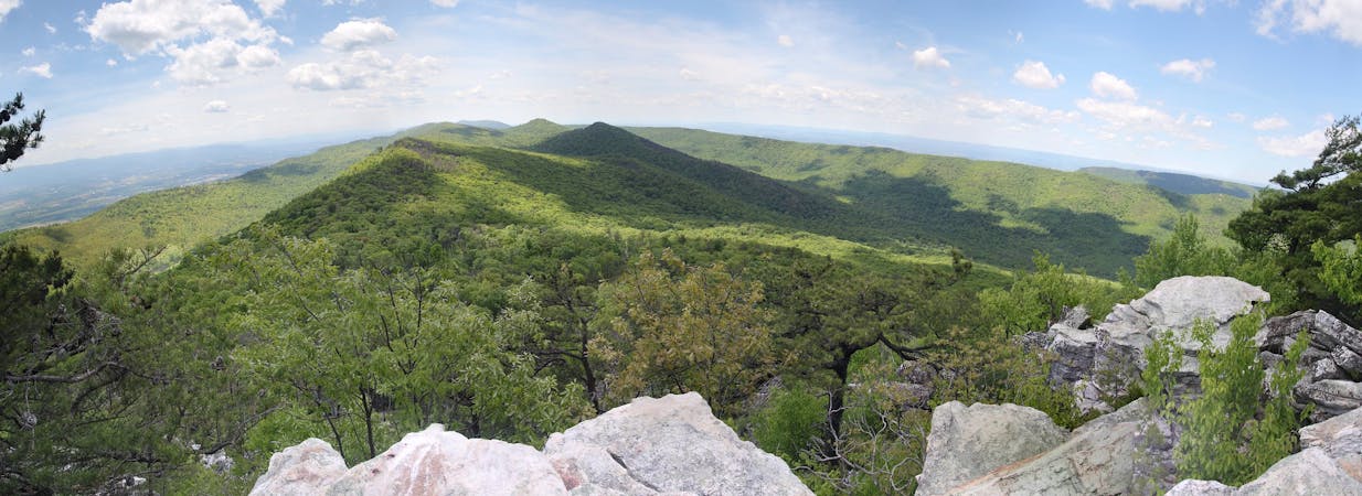
The run stretches from East Mountain Wilderness Park, Utah to Soldier Hollow, Utah and covers some of the most beautiful scenery the Wasatch Mountains have to offer. There is a cumulative gain of approximately 24,000 feet, as well as a cumulative loss of approximately 23,300 feet throughout the course.
Trail Running Extreme

START TO BOUNTIFUL B (MILE 0 to MILE 17.05)
From the start at East Mountain Wilderness Park, go past the green metal gate of East Mountain Wilderness Park and follow the dirt road north to the Bonneville Shoreline junction (mile 0.42), marked by a white rectangular sign. In about 360 feet you will encounter another trail junction. Bear right, and head uphill (you will encounter 2 additional forks as you head uphill, always take the right fork), northeast, onto the BST, which is at the 5200 foot terrace level (mile 0.68). From this junction take a right turn (90°) and go south. Here, the BST is at first single track and then double track, but with little elevation change.
As you travel south, you will first pass above the gun club range (mile 1.3), where can look down to the west, and see from where you started. Continue running south, maintaining your elevation on the BST. Then, at mile 2.38, as you approach Bair Canyon, you will drop off the BST and drop down southwest on a trail towards the mouth of Bair Canyon. As you descend, you will first cross an old dirt road and continue descending on the trail until dropping through a short, steep cut onto another good dirt road (mile 2.70). Turn right onto this road and head west for 500 feet. There will be a large water containment pond on your right. From here do not continue on west to the gate where the road becomes paved. Instead, bear left at the southwest end of the pond and head back east on a dirt road along the north slope embankment of Bair Creek for a short distance and then south again as the road crosses Bair Creek. Climb up the south slope embankment until coming out into a paved cul-de-sac. Stay left on pavement (climbing up the steep road, eastbound) until you pass by the Bair Canyon parking lot, and then a large white water tank. Both are on your left. You will pass eastbound through a gate and then, within a few feet, “T” onto a dirt road. Take a left (north) and in 150 feet straight ahead is the Bair Canyon trailhead signboard (2.93 miles). Turn right (east) and start up the Bair Canyon trail. You have about four miles of climbing ahead of you.
As you get into upper Bair Canyon, you will see the Francis Peak Radar Domes to the south appearing as huge “golf balls” looming to the south. When you have climbed four miles up the Bair Canyon trail you will reach the ridge road along the crest of the Wasatch (Mahler Junction, mile 7.07). Turn right and stay on this road southbound as it passes to the east of the radar domes. This dirt road meets another much larger and smoother graveled road south of the domes (mile 8.38). Go right, downhill on this wide road until you come to the large parking area at mile 11.94. This was the location of the former Francis Peak Aid Station. This is now Grobben’s Shed Water Station. Perhaps you will meet John Grobben, the race director, at this location. Don’t look for the shed, it’s been torn down.
Upon leaving the maintenance-shed area, go southeast on the smaller dirt road, which follows the eastern side of the ridge. In about 0.75 miles this main dirt road gently climbs into a saddle and leaves the ridge (Gold Ridge, mile 12.68), continuing to the right (west) side of the ridge. (Do not take the recreation vehicle trail going up Gold Ridge). The dirt road continues south for about 1.4 miles where the road crosses a small stream (look out for large road ruts made by OHV’s) and junctions with a road that goes south. This is called Watershed junction. Continue straight westward for 0.2 mile to Charlie’s Corner, a junction at mile 14.15. Turn left and follow the rocky 4-wheel drive road to the south as it climbs up and descends across a meadow. Go down the road until it turns east towards the aspen trees. Just before the trees, the road heads east. Leave the road onto a rough trail straight ahead and down. The rough trail stays west of the intermittent stream drainage until it drops far enough down to cross the first stream in the Right Hand Fork of Arthurs Fork at 15.22 miles. Cross below the beaver ponds; head south and stay to the right of the stream. You soon can step across another small tributary stream coming in from the west. Continue downstream until the trail climbs uphill and leaves the stream. The trail climbs steeply up and turns west for a few hundred yards and then heads across another stream. It then climbs steeply up the north face of a heavily forested area of tall fir and aspen trees. There are two other short but tough climbs through several meadows and then it finally climbs to the Bountiful B aid station at mile 17.05.
BOUNTIFUL B TO SESSIONS LIFT OFF (MILE 17.05 to MILE 21.30)
Head south from the Bountiful B checkpoint along the ridge road. It runs out onto the top of the ridge with large wide meadows. At times you will be able to see the valleys far below on either side of the ridge. It passes another OHV trail that heads to the west. The road eventually passes under tall spruce trees, crosses under some power lines, and heads south through some meadows on the ridge. The road twists, dropping southeast through the trees. The road becomes much rougher dropping very steeply down a hillside. Follow the road as it drops and rises until you near some tall white firs at an old campsite. This is the location of the “Sessions Lift-Off” Aid Station at mile 21.30.
SESSIONS LIFT OFF TO BIG MOUNTAIN PASS (MILE 21.30 to MILE 32.30)
From the Sessions Lift Off, continue south down the rough road, which levels out into a meadow. Look for a Great Western Trail sign on the left. The trail makes a stiff climb through aspen and pine until it comes to the ridge top of the Sessions Hills (mile 22.54). In this section there are frequent rocky areas with loose rocks to negotiate. Once on the ridge, drop downhill eastward through the sagebrush on the very rocky trail to a big saddle between peaks (mile 23.07) and follow the rocky trail uphill to the east until the trail bends southeast becoming a better trail which stays mostly on the southwest facing sides. At the junction with the Grandview Peak trail (mile 24.51), go hard left and eastward, remaining on the trail along the ridge. Continue east until the trail suddenly drops steeply down to City Creek Pass (mile 26.14). Head uphill east again to a junction known as the Brink (mile 26.51). At the junction, continue straight ahead (don’t take the trail on the right), and climb up the hill and follow the trail as it contours under Swallow Rocks. The trail continues east and encounters a jeep road at the Swallow Rocks area (mile 27.85).
From the Swallow Rocks area go east on the OHV road. Do not take any roads off this main ridge road. Continue eastward until at mile 29.50 you will come to a sagebrush-covered hill (Big Mt. Horse Trail Junction) where you leave the OHV road and take the Great Western Trail, which goes off uphill at an angle climbing to the right. TAKE THE TRAIL TO THE RIGHT. DO NOT STAY ON THE ROAD! If you are looking at your feet at this point, you will get lost for a long time. On the Great Western Trail, climb a short distance and swing east and then head south on the western side of Big Mountain. It drops into a meadow and passes through some aspen stands eventually coming out of the trees where you can see an exposed bare hill ahead of you (to the south), named Inspiration Point. Follow the trail around this hill (mile 31.26) on the west side and then south side where it starts dropping generally southeast. The trail switchbacks and crosses the highway to arrive at the Big Mountain Aid Station (mile 32.30).
BIG MOUNTAIN TO ALEXANDER RIDGE (MILE 32.30 to MILE 40.13)
From the Big Mountain Aid Station, the trail begins on the eastern side of the parking lot. It climbs southeast eventually turning south along the ridge top. Yellow painted splotches on trees and signs indicate East Canyon Resort property, which will be on your left side as you head south. Drop into a valley called Mule’s Ear Meadow at 33.94 and proceed on into the forest ahead. Bald Mountain is at mile 35.70. Continue south paralleling a private road until you reach Pence Point at mile 36.23. Turn right here, and do not continue on a trail straight ahead. DO NOT CONTINUE STRAIGHT AHEAD! If you are looking at your feet at this point, you will get lost for a long time. The trail, now heading west, winds along the ridge tops through the oak brush. You will find the trail to be steep in places (Baugh Bearing Hill) with loose round rocks. Be careful. After many up and down hills crossing the ridge, you descend past a grassy buried pipeline route, onto a flat under power lines. On race day this is the location of the Alexander Ridge Aid Station (mile 40.13).
Special note: The section from Big Mountain to Lambs Canyon takes 3 to 5 hours. It will feel cooler out of Bald Mountain because there is some shade. However, a few miles out, the trail becomes difficult as you run on ball-bearing size loose rocks. Exposure to the sun may become severe with temperatures sometimes above 100 F. The hot sun reflects off the light colored soil and can bake everyone in the Alexander Springs area and in the descent down to Lamb’s. CARRY MORE WATER THAN YOU THINK YOU WILL NEED ON SUNNY DAYS. Dehydration strikes hard. Nausea runs rampant. Wear a hat, a loose neck bandana, and keep them wet. Take a flashlight if there is any chance of finishing this section after 7 PM.
ALEXANDER RIDGE TO LAMBS CANYON (MILE 40.13 to MILE 45.71)
Head east From the Alexander Ridge aid station along the hillside grassy rolling trail/road (traversing the hillside) to the canyon bottom at Alexander Springs at mile 41.21. This is an open (and sometime wet, boggy) area with pipelines and several utility right-of-ways. There is drinkable spring water from a pipe a hundred yards south of the trail/road in this area. From here the trail starts climbing uphill, continuing east, on the obvious grassy road/ trail. There are gas pipeline signs marking right-of-way. As you continue eastbound up the canyon, the power lines will first be on your right (south) and then they will cross over to your left (north, 0.87 mile, from the spring) and will stay just to your left along the north side of the trail.
Every year runners miss the Roger’s Saddle junction coming up, so this is critical! Look for the last power pole on your left, which is POLE 177. This is a visible warning that you are approaching the Rogers Saddle junction. Just after POLE 177, the power lines cross back over to the south (right side) of the trail (mile 42.65, or about 1.4 miles up from Alexander Springs).
Where the power lines pass over you from the left to the right, the road/trail also gently bends to the left giving you a clear view straight ahead to the top of the canyon. You are only 470 feet from the critical Rogers Saddle junction. Next, pass between two warning gas pipeline signs. The critical junction is coming right up. Finally, look for the single pipeline sign on your right just ahead. There is also an old twisted, metal post alongside the single sign. (NOTE: THESE POLES/SIGNS MAY BE ON THE GROUND! They have been known to fall over). Take the sharp, sudden trail on the right and leave the road. This is Rogers Trail Junction at mile 42.75. DO NOT STAY ON THE ROAD! If you are looking at your feet at this point, you may get lost for a long time.
After the junction, this section of the trail climbs through pine trees and brush. Go over the top of the gentle ridge (Rogers Saddle, mile 43.01) and drop south to the other side eventually coming to the railroad fill (mile 43.35) where you turn right. Follow the railroad grade all the way down to the causeway/fill crossing over the Parleys Creek stream. Bear to the right here. If you go straight ahead you will miss the junction and come to a paved frontage road. If so, turn back and look for the trail. The trail heads bears right, west, paralleling the paved frontage road, which is hidden by thick oak brush. The trail follows under some power lines for a while and cuts down abruptly crossing the small stream, and continues downstream. Look for the sudden left turn which crosses the stream again. Climb up the hill onto the dirt road and go eastward to the Lambs Canyon Checkpoint (mile 45.71).
LAMBS CANYON TO UPPER BIG WATER (MILE 45.71 to MILE 54.18)
Runners take 2 to 3.5 hours to go from Lamb’s to Upper Big Water. Temperatures will cool down as you gain altitude and reach the forests and canyons. The climb up Lamb’s gains 1500 feet in 2.1 miles. Most runners will need flashlights through this section and warmer clothing. Dehydration and altitude make a dangerous combination so take precautions.
From Lambs Canyon aid station, pass under the freeway and go 1.6 miles up Lambs Canyon to the trailhead (mile 47.39) where there is a small parking area with rest room. (If you stay on the road, you will come to some cabins, and have gone too far). At the bathrooms, the trail drops off the right side of the road and crosses the stream. The trail climbs southwest up the ridge between the two canyons taking a very big switchback before it reaches the top. When you cross over the top of the divide (Bear Bottom Pass, mile 49.42), continue downhill making several switchbacks and turn left (downward) at the Mount Aire Trail fork junction. In about a quarter mile you will come to Elbow Fork Trailhead on the Millcreek Canyon paved road (mile 51.12). Turn left and go up the road. Be careful of cars in this canyon, especially in the dark. The road is very narrow with many blind corners. Go up the road for 3.1 miles to Upper Big Water Aid Station (mile 54.18).
UPPER BIG WATER TO DESOLATION LAKE (Mile 54.18 to Mile 59.07)
Runners take 1.2 to 2.5 hours from Upper Big Water to Desolation Lake. The trail is broad and quite an improvement over the previous trails. It is easier and faster. The course leaves the Upper Big Water Aid Station on a trail on the south side. In about 1/4 mile this trail joins the trail coming up from the Lower Big Water parking lot. At this intersection keep going uphill and follow this gently switching wide trail. In one mile is a wooden bridge, cross it and stay on the main trail. In another quarter mile is a trail junction (mile 55.4). Bear right at this junction continuing towards Dog Lake. Continue until you reach a trail junction at mile 56.8, and turn right and uphill to a second junction in 0.2 miles that has a sign indicating you are now on the Desolation Trail. Bear left, go downhill 0.1 mile to Dog Lake (named for water dogs or salamanders). Stay on the left side of the lake. Just a few dozen feet past Dog Lake is a new trail junction. Take the left fork and continue onto the just completed bypass trail. This new, delightful trail is generally level and laterals east (avoiding Blunder Fork, far below) until rejoining the old course trail coming up from Blunder Fork (mile 57.9). Bear to the left and continue just over a mile east from this junction until you cross up and over a rise and descend into the bowl containing Desolation Lake and the Desolation Lake Aid Station (mile 59.07). This aid station is back country and will have limited food.
DESOLATION LAKE TO SCOTTS PEAK (Mile 59.07 to Mile 63.03)
After a steep climb up from the Desolation Lake aid station up to “Red Lovers Ridge” (mile 59.68) you reach the main ridge of the Wasatch Range (9900 feet elevation). Turn right (south) at the trail junction on the ridge and continue southwards as it climbs up staying mainly on the southwest side of the ridge. Runners can make better time as the trail hovers around 9500 to 10,000 feet. The lights of Park City, Brighton, and Salt Lake City can be seen at night up on the higher vantage points. The trail becomes a primitive road about a mile before the Scotts Peak Aid Station (mile 63.03).
SCOTTS PEAK TO BRIGHTON (Mile 63.03 to Mile 67.08)
Leaving Scotts Peak aid station, the trail then traverses around Scotts Peak (with cell phone towers and buildings beside the trail) and then descends a very steep dirt road (called Puke Hill) to Scotts Pass (mile 64.21). From Scotts Pass take the main dirt road continuing down to the west. The road laterals around on the northwestern side of the forested slope for about a mile until you arrive at a metal gate, which you go around. Just beyond the gate is a restroom on the right. The course no longer continues on ahead onto the paved Guardsman Pass road. Instead, the course now leaves the dirt road immediately after the bathroom by taking a trail down off to the right (at mile 64.91). If you miss this trail and hit the paved road, you’ve gone too far.
This single track trail parallels the highway above you (to your left) for about 1/3 mile until you come to a junction with a quality trail coming up from behind you on your right. Don’t proceed ahead on the poor trail, but rather take the hard 270° turn to your right, where the trail turns into a very nice dirt road. Head northwest for another about 1/3 mile until you hit another road junction coming up from behind you on your left. Take the hard 270° turn to your left onto this road, heading south. (There is a solar panel on a steel pole on your left, close to this turn). After this turn, the road then bends gently around to the right crossing over the creek, then heading you gently uphill, northwest. Continue for ¼ mile until you climb up onto the Guardsman Pass road (rejoining the 2016 course). Go downhill on the paved road until you finally reach the junction with the main highway to Brighton (mile 66.53). Turn left at the highway and go up the road a quarter mile up to the Brighton loop road (where the Brighton Store is located). At the loop, go left against vehicle traffic and follow the loop road around to its south end. Go through the parking lot to the Brighton Center building which is now the Brighton Aid Station (mile 67.08). Because of construction being done at the Brighton Manor, the aid station for 2017 is located in the large, impressive Brighton Center building. You step off the asphalt and into the entrance.
BRIGHTON TO ANT KNOLLS (MILE 67.08 to MILE 71.79)
Coming out of the Brighton Aid Station, go down the stairs and go straight ahead to the Lake Mary/Catherine Pass trail head sign intersecting the gravel trail and turn right. Follow the gravel trail uphill between the Brighton Snowboard/Ski School building (on the left) and a large pine tree (on the right) until you come to a road with a green gate on the opposite side. Don’t go through the gate, but take the trail across the road to the right of the green gate between the large logs. Continue uphill on this trail as it heads southeast and switchbacks up underneath the ski lifts in broad open uphill meadows. In about 2/3rd mile the trail skirts around a granite outcrop where it bends to the right and flattens out. It then climbs a bit until you reach a wooden sign that says “trail” with an arrow pointing to the right into the trees.
Continue south uphill to the Dog Lake Junction continuing straight and over a wooden bridge just past the junction. The Twin Lakes junction is a couple of hundred feet past that. Pass by that junction and continue climbing on a very rocky trail with granite boulders. Climb up the trail to the dam just below Mary Lake and the lake edge and follow the main trail going left. Continue on this trail as it climbs south uphill past Lake Martha on your right. It switchbacks to an overlook above Dog Lake and continues up to the Lake Catherine trail junction sign at mile 69.34. Pass by that junction and follow the trail up to the ridge west to Catherine Pass (mile 69.79).
The trail splits here; one trail going west, downhill to Albion Basin (do not take this trail) and the correct trail going south, uphill. Take the uphill trail southward as it climbs and switchbacks onto a very sandy area (the “Beach”) short of the crest of the range. At mile 70.04 you crest the highest point of the course, Sunset Pass (aka Point Supreme, 10,464 feet). The trail goes over the crest and drops down into the Dry Fork drainage through some firs on the south side of the range and proceeds in a southeast direction on a rocky trail. It is also marked “Great Western Trail.” It then again drops steeply, twisting through meadows on very rocky trails eventually dropping down an excruciatingly steep jeep road with loose rocks. The jeep road soon drops to the trail junction of trail #157 on your left. This is the location of the Ant Knolls aid station (mile 71.79).
ANT KNOLLS TO POLE LINE PASS (MILE 71.79 to MILE 74.97)
Leaving the Ant Knolls Aid Station, take the trail east, climb up the “grunt” to the ridge top, at mile 72.36, and turn right and head south. The trail traverses around the Ant Knolls through stands of aspen trees heading south. The trail splits at “Goblins Corner, where you traverse, bearing right. Do not go to the left and head uphill along the ridge. Past this split on the right side and continue to traverse the west side of the ridge for one mile. Then, in about a mile, the trail crosses over to the east side of the ridge for another half mile until the trail zigzags down the mountain for 0.7 miles and ends up at Pole Line Pass (mile 74.97).
POLE LINE PASS TO ROCK SPRINGS WATER STOP (Mile 74.97 to Mile 78.95)
Look for the trailhead sign for Trail 157 and head south on this trail. Stay on the trail until you come to Sandy Baker Pass (75.59) and the northern junction of the Pot Hollow-East Ridge Trail 38 with Trail 157. Head right on Trail 157 going west. The trail then traverses for about 3/4 of a mile through a pine and fir forest, turns south, and climbs gently for another mile. You may see Forest Lake below you to your right and evidence of winter avalanche tree fall as you run along this section. The trail then passes the Forest Lake trail junction (mile 77.32). Stay on Trail 157 as it climbs steeply to Point Contention, mile 77.98, and curves back to the left climbing gently until it reaches the junction with Holman Trail 39. Bear left at the intersection while the trail drops through some aspen trees to Rock Springs. A small pipe on the left side of the trail with water running into a catch basin will usually have drinkable water. This is the location of the Rock Springs Water Stop, mile 78.95.
ROCK SPRINGS WATER STOP TO POT HOLLOW AID STATION (Mile 78.95 to Mile 84.79)
One hundred feet east of Rock Springs is the trail junction with East Ridge Trail 38. Take the East Ridge trail going uphill to the left and climb through the Aspen trees. The trail climbs up to Serenity Point, mile 79.43. Follow the trail on an old CCC terrace until it joins a newly created trail (now called the “Glide”, at mile 79.73, replacing the historical “Dive”). The new trail contours around the mountain until it reaches the start of the “Plunge” and drops northeast out on a ridge, then down into a gully (a 600 foot decent) and until bottoming out at mile 81.51. Turn a sharp left here heading uphill to the northeast. This trail climbs up through several fir and alpine meadows until it meets the Pot Hollow trail #37 junction at mile 83.38 where you turn right and drop east. The trail is steeper for about one-half mile to Ruminant Springs (83.76). It swings back eastward down through the trees to the bottom of Pot Hollow, the location of the Pot Bottom aid station at mile 84.79.
POT HOLLOW TRAILHEAD TO STATON AID STATION (Mile 84.79 to Mile 89.52)
From the Pot Hollow Trail Head go left, uphill along the jeep road. At the next junction bear right and continue up the old jeep road for 1.3 miles to Lower Old Goat Junction on the Cummings Parkway Road (Wasatch Mountain State Park Road #1) at mile 86.18. Turn and run south along this dirt OHV road that runs along the crest of the mountain ridge. Please note that runner crews are NOT allowed on Cummings Parkway. Continue south along this road to the 4-way junction on the ridge which is the location of the Staton Aid Station (mile 89.52).
STATON AID STATION TO DECKER CANYON AID STATION (Mile 89.52 to 93.83)
From the Staton Aid Station proceed south on the OHV trail (Wasatch Mountain State Park trail #4) until this OHV trail switchbacks down the south face of the ridge to reach the Cascade Springs dirt road called The Top of the Wall, mile 91.48. This is the dirt road that goes from Midway to Cascade Springs. This location is designated as a “pacer exchange point.” Continue south, crossing the Cascade Spring Road on an OHV trail for 0.3 of a mile to Joan’s Junction at mile 91.68. At this point Joan’s Trail leaves the OHV trail and turns to the left (East) down to Decker Canyon. In 1.9 miles you will come to the Decker Canyon Aid Station, mile 93.83.
DECKER CANYON AID STATON TO THE FINISH (Mile 93.83 to Mile 99.67)
From the Decker Canyon Aid Station continue down Decker Canyon going South out to the mouth of the canyon where it meets the Deer Creek Parkway Trail. Go left (East and North) around Deer Creek Reservoir for 5 miles on the Parkway Trail. You will exit the trail at the bottom of Soldier Hollow Pavilion; continue through the small parking lot to the main road going up to the Pavilion. Run alongside the road for 0.6 of a mile to the Finish Line.
Extreme

Some trail sections are extremely exposed where falling will almost certainly result in serious injury or death.
In the high mountains or remote conditions, all individuals must be completely autonomous in every situation.
5 routes · Trail Running
3 routes · Trail Running
4 routes · Trail Running