
58 routes · Hiking
A trek across endless Brushy Mountains, past Dismall Falls, and ending at New River.
Hiking Difficult

The southern terminus for this segment is located where the trail crosses Interstate 77. The famous Brushy Mountain Outpost lies adjacent to the highway and serves as a popular place among thru-hikers to refuel after a long stretch of trail. The small town of Bland, VA is also a few miles away and serves as a good resupply town.
There is no developed trailhead for this stretch, but there are still a few places to park along the road or near the restaurant. With shelters every 10 to 15 miles, the average hiker should allocate 3 to 5 days to complete this 40+ mile stretch.
Heading north on the trail, you'll find yourself atop a long, quiet ridge before reaching State Routes 611, 608, and 606. There are no developed trailheads at any of the road crossings, but small pull-offs still allow for a couple of cars to park at each.
Should you need to resupply by SR 606, head north on the road to Trent's Grocery for roughly a half of a mile.
Just a short trek north on the AT, a side trail should denote a spur to Dismal Falls, a popular swimming hole and picturesque destination. The falls can also be accessed by a 10-minute hike from Dismal Creek Road.
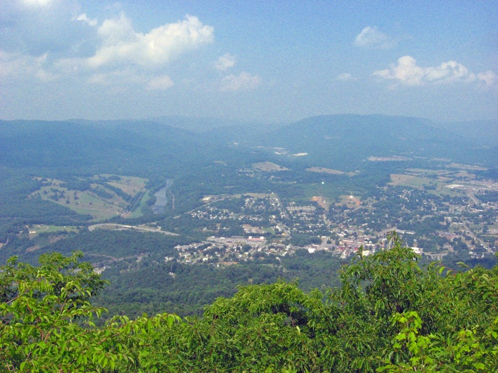
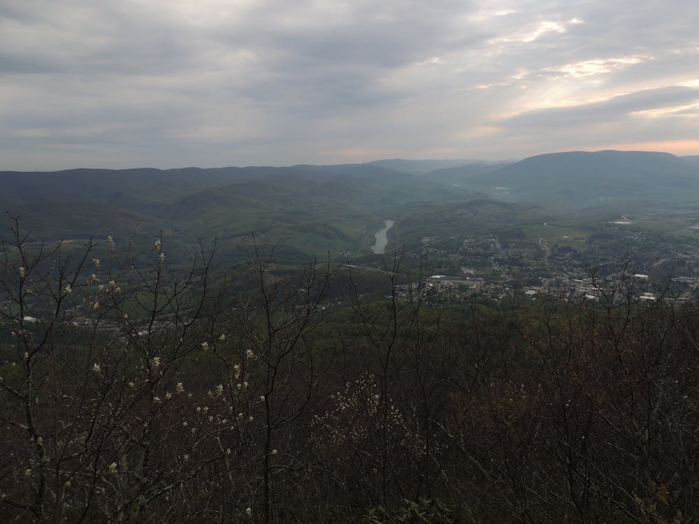
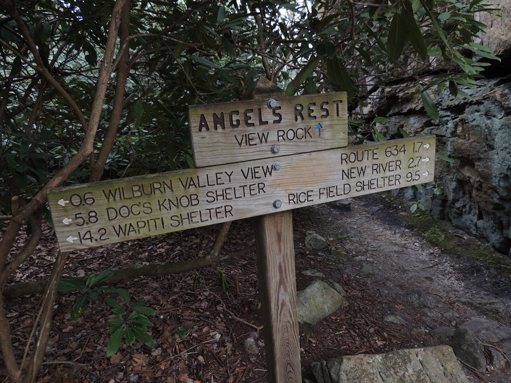
Further north, the trail winds around the summit of Sugar Run Mountain before again continuing across a ridgeline. Ending your time on the ridge, you'll cross over Pearis Mountain before reaching the final landmark, Angels Rest. This picturesque overlook is only a short hike from town and a great spot to snag a few pictures before making your way to New River, the northern terminus of this stretch.
As you near the road, know that the original path for the AT has changed over time and may be rerouted.
Sources: https://www.whiteblaze.net/forum/archive/index.php/t-108742.html https://www.reddit.com/r/AppalachianTrail/comments/1ptgth/theappalachiantrailin30days830atkinsvato/
Difficult
Hiking trails where obstacles such as rocks or roots are prevalent. Some obstacles can require care to step over or around. At times, the trail can be worn and eroded. The grade of the trail is generally quite steep, and can often lead to strenuous hiking.

The trail contains some obstacles such as outcroppings and rock which could cause injury.
Away from help but easily accessed.
58 routes · Hiking