1.9 km away
Billy Goat Trail Section A
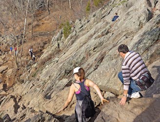
A technical hike along Mather Gorge.
Severe Hiking
- Distance
- 6.2 km
- Ascent
- 83 m
- Descent
- 83 m
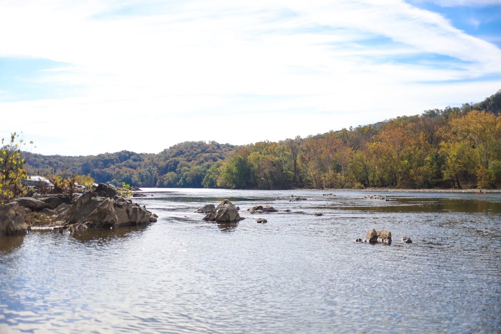
A beautiful hike along the Potomac River.
Hiking Moderate

The Billy Goat Trail is a popular hike along the Potomac River and Mather Gorge. From this stretch of trail, you can view the Lower Mather Gorge, including Stubblefield Falls.
At one point, the trail runs along the top of a cliff band that is popular with rock climbers. You can stop and watch the climbers trying their luck on the cliff faces while simultaneously enjoying the expansive views of the region.
Section C of the Billy Goat trail is one of the easiest sections to hike, while A is dramatically more challenging.
The route shown here is mapped as an out-and-back, but if you prefer, you can turn it into a loop by using the C&O Towpath.
Moderate
Hiking along trails with some uneven terrain and small hills. Small rocks and roots may be present.

The trail contains some obstacles such as outcroppings and rock which could cause injury.
Away from help but easily accessed.
1.9 km away
A technical hike along Mather Gorge.
Severe Hiking
9.5 km away

A popular rail trail in the Washington DC Metro Area.
Easy Hiking