1.3 km away
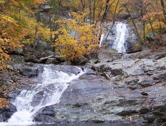
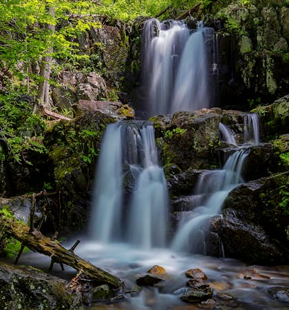
Dark Hollow Falls
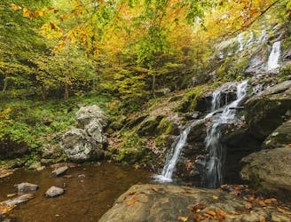
A classic short hike to a stunning waterfall in Shenandoah National Park.
Moderate Hiking
- Distance
- 2.5 km
- Ascent
- 181 m
- Descent
- 181 m
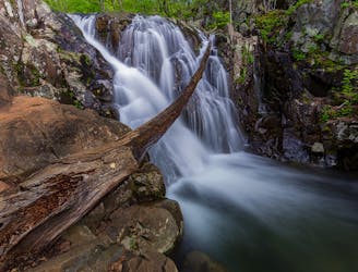
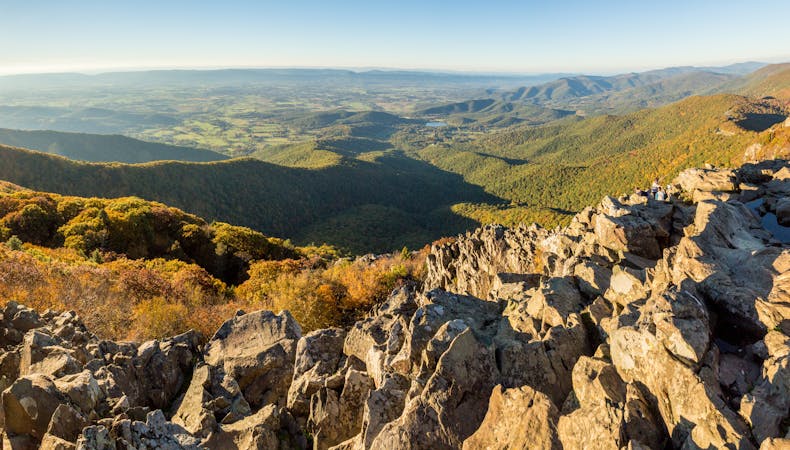
A short yet challenging hike pairing the epic views from Blackrock with Lewis Spring Falls, the fourth-largest waterfall in the park.
Hiking Difficult

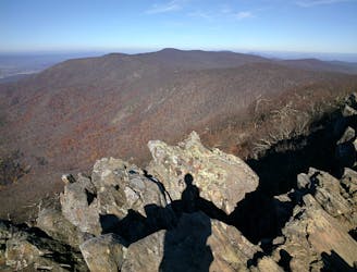
Located in the Big Meadows Area, Blackrock is one of the best short hikes in all of Shenandoah National Park. The NPS even highlights it as part of the Kids in Parks program, making it a perfect hike for the entire family! A talus rock slope offers stunning views to start. Then you'll pay a visit to Lewis Spring Falls — a beautiful waterfall and fourth-largest in Shenandoah National Park. Though Blackrock and Lewis Falls are most often viewed as separate hikes, this is an excellent option to enjoy both in a single ~3-mile trek!
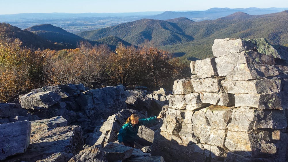
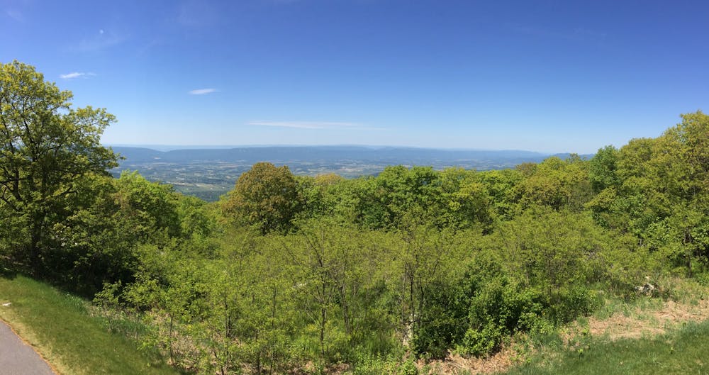
There are countless ways to earn the views from Blackrock, the shortest of which begins at the Picnic Area or Lodge (as mapped). If you're simply driving along Skyline Drive, the NPS suggests parking at the Blackrock parking area at milepost 84.4. The main overlook is located on the Appalachian Trail, so you'll also enjoy the views if you're planning a longer thru-hike in the park. The AT also connects to the adjacent Big Meadows Campground.
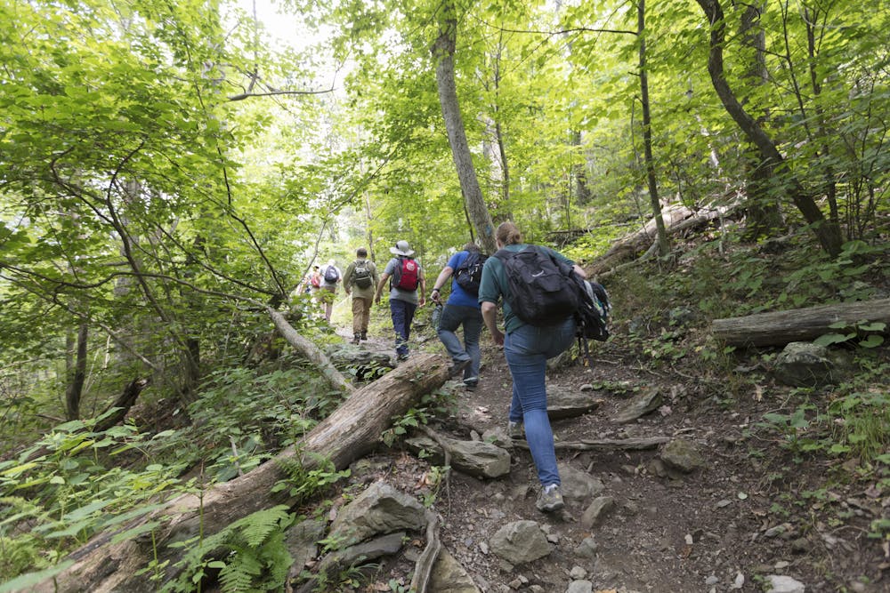
While the short walk to Blackrock is great for the entire family, this route increases in difficulty when you add a visit to Lewis Spring Falls (as mapped). The stunning waterfall is the fourth-largest in the park and lesser-visited than many of the others, such as Dark Hollow Falls or the Browns Gap Waterfall Loop.
Sources: https://www.nps.gov/thingstodo/hikeblackrocksummit.htm https://virginiatrailguide.com/2009/07/09/lewis-spring-falls/
Difficult
Hiking trails where obstacles such as rocks or roots are prevalent. Some obstacles can require care to step over or around. At times, the trail can be worn and eroded. The grade of the trail is generally quite steep, and can often lead to strenuous hiking.

The trail contains some obstacles such as outcroppings and rock which could cause injury.
Away from help but easily accessed.
1.3 km away
A classic short hike to a stunning waterfall in Shenandoah National Park.
Moderate Hiking
1.9 km away
A moderate 4-mile hike with stunning waterfalls, an abandoned mine, and a historic cemetery.
Moderate Hiking
5.7 km away
A short loop to the highest peak in Shenandoah National Park.
Moderate Hiking
8.2 km away
A challenging, but epic, overnight loop showcasing Whiteoak Canyon and Old Rag Mountain.
Severe Hiking
8.2 km away
A spectacular hike with eight waterfalls and plenty of summer swimming holes.
Moderate Hiking
6 routes · Hiking
10 routes · Hiking