3.8 km away
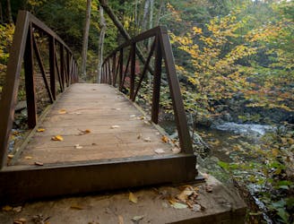
Whiteoak Canyon -> Nicholson Hollow -> Old Rag Circuit
A challenging, but epic, overnight loop showcasing Whiteoak Canyon and Old Rag Mountain.
Severe Hiking
- Distance
- 28 km
- Ascent
- 1.5 km
- Descent
- 1.5 km
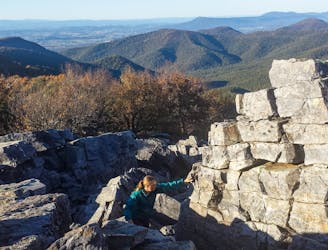
A short loop to the highest peak in Shenandoah National Park.
Hiking Moderate

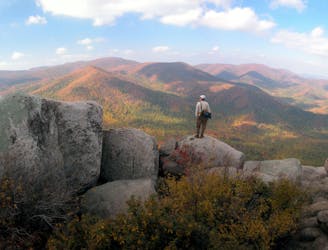
Towering in at 4,050', Hawksbill Mountain is the highest peak anywhere in Shenandoah National Park. In addition to the stunning views, the summit is home to balsam fir, a tree typically only seen in the northern latitudes - especially in New England and Canada. It is also a nesting ground for peregrine falcons - "the fastest bird in the world and the fastest member of the animal kingdom source." When hunting, they can reach speeds over 200mph!
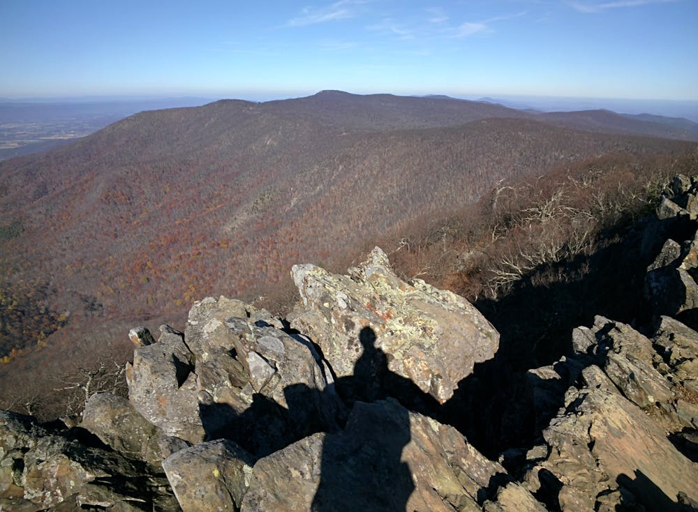
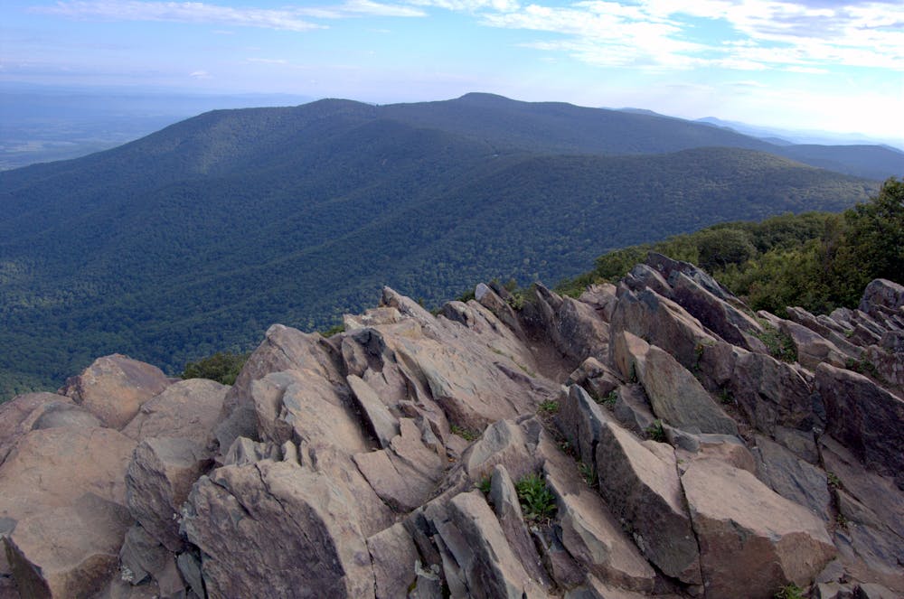
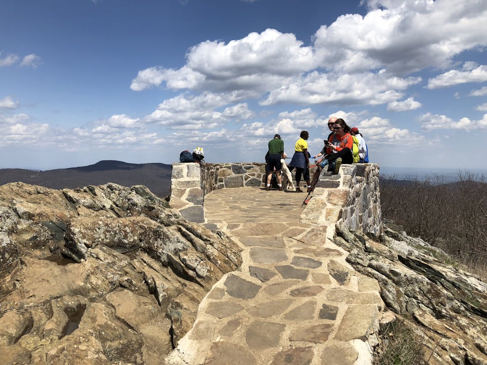
As mapped, this version of the hike begins at Hawksbill Gap on Skyline Drive. Though you could opt for an out-and-back to the overlook, this loop links the Lower Hawksbill and Salamander Trails with the Appalachian Trail - an excellent option for the entire family. All of the trails on this hike are dog friendly, and it's great when hiked in either direction!
There is a large stone observation platform at the summit and plenty of other opportunities where you can find a quiet view of your own. Thanks to a spectacular 360-degree view, this is one of the most popular short hikes in the park, so get an early start to your day to avoid the crowds.
Moderate
Hiking along trails with some uneven terrain and small hills. Small rocks and roots may be present.

The trail contains some obstacles such as outcroppings and rock which could cause injury.
Away from help but easily accessed.
3.8 km away
A challenging, but epic, overnight loop showcasing Whiteoak Canyon and Old Rag Mountain.
Severe Hiking
3.8 km away
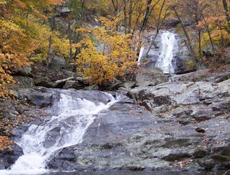
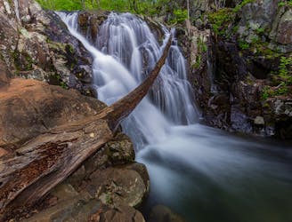
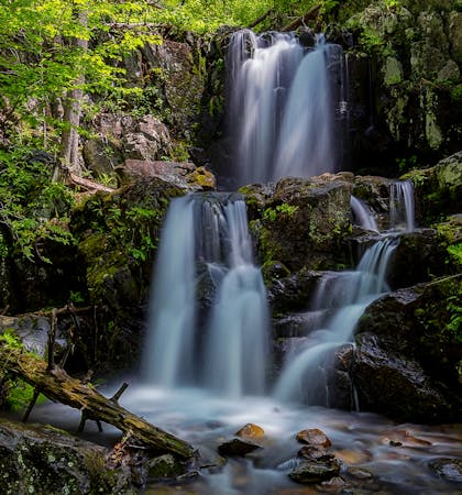
A spectacular hike with eight waterfalls and plenty of summer swimming holes.
Moderate Hiking
3.9 km away
A moderate 4-mile hike with stunning waterfalls, an abandoned mine, and a historic cemetery.
Moderate Hiking
5.6 km away
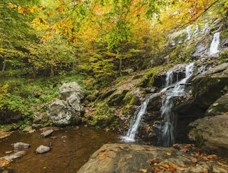
A classic short hike to a stunning waterfall in Shenandoah National Park.
Moderate Hiking
5.7 km away
A short yet challenging hike pairing the epic views from Blackrock with Lewis Spring Falls, the fourth-largest waterfall in the park.
Difficult Hiking
5.8 km away
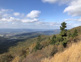
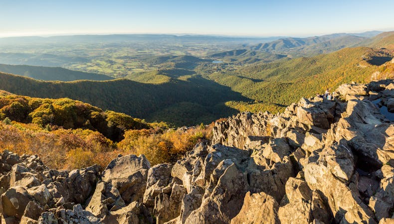
A short hike with epic views atop the northernmost 4,000' peak in the Blue Ridge Mountains.
Difficult Hiking
8.9 km away
A epic and mesmerizing hike — "One of Shenandoah's premier experiences."
Difficult Hiking
6 routes · Hiking
10 routes · Hiking

10 routes · Hiking

63 routes · Alpine Climbing · Hiking