45 m away
Appalachian Trail: McAfee Knob Trailhead to Blackhorse Gap
The iconic AT segment home to McAfee Knob and Tinker Cliffs.
Difficult Hiking
- Distance
- 52 km
- Ascent
- 2.5 km
- Descent
- 2.3 km
Arguably the most iconic viewpoint on the Appalachian Trail!
Hiking Difficult

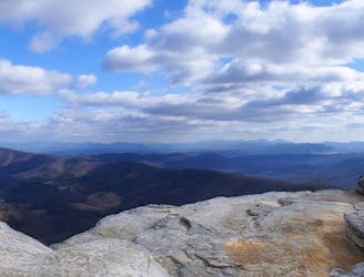
McAfee Knob is arguably the most iconic viewpoint on the entire Appalachian Trail! This rock outcropping juts away from the mountainside, out into free air, providing the perfect opportunity to take a photo that will make your mom freak out just a little bit.
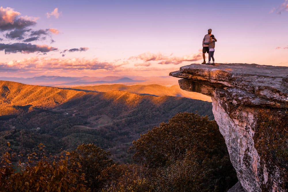
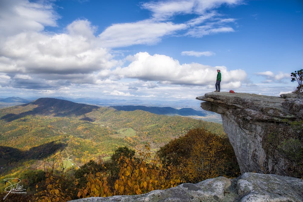
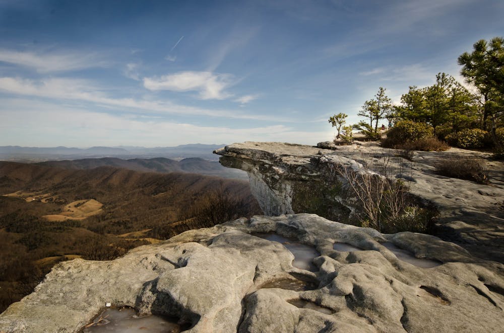
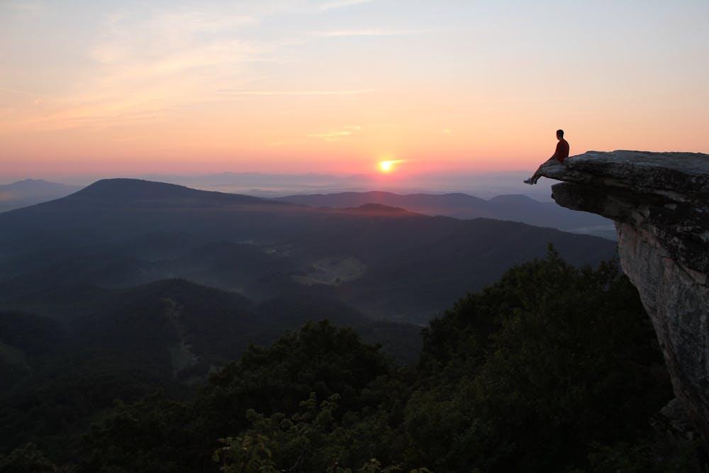
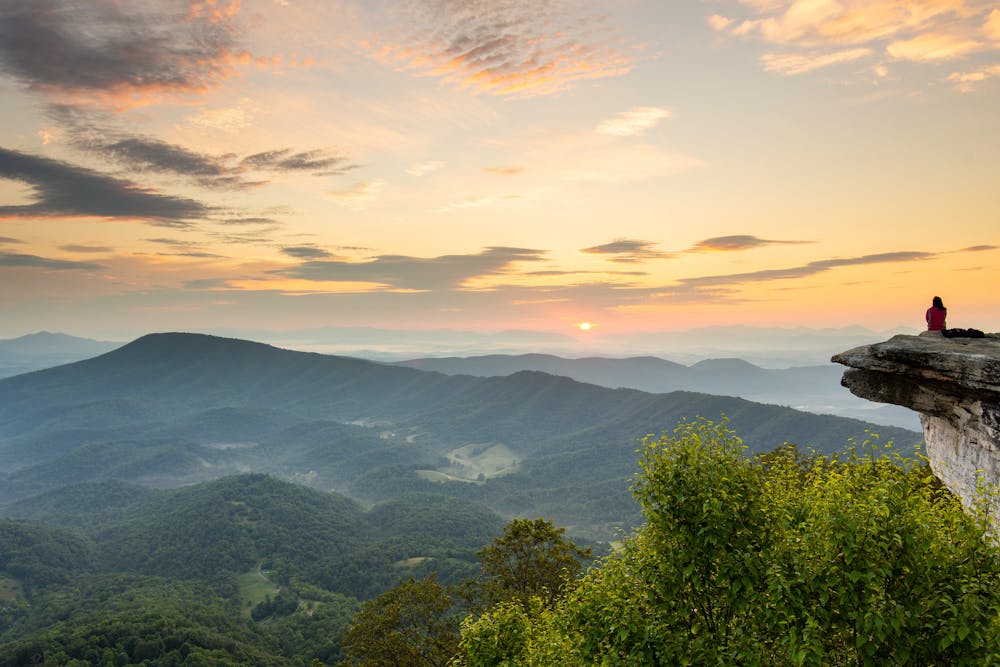
“This unique rocky outcropping draws in countless visitors each year,” according to adventure travel writer Brendon Voelker. "Expect to spend some time enjoying the 270° views from the formation.”
While you will, of course, pass this viewpoint while doing a through hike or section hike of the Appalachian Trail, the 8-mile out-and-back hike is a perfect day hiking objective that’s easily accessible from a trailhead on the nearby highway. It’s this combination of thru-hikers and day hikers that makes McAfee Knob the most photographed spot on the entire Appalachian Trail.
The hike to the knob is a consistent, steady uphill climb. The route as mapped here ascends almost 1,900 feet, requiring hikers to be respectably fit. While you can expect to encounter some rocks and rough sections of trail, no scrambling is required to reach the overlook.
While this area might seem like the perfect spot to camp, note that due to the extreme popularity of the area, “no camping or campfire are permitted around McAfee Knob” to prevent damage to the area’s natural beauty, according to Voelker.
According to Wikipedia, "...the only legal campsites” along this section of the Appalachian Trail "are Johns Spring Shelter, Catawba Shelter and campsites, Pig Farm campsite, Campbell Shelter, and Lambert’s Meadow Shelter and campsites."
Sources: https://www.earthtrekkers.com/hiking-mcafee-knob-appalachian-trail/ https://fatmap.com/routeid/44256/AppalachianTrail:McAfeeKnobTrailheadtoBlackhorseGap https://en.wikipedia.org/wiki/McAfeeKnob
Difficult
Hiking trails where obstacles such as rocks or roots are prevalent. Some obstacles can require care to step over or around. At times, the trail can be worn and eroded. The grade of the trail is generally quite steep, and can often lead to strenuous hiking.

The trail contains some obstacles such as outcroppings and rock which could cause injury.
Away from help but easily accessed.
45 m away
The iconic AT segment home to McAfee Knob and Tinker Cliffs.
Difficult Hiking

58 routes · Hiking

25 routes · Alpine Climbing · Hiking

10 routes · Hiking