2.3 km away
Piney Branch -> Hogback Mountain -> Thornton River -> AT Circuit
A versatile two-night trip with "views, poplar forests, park history, and fishing streams" open for harvest.
Difficult Hiking
- Distance
- 26 km
- Ascent
- 1 km
- Descent
- 1 km
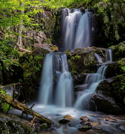
A one-night loop or long day hike including the highest waterfall in SNP, plus multiple cascades and swimming holes.
Hiking Difficult
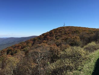
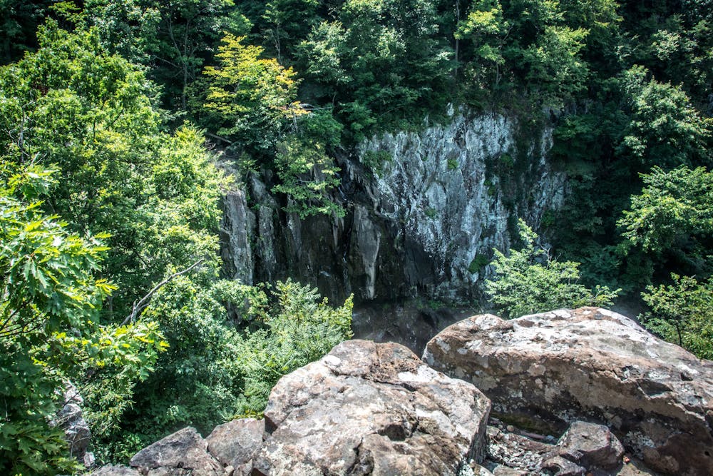
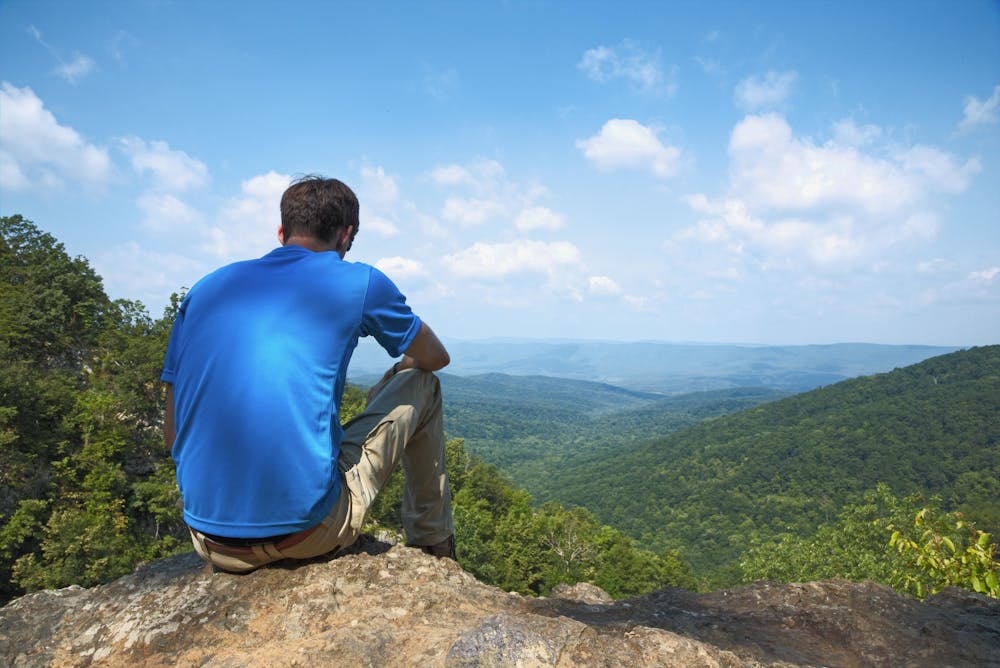
This loop is a perfect one-nighter or long day trip in Shenandoah's northern district. This loop includes plenty of swimming holes, explores some of the more remote areas in the park, and visits the largest waterfall in the Shenandoahs - 93' Overall Run Falls. It's perfect for an experienced hiker looking for a quick overnight or a beginner looking for a challenge.
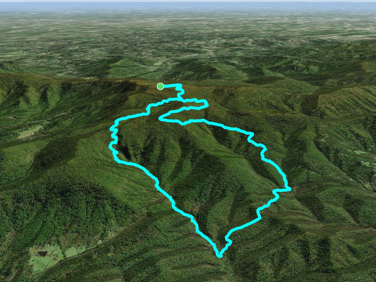
This version of the loop begins at milepost 21 on Skyline Drive. You could also drive north around the bend to the bottom of the Hogback Mountain trailhead. There's an overlook in the middle you could leave a car at too, but you should first contact the Ranger Station at 540-999-3500 to make sure that's alright (and so that you don't get towed). You will also circle Matthews Arm Campground if you wanted to reserve a site and start there instead.
After reaching Matthews Arm Campground, this lollipop route loops the Tuscarora/Overall Run Trail with Heiskell Hollow and Weedlewood Trails. Beecher Ridge Trail dissects the loop and is another excellent option and roughly two miles less than this mapped version of the hike. Beecher Ridge is a more popular option according to the NPS, but we've mapped the alternative since it puts you a little further off the beaten path.
As with any hike that begins on Skyline Drive, there is a fee to enter the park. A current list of fees and passes can be found here. All trails on this loop are dog friendly as well, a rarity among many National Parks across the country.
Sources: https://www.nps.gov/shen/planyourvisit/upload/SHENBCTrip-OverallRunandBeecherRidgeE026-508.pdf
Difficult
Hiking trails where obstacles such as rocks or roots are prevalent. Some obstacles can require care to step over or around. At times, the trail can be worn and eroded. The grade of the trail is generally quite steep, and can often lead to strenuous hiking.

Some trail sections have exposed ledges or steep ascents/descents where falling could cause serious injury.
Little chance of being seen or helped in case of an accident.
2.3 km away
A versatile two-night trip with "views, poplar forests, park history, and fishing streams" open for harvest.
Difficult Hiking
6 routes · Hiking