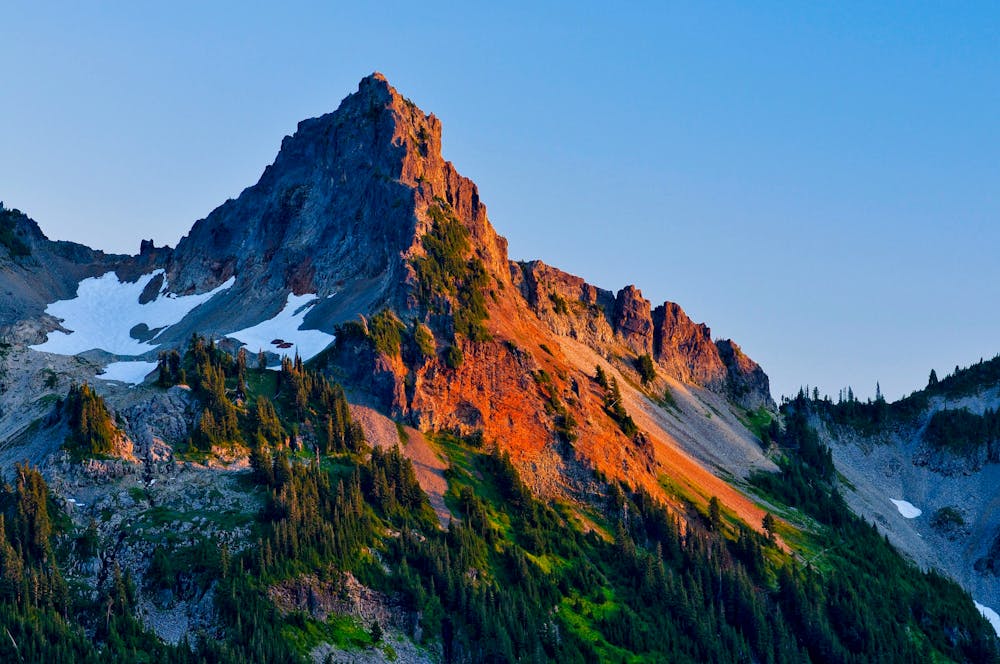
Pinnacle Peak
Mount Rainier National Park
A steep hike and scramble to the summit of Pinnacle Peak.
Alpine Climbing Moderate
- Distance
- 4.6 km
- Ascent
- 500 m
- Descent
- 499 m
- Low Point
- 1.5 km
- High Point
- 2 km
- Gradient
- 26˚

If you are looking for a short but challenging hike with stunning views of Mount Rainier and the surrounding peaks, the Pinnacle Peak hike is a great option. This 2.9-mile round-trip trail climbs over 1,600 feet to the summit of Tatoosh Range.
Description
The trail starts at the Reflection Lakes parking area and ascends through subalpine meadows and forests. The trail can be rocky and snowy, so hiking boots are recommended. As you climb, you will get glimpses of Mount Rainier and the lakes below.
The designated trail ends at the saddle, where you will be rewarded with panoramic views of Mount Rainier, Paradise, Mount Adams, Mount St. Helens, and Mount Hood. You can also see the other peaks of the Tatoosh Range, such as Castle Peak and Unicorn Peak. This is a great spot to see wildlife, such as pikas, marmots, and birds.
Intrepid climbers will, of course, want to finish the climb by scrambling to the summit of Pinnacle Peak, or nearby Plummer Peak. However, be aware that these routes are steep and exposed, and require some climbing skills. For an easier hike, simply turn around at the saddle and return the way you came.
Sources: Pinnacle Peak Trail - Mount Rainier National Park (U.S. National Park .... https://home.nps.gov/mora/planyourvisit/pinacle-peak.htm. Pinnacle Peak Saddle Hike Route Guide- See Mount Rainier - 10Adventures. https://www.10adventures.com/hikes/mount-rainier-national-park/pinnacle-peak-saddle-trail/. Pinnacle Peak Trail. https://www.nps.gov/mora/planyourvisit/pinacle-peak.htm. Mount Rainier National Park Pinnacle Peak Trail. https://www.us-parks.com/mount-rainier-national-park/pinnacle-peak-trail.html. Conversation with Bing Chat
Difficulty
Moderate
May involve slightly more complex glacier hikes, easy but possibly long rock ridges and steep snow up to 45 degrees. Equivalent to PD, PD+
Extreme Exposure

The majority of the route is "no fall" terrain.
Remoteness

Little chance of being seen or helped in case of an accident.