53 m away
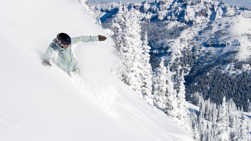
Shaker's Right

A long steep couloir that opens onto a face.
Severe Freeride Skiing
- Distance
- 636 m
- Ascent
- 0 m
- Descent
- 355 m
A steep narrow couloir for experts only.
Freeride Skiing Severe

This steep narrow couloir is for experts only. The upper section of this run is bordered by a steep rocky buttress on the right and thick timber on the left. Some access from the left, sneaking into the couloir below the upper section. It is also possible to ski the steep right buttress on the right between Shaker's Left and Shaker's Right. Watch for rocks here and sections requiring mandatory air. To ski the Shaker's Left Chute itself from the top, wiggle through the trees. Depending on snow level, you may be required to drop a short distance and straight-line through the upper section. This upper part is often ignored. Below the narrowest funnel, Shaker's Left opens up to an open face with great skiing. The snow here is often deeper than in Niagaras. This slope avalanches regularly and is off the beaten path. Below the steep face, follow undulating treed slopes to Mike's Face, the last steep section above I-5. Follow the trail through the long traverse back to base area. Alternately, head down below the scree field to the right of Mike's Face to the parking lot and catch the shuttle back (it runs on busy days and weekends) to the base area.
Severe
Steep skiing at 38-45 degrees. This requires very good technique and the risk of falling has serious consequences.

As well as the slope itself, there are some obstacles (such as rock outcrops) which could aggravate injury.

Little chance of being seen or helped in case of an accident.
53 m away
A long steep couloir that opens onto a face.
Severe Freeride Skiing
199 m away

A steep, wide couloir for experts
Severe Freeride Skiing
200 m away

Another steep chute in the Niagara's area
Severe Freeride Skiing
200 m away

A narrow, steep chute for experts only.
Severe Freeride Skiing
200 m away

A steep face for experts
Severe Freeride Skiing
201 m away

A long steep couloir for experts only.
Severe Freeride Skiing
447 m away

A short steep rollover that ends in thick trees.
Difficult Freeride Skiing
466 m away

A steep section below the chair crosshatched with rock bands.
Difficult Freeride Skiing
484 m away

A series of steep cliff bands for experienced experts only.
Extreme Freeride Skiing
484 m away

A steep, narrow couloir requiring mandatory air.
Extreme Freeride Skiing
14 routes · Freeride Skiing · Ski Touring