3.5 km away
Talapus Lake and Olallie Lake
A mellow hike to two stunning alpine lakes, with the option to camp at either one.
Moderate Hiking
- Distance
- 9.4 km
- Ascent
- 386 m
- Descent
- 386 m
A spectacular alpine lake high above Snoqualmie Pass.
Hiking Difficult

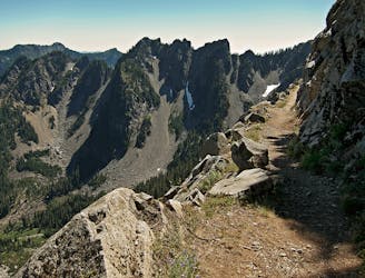
If you are looking for a beautiful hike that offers waterfalls, wildflowers, forests, mountain views and a serene alpine lake, look no further than the Annette Lake Trail. This 7.1-mile out-and-back trail near Snoqualmie Pass will take you through a variety of scenery and terrain, with a gentle but steady elevation gain of 2,290 feet.
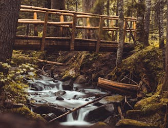
The trail starts near the Asahel Curtis Nature Trail, where you can admire the mossy trees and giant skunk cabbage along Humpback Creek. After crossing a bridge over one of the best tumbling falls in Washington, the trail enters an open area under powerlines and crosses the Iron Horse Trail. From here, the trail begins to climb through the forest, with occasional small water crossings and wildflower meadows.
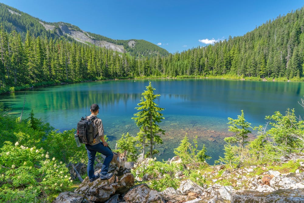
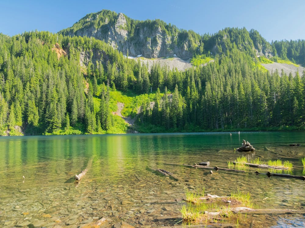
The trail opens up as you traverse several talus slopes, offering views of Granite Mountain and Humpback Mountain. These are also good places to see trillium and glacier lilies in late spring. After the last talus slope, the trail flattens out and reaches the north shore of Annette Lake. Here you can enjoy the sights of Abiel Peak and Silver Peak, as well as a waterfall cascading into the lake's east shore. There are several campsites around the lake if you want to stay overnight and catch a sunrise or sunset on the water.
Sources: Annette Lake — Washington Trails Association. https://www.wta.org/go-hiking/hikes/annette-lake. Annette Lake: moderate summer day hike near Seattle. https://www.ordinary-adventures.com/2019/07/annette-lake-hike-moderate-day-hike-that-has-it-all/. Conversation with Bing Chat
Difficult
Hiking trails where obstacles such as rocks or roots are prevalent. Some obstacles can require care to step over or around. At times, the trail can be worn and eroded. The grade of the trail is generally quite steep, and can often lead to strenuous hiking.

The trail contains some obstacles such as outcroppings and rock which could cause injury.

Little chance of being seen or helped in case of an accident.
3.5 km away
A mellow hike to two stunning alpine lakes, with the option to camp at either one.
Moderate Hiking
3.5 km away

A mellow hike to a stunning alpine lake.
Moderate Hiking
5.8 km away
Miles 2393.2-2464.1 of the northbound PCT: Stunning views along a series of big ups and downs, between high mountain lakes and lush valley forest in the Alpine Lakes Wilderness.
Difficult Hiking
6 km away
Hike to the stunning Kendall Katwalk section of the PCT.
Difficult Hiking
9.3 km away

An easily-accessible alpine lake hike right off the I-90 corridor.
Difficult Hiking

10 routes · Hiking

72 routes · Hiking

19 routes · Hiking