6.9 km away
Rachel and Rampart Lakes
A challenging hike to some of Washington's most beautiful alpine lakes.
Severe Hiking
- Distance
- 15 km
- Ascent
- 864 m
- Descent
- 864 m
An easily-accessible alpine lake hike right off the I-90 corridor.
Hiking Difficult

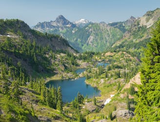
If you're looking for a hidden gem within the I-90 corridor, you might want to check out the Margaret Lake trail. This 6-mile out-and-back trail takes you through a variety of terrain, from old logging roads and clearcuts to dense forest and alpine meadows. You'll enjoy views of the valley and the surrounding peaks as you climb almost 2,000 vertical feet to reach the lake, which lies at the base of a rocky ridge.
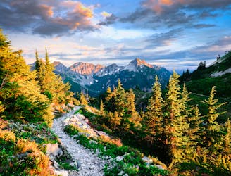
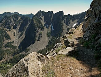
The trail starts from a parking lot off Forest Road 4930, which may require a high-clearance vehicle in winter or after heavy rain. The first mile follows an old road that gradually ascends through regrown forests and berry meadows. At the junction, turn left and follow the sign for hikers only. The trail becomes narrower and steeper as it enters the Alpine Lakes Wilderness and switchbacks up the hillside. You'll cross some small streams and pass by some waterfalls along the way. The trail can be dusty and rocky in places, so watch your footing.
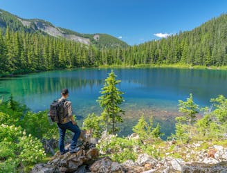
After about two miles, you'll reach another junction where you'll turn right to descend to Margaret Lake. The lake is a short distance away, but you'll have to navigate some snow fields and boulders in early season. Margaret Lake is a lovely spot to relax and enjoy the scenery, with clear water and views of the ridge above. You can also continue on the trail to explore other lakes in the area, such as Lake Yvonne or Lilian Lake.
Sources: Margaret Lake — Washington Trails Association. https://www.wta.org/go-hiking/hikes/margaret-lake. Margaret Lake Trail, WA • Hike - HikeArizona.COM. https://hikearizona.com/decoder.php?ZTN=7617. Conversation with Bing Chat
Difficult
Hiking trails where obstacles such as rocks or roots are prevalent. Some obstacles can require care to step over or around. At times, the trail can be worn and eroded. The grade of the trail is generally quite steep, and can often lead to strenuous hiking.

The trail contains some obstacles such as outcroppings and rock which could cause injury.

Little chance of being seen or helped in case of an accident.
6.9 km away
A challenging hike to some of Washington's most beautiful alpine lakes.
Severe Hiking
8.2 km away
Miles 2393.2-2464.1 of the northbound PCT: Stunning views along a series of big ups and downs, between high mountain lakes and lush valley forest in the Alpine Lakes Wilderness.
Difficult Hiking
8.2 km away
Hike to the stunning Kendall Katwalk section of the PCT.
Difficult Hiking
9.3 km away
A spectacular alpine lake high above Snoqualmie Pass.
Difficult Hiking

10 routes · Hiking

72 routes · Hiking

19 routes · Hiking