227 m away
Rattlesnake Ledge
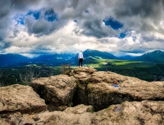
A very accessible hike to a stunning overlook.
Moderate Hiking
- Distance
- 7.2 km
- Ascent
- 352 m
- Descent
- 352 m
Quick and easy ascent via the main trail to views up the Middle Fork Valley
Hiking Easy

This is a popular hiking route which is generally considered to be easy. It's not remote, it features low exposure and is typically done all year round. From a low point of 295 m to the maximum altitude of 575 m, the route covers 6.3 km, 301 vertical metres of ascent and 303 vertical metres of descent.
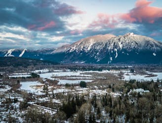
This trail starts on the graded Palouse to Cascades State Park Trail turns upward just after crossing Boxley Creek. The top is wooded but provides a view up the Middle Fork Valley. Take the Boxely Creek Blowout variant on the way down for a less steep descent.
Easy
Walking along a well-kept trail that’s mostly flat. No obstacles are present.

The path is on completely flat land and potential injury is limited to falling over.
Close to help in case of emergency.
227 m away
A very accessible hike to a stunning overlook.
Moderate Hiking
5.1 km away
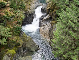
Hike to two incredible waterfalls in a narrow gorge.
Moderate Hiking
6.9 km away
A popular climb to gorgeous views from the summit of Mount Si.
Severe Hiking
8.4 km away
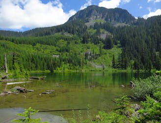
Escape the crowds on this isolated hike to Granite Lakes.
Difficult Hiking

10 routes · Hiking
5 routes · Hiking

19 routes · Hiking