3.4 km away
Twin Falls
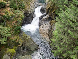
Hike to two incredible waterfalls in a narrow gorge.
Moderate Hiking
- Distance
- 3.9 km
- Ascent
- 214 m
- Descent
- 214 m
Escape the crowds on this isolated hike to Granite Lakes.
Hiking Difficult

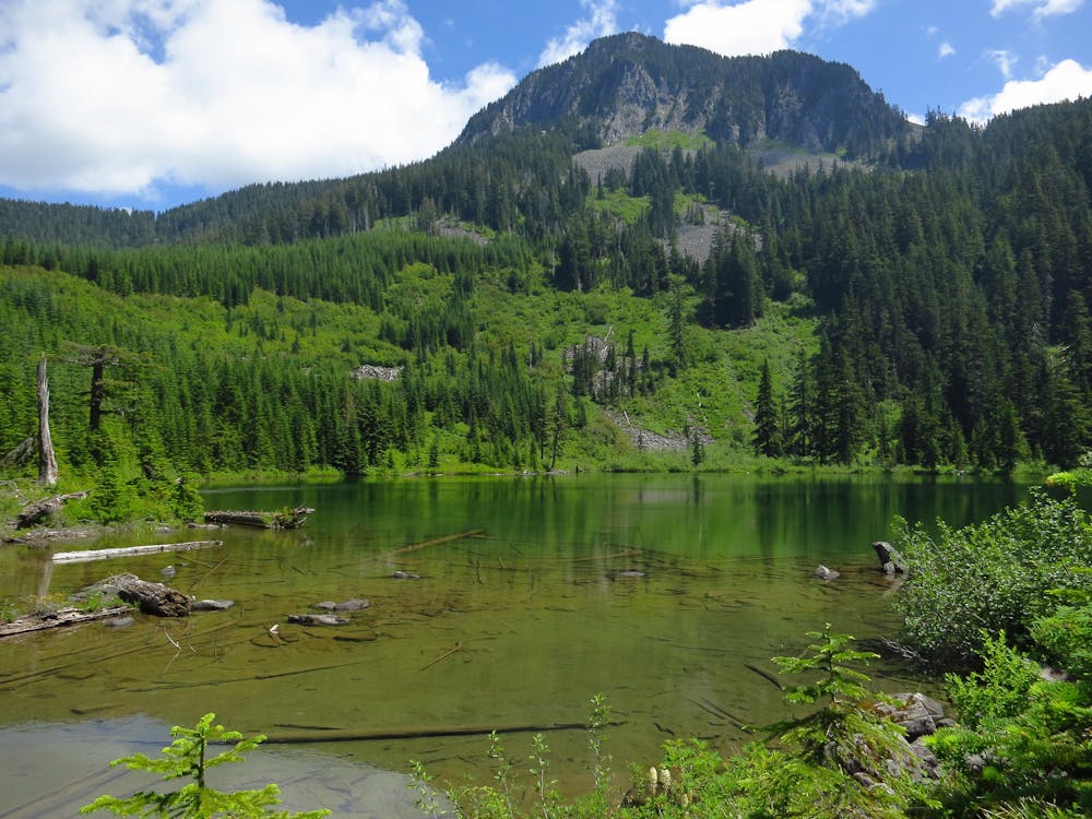
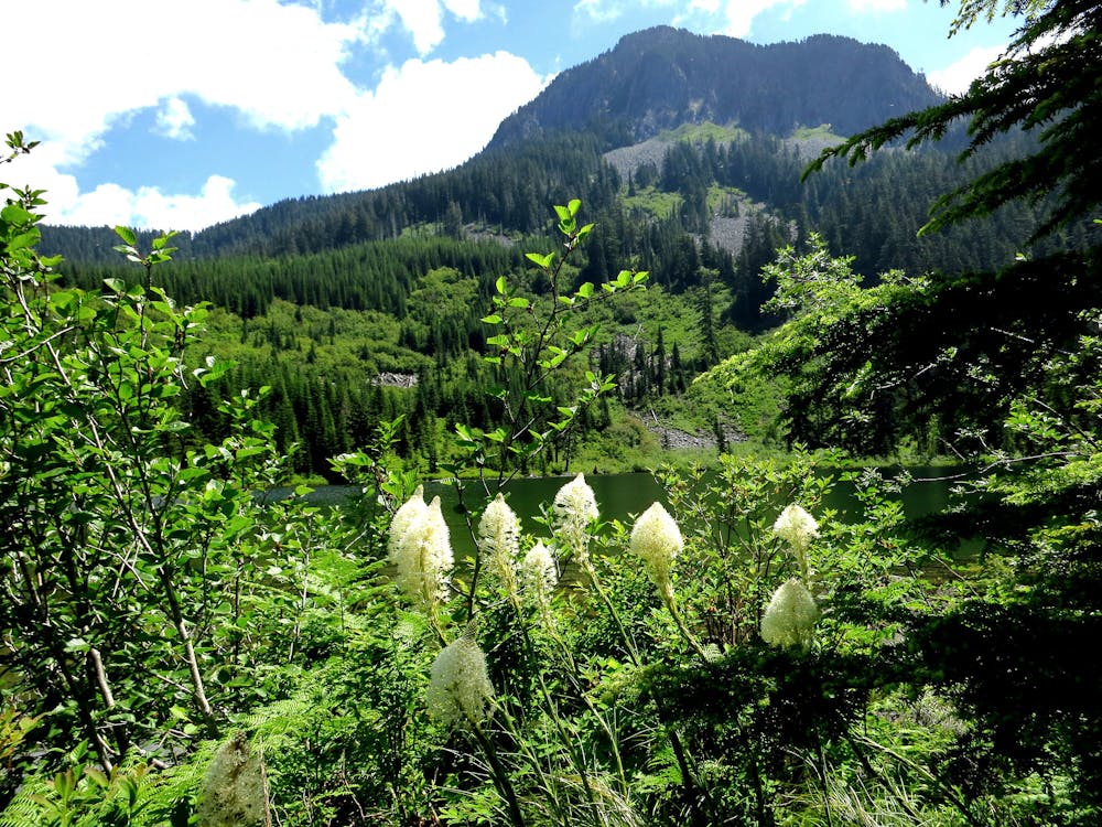
The hike to Granite Lakes is a great way to escape the press of the crowds found on most of the other trails in the Middle Fork of the Snoqualmie River Valley. “The hike to Granite Lakes follows a crashing creek to two small lakes set in a talus-strewn cirque and home to several rare amphibians,” according to local guidebook author Craig Romano (Source).
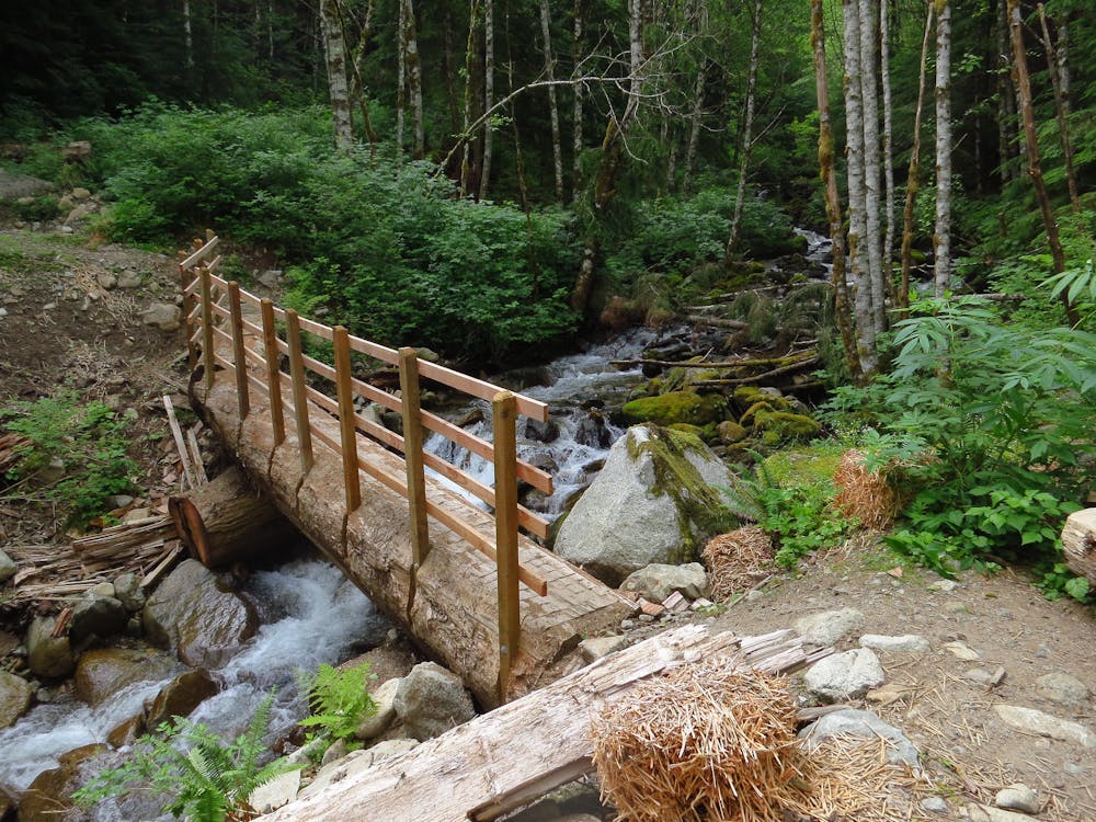
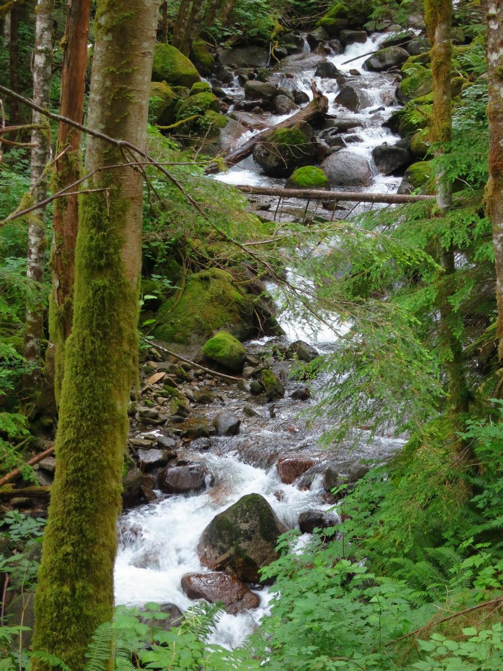
The trail to the lakes consists of an old logging road that’s been rehabilitated and converted into a hiking trail. "The new trail has excellent drainage features, with many turnpikes, culverts, and drains keeping the surface dry under nearly all conditions,” according to Maxwell Krem on WTA.org.
During the hike, you’ll enjoy the sight and sounds of the rapids of Granite Creek. At 1.8 miles into the hike, you’ll cross a bridge over the creek. During the next section of trail, you’ll have to cross 8-10 tributary creeks that flow into the main Granite Creek. "These crossings are not difficult by-and-large, but the widest and deepest crossing at 2.4 miles may have ankle-deep waters,” says Krem. "Waterproof boots and trekking poles will be helpful. Your payoff after the crossing is a 30-foot waterfall on the left.”
Most of the hike takes place beneath a towering forest canopy of hemlock, alder, Douglas fir, and cedar trees. Higher up the mountain, viewpoints begin to appear through the trees, with the final reward of a beautiful mountain view at Upper Granite Lake!
Sources: https://www.outsideonline.com/2404959/6-great-hikes-do-seattle https://www.wta.org/go-hiking/hikes/granite-creek-road-trail
Difficult
Hiking trails where obstacles such as rocks or roots are prevalent. Some obstacles can require care to step over or around. At times, the trail can be worn and eroded. The grade of the trail is generally quite steep, and can often lead to strenuous hiking.

The trail contains some obstacles such as outcroppings and rock which could cause injury.

Little chance of being seen or helped in case of an accident.
3.4 km away
Hike to two incredible waterfalls in a narrow gorge.
Moderate Hiking
4.6 km away
A popular climb to gorgeous views from the summit of Mount Si.
Severe Hiking
8.5 km away
A very accessible hike to a stunning overlook.
Moderate Hiking

10 routes · Hiking
5 routes · Hiking

19 routes · Hiking