3.6 km away
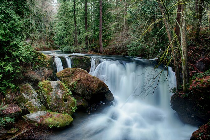
Lookout Mountain Forest Preserve: Waterfall Trail

Enjoy two different waterfalls along Austin Creek.
Easy Hiking
- Distance
- 4.2 km
- Ascent
- 111 m
- Descent
- 111 m
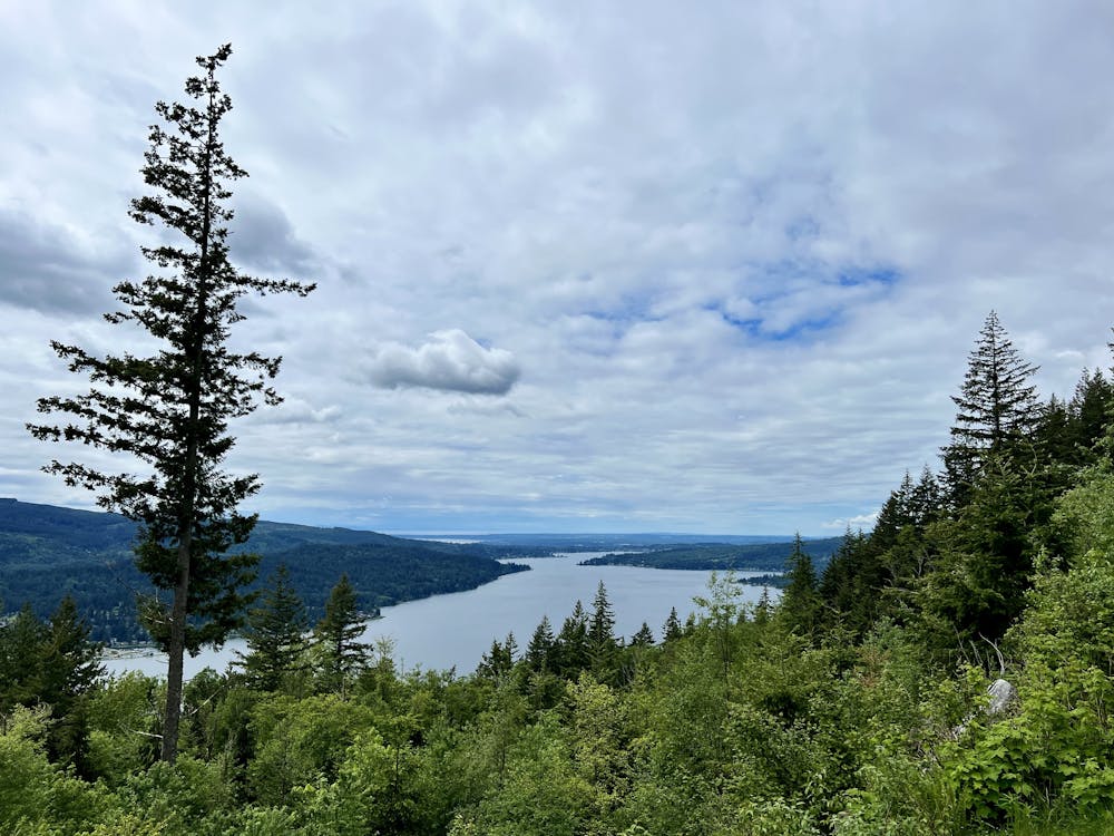
A technically easy but aerobically difficult climb to an elevated overlook of Lake Whatcom.
Hiking Moderate

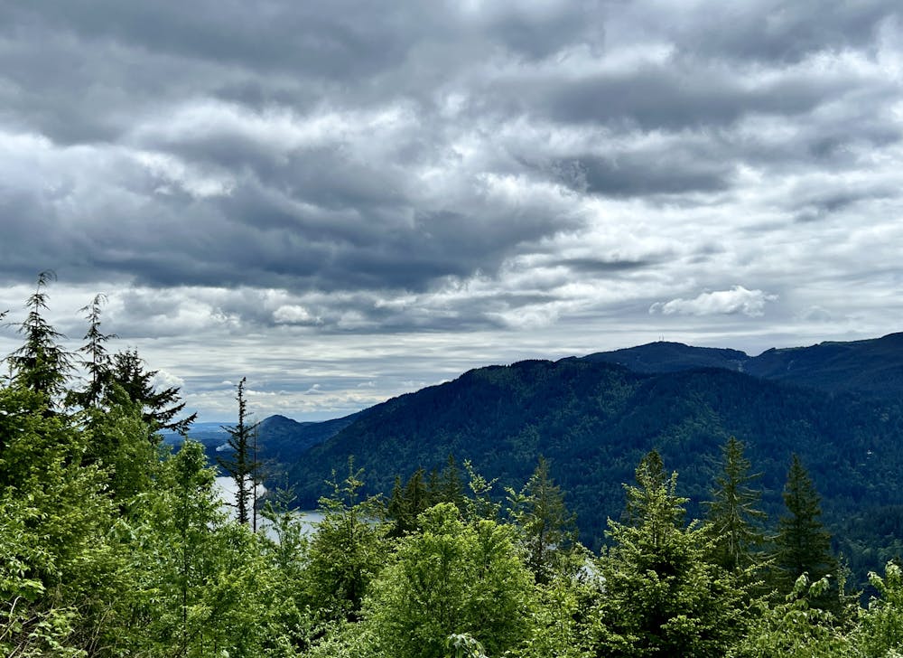
This 4.4-mile round trip hike to the Chanterelle Overlook is technically easy but aerobically is quite difficult. This steep trail gains over a thousand vertical feet in its direct 2.2-mile ascent to the overlook. The effort is well worth the reward. From this vantage point, you'll enjoy an incredible vista of Lake Whatcom in the foreground, with Bellingham and Bellingham Bay off in the distance. It's relatively rare to find an overlook this spectacular in this area, as the trails are usually hemmed in by the towering trees. But from this small clearing, you can fully absorb the grandeur of this beautiful region.
Several different trails begin from the same parking area, but the Chanterelle Trail begins in the far corner to the left of a gated forest road. Chanterelle begins climbing immediately on a gravel trail tread, powering up a never-ending climb. The Chanterelle Trail does switchback as it ascends, but despite the benchcut traversing sections, the grade still feels relentless. If you want to get a workout in a hurry, this trail is a great choice.
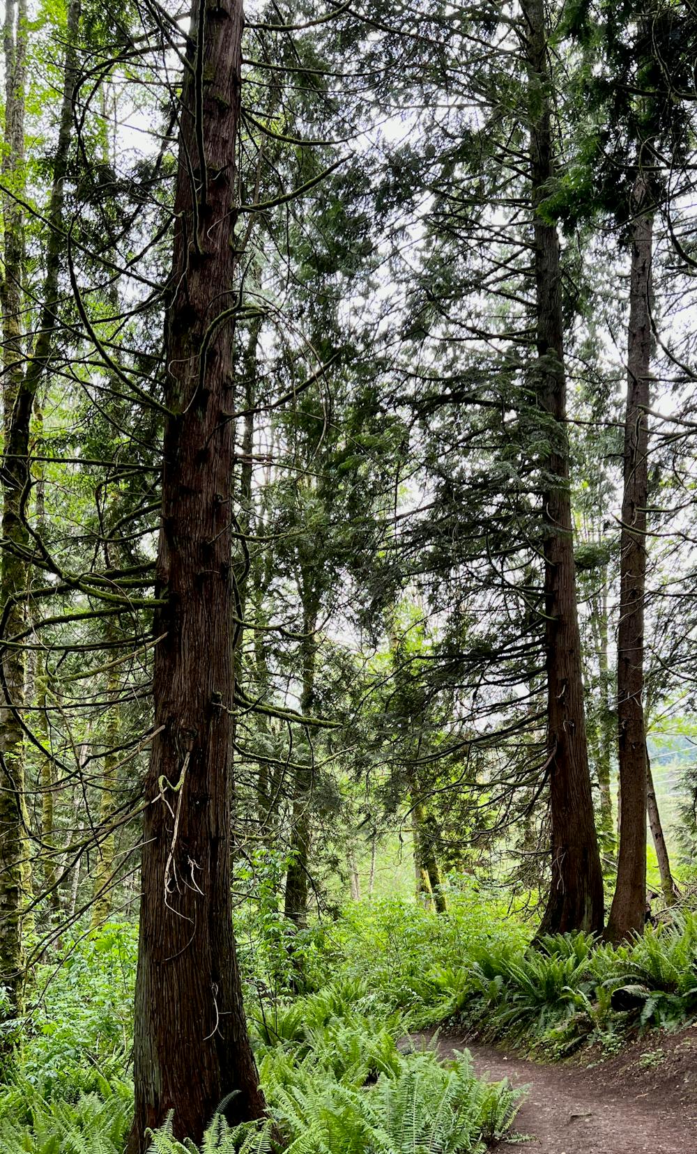
Along the climb, you'll get to enjoy the towering Douglas firs above you, the babbling of small streams, a beautiful understory of endless ferns, as well as birds and other wildlife. While the viewpoint at the top might be the destination, this entire hike is a beautiful, rewarding endeavor!
If you reach the viewpoint and you haven't had enough hiking yet, you can choose to continue higher up the Chanterelle Trail. This upper section of trail is little traveled by hikers, but there is reportedly another lookout a few miles higher up. Otherwise, simply retrace your steps and return to your car the way you came.
Moderate
Hiking along trails with some uneven terrain and small hills. Small rocks and roots may be present.

The path is on completely flat land and potential injury is limited to falling over.

Away from help but easily accessed.
3.6 km away
Enjoy two different waterfalls along Austin Creek.
Easy Hiking
9.2 km away
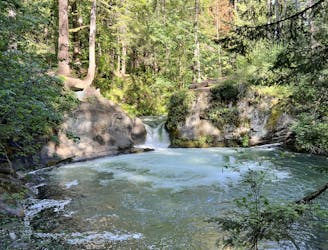
Whatcom Falls is by far the easiest waterfall to access in Bellingham, yet this impressive two-part cascade is well-worth the visit!
Easy Hiking
4 routes · Hiking