6.6 km away
Olympic Hot Springs Trail
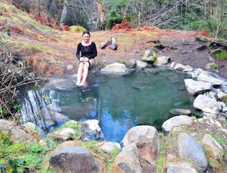
Wilderness hot springs deep in the forest, near a tumbling creek, and with backcountry camping nearby.
Easy Hiking
- Distance
- 27 km
- Ascent
- 1.1 km
- Descent
- 1.1 km
Hike to a spectacular summit in the heart of the Olympic Mountains
Hiking Difficult

This is a breathtaking hike which passes through diverse landscapes, including beautiful subalpine meadows and forests of fir and cedar trees. The trail is clear and easy all the way to the summit, making this a relatively stress-free way to enjoy the Washington mountains.

One of the unique aspects of this hike is that the first quarter-mile is paved, making it accessible for all. This makes it a versatile hike, allowing everyone to enjoy the stunning views without needing to go far up the trail.
The hike to the summit of Hurricane Hill is all about views, and what views they are! The vistas across the Olympic Peninsula are staggering, and the feeling of being immersed in your surroundings is intoxicating.
If you're looking for a non-technical summit hike in the heart of the Olympic Peninsula, this is your trip.
Difficult
Hiking trails where obstacles such as rocks or roots are prevalent. Some obstacles can require care to step over or around. At times, the trail can be worn and eroded. The grade of the trail is generally quite steep, and can often lead to strenuous hiking.

The path is on completely flat land and potential injury is limited to falling over.

Little chance of being seen or helped in case of an accident.
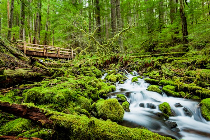
6.6 km away
Wilderness hot springs deep in the forest, near a tumbling creek, and with backcountry camping nearby.
Easy Hiking
11 routes · Hiking