429 m away
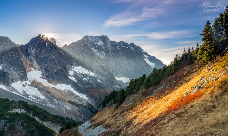
Granite Lakes
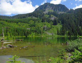
Escape the crowds on this isolated hike to Granite Lakes.
Difficult Hiking
- Distance
- 17 km
- Ascent
- 757 m
- Descent
- 756 m
A long, steep hike (especially if you choose the old trail), that culminates in an extensive talus field before reaching the mailbox at the summit.
Hiking Difficult

This is a popular hiking route which is generally considered to be difficult. It's an unknown remoteness, it features medium exposure and is typically done in an unknown time of year. From a low point of 239 m to the maximum altitude of 1.5 km, the route covers 13 km, 1239 vertical metres of ascent and 1252 vertical metres of descent.
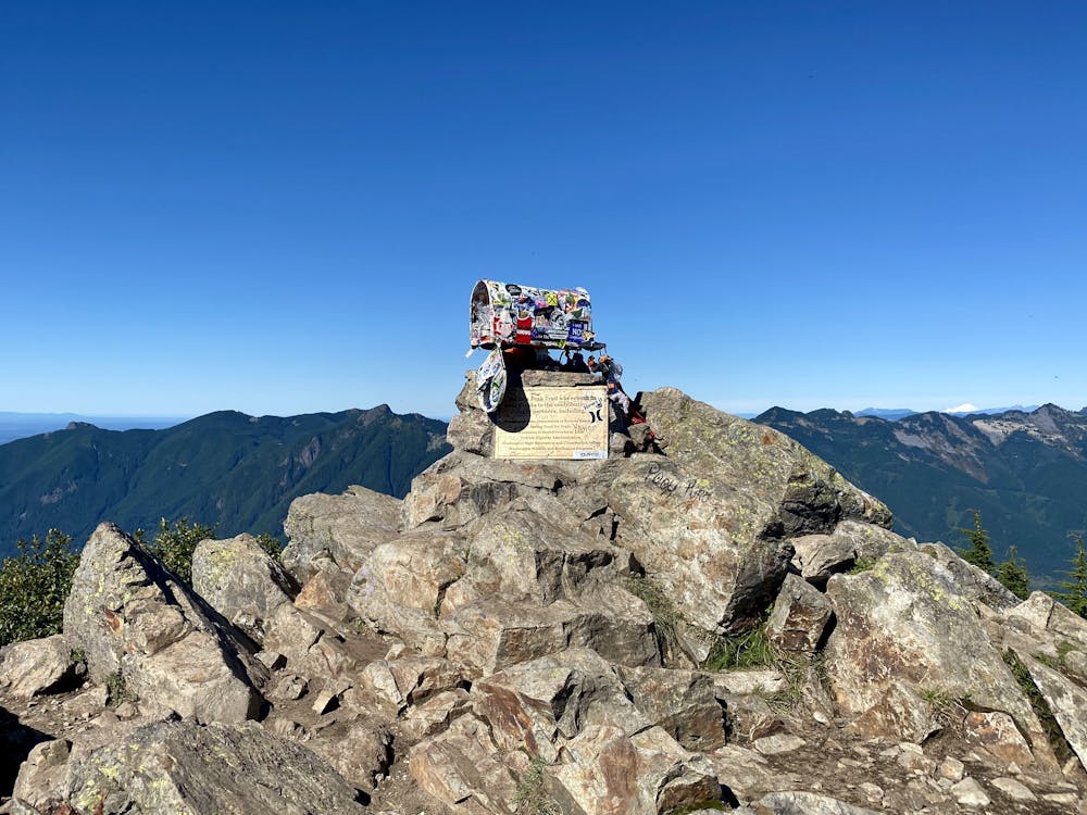


While the new trail to the left is long, it is relatively moderate of a hike. However if you choose to hike up the old trail, be ready for a workout. Either way, the two options provide a nice loop. The views at the summit are great. And there is a mailbox on top as well...
Difficult
Hiking trails where obstacles such as rocks or roots are prevalent. Some obstacles can require care to step over or around. At times, the trail can be worn and eroded. The grade of the trail is generally quite steep, and can often lead to strenuous hiking.

The trail contains some obstacles such as outcroppings and rock which could cause injury.
429 m away
Escape the crowds on this isolated hike to Granite Lakes.
Difficult Hiking
3 km away
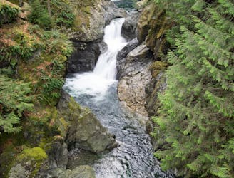
Hike to two incredible waterfalls in a narrow gorge.
Moderate Hiking
4.5 km away

A popular climb to gorgeous views from the summit of Mount Si.
Severe Hiking
8.1 km away

A very accessible hike to a stunning overlook.
Moderate Hiking

10 routes · Hiking
5 routes · Hiking

19 routes · Hiking