11 routes · Hiking
Day hike or backpacking trip through towering rainforest and along a dramatic stretch of the Olympic Coast.
Hiking Moderate

This triangle-shaped loop grants a brief tour of the wild Olympic Coast, with its coniferous rainforest, rocky beaches and tide pools, and sea stacks rising from the waves. The distance makes it doable as a day hike, but the coast has some fantastic campsites that make this better as a backpacking trip, for those who can reserve a permit. The permits are not easy to get because they are in high demand, and can be booked far in advance. Get yours as early as possible. Camping is allowed only in designated sites, and other regulations apply as well, such as using bear canisters for food storage and using only driftwood for campfires. Be sure to read up on backcountry permits if you want to do this as a backpacking trip.
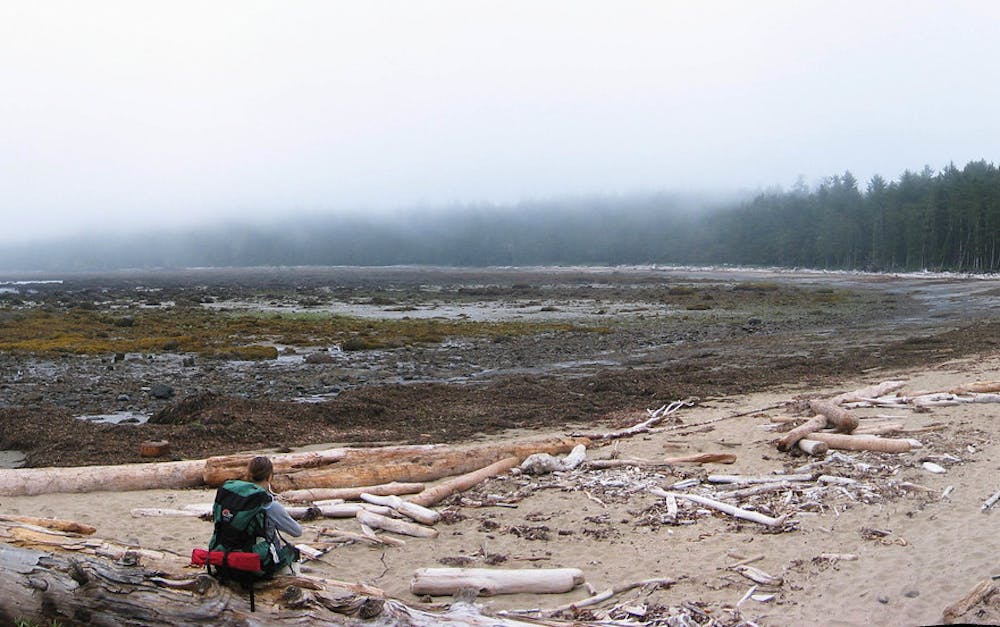
Whether day hiking or backpacking, expect to deal with weather on this route. The ocean frequently contributes wind, fog, clouds, and rain. Add that wetness on top of the beaches of slippery rocks, plus flooding by high tide, and you’re entering quite a harsh environment at the coast. Though calm and sunny days do occur, the timing of your trip may not fall during a window of good weather, so you should come prepared for anything.
The journey begins from Ozette, a tiny outpost within Olympic National Park. It has a campground, ranger station, and a small general store. In case you forgot some critical supplies for your hike, there’s a chance the store might have it, but don’t count on it. The trails begin just behind the ranger station, where you can check a tide table if you don’t have one. It’s best to carry a tide chart with you, because sections of the beach can get cut off by the rising water. Though it’s not impossible to complete at high tide, the beach section is much easier when the tide is low.
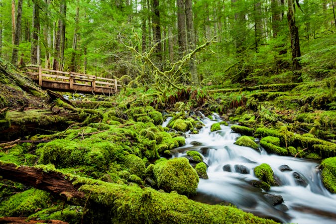
An arcing footbridge initiates the hike, crossing the outlet creek of Lake Ozette. The trail soon makes a fork where you’ll go one way to Cape Alava or the other to Sand Point. You can go either way to make the loop, as the two paths connect by the beach in between. The route mapped here takes Cape Alava Trail first and returns by Sand Point Trail.
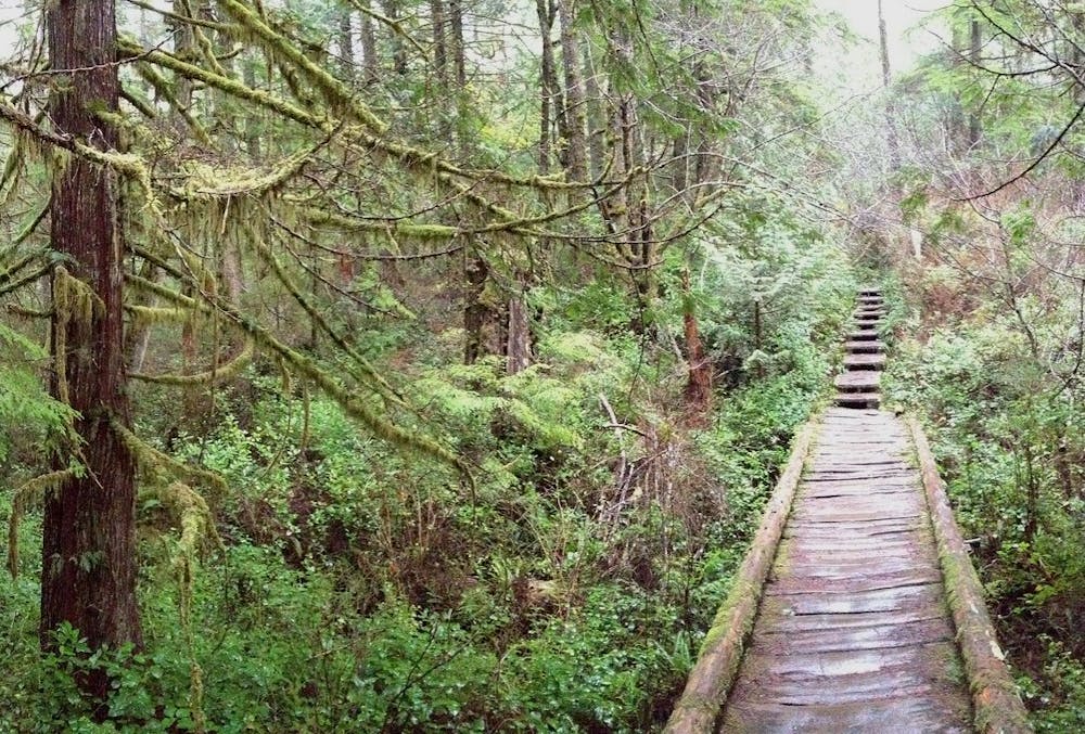
This forest near the coast stays cool and damp nearly all the time, and it’s bursting with flora at every level from the ground to the canopy. A boardwalk is necessary for passage through the boggy understory. It’s made of crude wooden planks that are fringed with moss, and can be slippery. Over sections that are drier and less overgrown, the trail is a raised gravel path that’s easy walking. In places it emerges from the trees and into grassy meadows, adding even more variety to the environment.
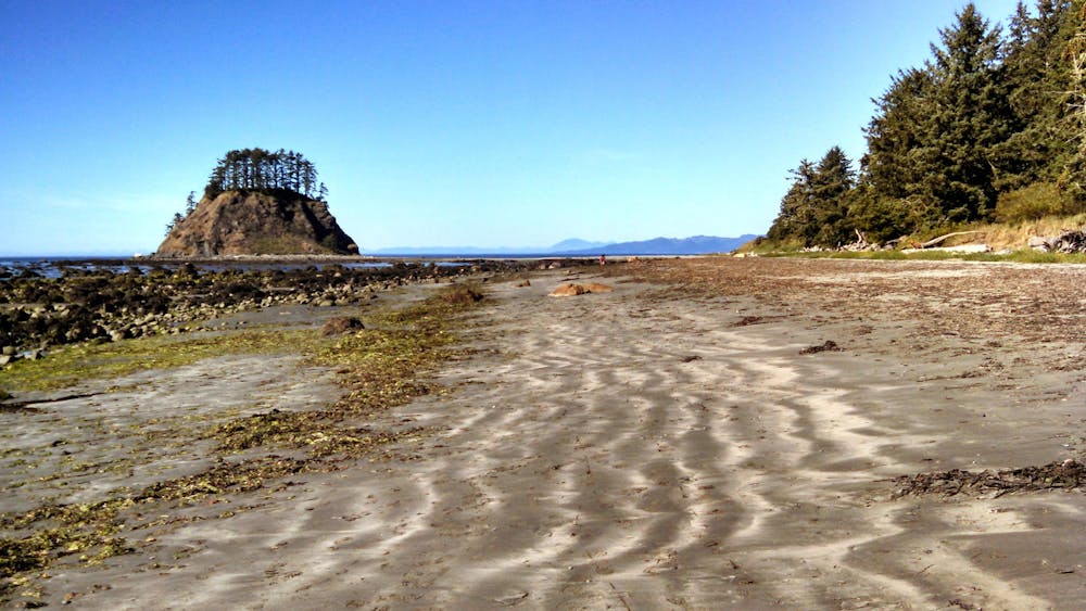
The forest ends abruptly at the beach, which at Cape Alava is a spit of sand with a tree-crowned island rising just offshore. The island is part of the Ozette Indian Reservation and is off limits, even though it’s connected by the beach at low tide. Just to the south is a wooden shack with whale bones and a plaque commemorating the Ozette indigenous village, which was uncovered here by archaeologists.
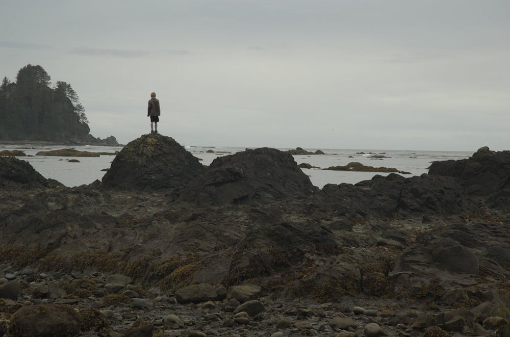
Many hikers go just to Cape Alava and then turn around, but if you wish to continue the loop you’ll head south along the beach. Marching over the sand and rocks, with a wall of forest on one side and crashing waves on the other, you’ll be walking a portion of the North Coast Route, which is a multi-day trek along this shoreline in Olympic National Park. If the tide is too high while you’re here, you might have to look for overland trails that bypass inundated parts of the beach. These rugged detours are marked by red and black signs, but sometimes they are harder to follow than you might imagine, so pay close attention.
The next major landmark is Wedding Rocks, an outcrop where petroglyphs can be found. These are carvings left by indigenous people of centuries ago, depicting whales, ships, and human faces. You can look, but must never touch these priceless relics in order to preserve them. The Wedding Rocks are about halfway to Sand Point. Though the remaining distance is not far, the beach is rockier in this stretch, so you might expect it to take longer than the northern half.
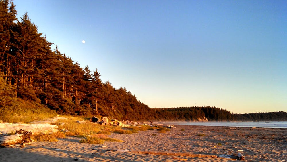
At Sand Point you’ll find a beautiful expanse of sand, with a backdrop of stately firs on land and a panorama of sea stacks in the water. This is another popular destination for one-way day hikes, and it’s an easy walk back to Lake Ozette from. Sand Point Trail is quite similar to Cape Alava Trail, on boardwalks and gravel through the temperate rainforest.
Sources: https://www.nps.gov/olym/planyourvisit/ozette-loop.htm https://www.nps.gov/olym/planyourvisit/visiting-ozette.htm https://www.wta.org/go-hiking/hikes/lake-ozette https://happiestoutdoors.ca/ozette-loop-guide/
Moderate
Hiking along trails with some uneven terrain and small hills. Small rocks and roots may be present.

The trail contains some obstacles such as outcroppings and rock which could cause injury.

Little chance of being seen or helped in case of an accident.
11 routes · Hiking