
72 routes · Hiking
Miles 2294.9-2323.5 of the northbound PCT: Approaching Mount Rainier among montane forest and volcanic ridges dotted with lakes.
Hiking Moderate

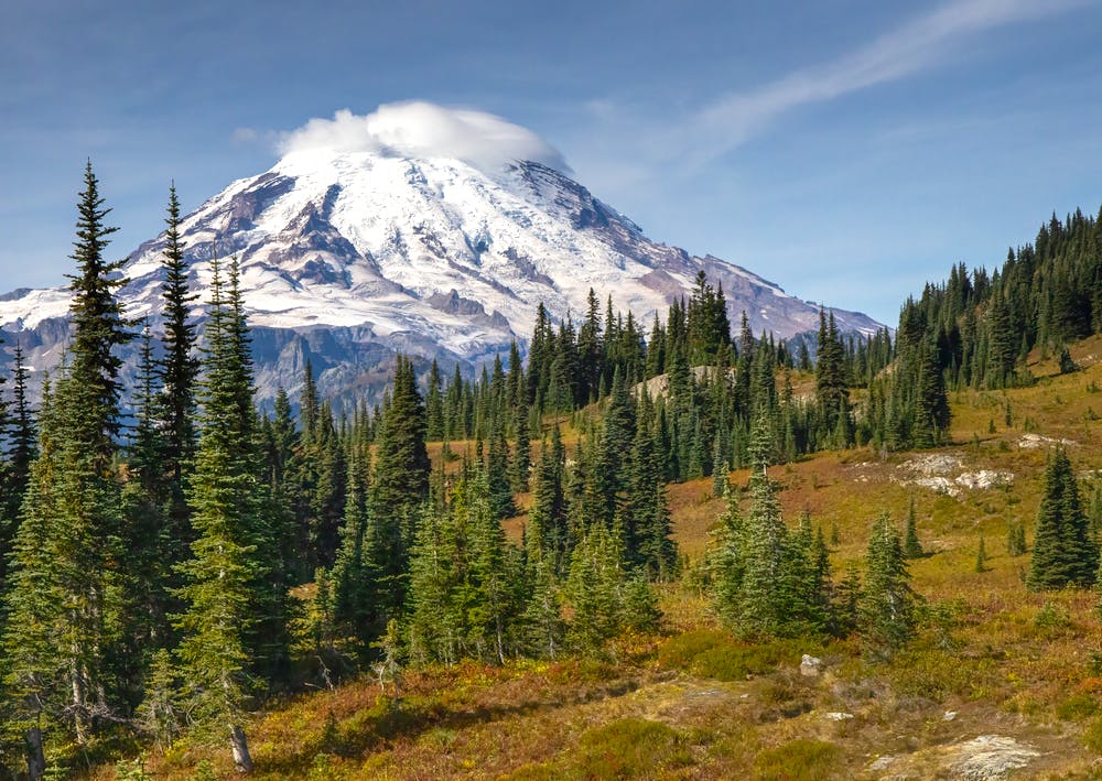
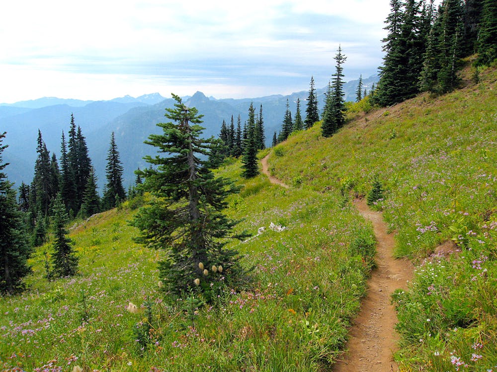
Along this section, the PCT climbs gradually from White Pass and enters another wilderness area, passing several lakes surrounded by grass and forest. Eventually, the incline steepens dramatically, and the trail climbs to a subalpine crest where clearings reveal Mount Rainier plus other Cascade volcanoes on the horizon. The segment ends at Chinook Pass on the boundary of Mount Rainier National Park, where crowds of day hikers will likely share the trail on good-weather days.
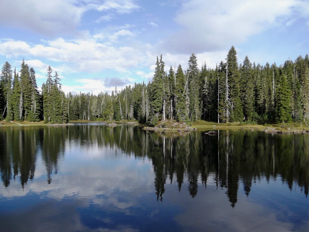
From White Pass, the PCT soon enters the William O. Douglas Wilderness (NB mile 2296.1), and the series of lakes begins right away. There’s a lake or pond every few miles along the trail, with some clusters of even greater density. If you’re looking for lakeside camping, Deer Lake (NB mile 2297.2) and Pipe Lake (NB mile 2302) are especially inviting. Be prepared for bugs in early to mid-summer, though. A number of side trails also branch off in this wilderness area, making various loop options for section hikers.
The PCT continues through forest and intermittent meadows, passing one spot by a creek with several good campsites (NB mile 2307.3). Eventually, the trail meets the Bumping River (NB mile 2308.6), a larger creek that must be forded or crossed on logs. Up to this point, the elevation gain has been gradual, but beyond the river, the trail faces the escarpment of Crag Mountain. The next four miles go aggressively uphill but weave among spectacular scenery in montane forest, gurgling creeks, and bench lakes. Tree gaps reveal views toward Mount Adams, St. Helens, and finally Rainier over the course of the climb. Eventually, the incline lessens, but the preceding miles continue mostly uphill. Moving higher up, the forest frequently opens into gorgeous subalpine meadows with rocky peaks overhead.
A good camp is at the Two Lakes trail junction (NB mile 2314.6), but even better spots may be found with a half-mile detour to the lake. Over the next several miles, the PCT crosses in and out of the national park, more or less straddling its eastern boundary. Camping is not allowed inside the park, but plenty of spots occur along stretches of trail that are in the national forest.
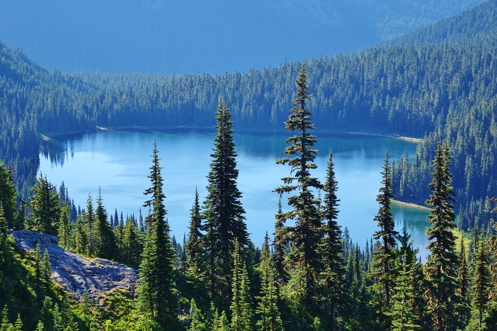
If you have the time, you might enjoy side trips to Cougar Lakes (NB mile 2316) or American Lake (NB mile 2317.2) for camping, but farther along the PCT, you’ll find camps near Anderson Lake (NB mile 2318.5) and at Dewey Lakes (NB mile 2320.5) as well. Past Dewey, the trail makes a short but steep climb over another ridge then makes a panoramic contour on the slopes of Naches Peak, which makes a popular day hike for national park crowds. Here the PCT exits the wilderness and soon reaches Highway 410 at Chinook Pass (NB mile 2323.5). A large footbridge embossed with “Mount Rainier National Park” takes the PCT over the road. On the other side, the trail soon reaches a large trailhead area with toilets and trash cans. This is a busy spot during much of the year because of its proximity to the national park.
Permits: This segment is mostly within the William O. Douglas Wilderness of Okanogan-Wenatchee and Gifford Pinchot national forests. Hiking and camping in the wilderness requires a permit, but these are free and self-issued at trailheads. Parts of the trail cross into Mount Rainier National Park where camping is not allowed, but it’s easy enough to find sites outside the park bounds. Watch for signs along this segment that denote boundaries and restrictions. Additionally, section hikers may need the Northwest Forest Pass or equivalent for parking at trailheads.
Sources: https://www.fs.usda.gov/recarea/okawen/recarea/?recid=79426 https://www.pcta.org/discover-the-trail/maps/ https://pctmap.net/trail-notes/
Moderate
Hiking along trails with some uneven terrain and small hills. Small rocks and roots may be present.

The trail contains some obstacles such as outcroppings and rock which could cause injury.

Little chance of being seen or helped in case of an accident.
72 routes · Hiking