2.1 km away
Kendall Katwalk
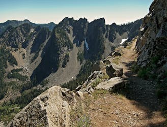
Hike to the stunning Kendall Katwalk section of the PCT.
Difficult Hiking
- Distance
- 18 km
- Ascent
- 935 m
- Descent
- 935 m
Snoqualmie Mountain summit
Hiking Difficult

This is a popular hiking route which is generally considered to be difficult. It's remote, it features high exposure and is typically done between August and September. From a low point of 954 m to the maximum altitude of 1.9 km, the route covers 2.3 km, 939 vertical metres of ascent and 0 vertical metres of descent.
Snoqualmie Mountain
Difficult
Hiking trails where obstacles such as rocks or roots are prevalent. Some obstacles can require care to step over or around. At times, the trail can be worn and eroded. The grade of the trail is generally quite steep, and can often lead to strenuous hiking.

Some trail sections have exposed ledges or steep ascents/descents where falling could cause serious injury.

Away from help but easily accessed.
2.1 km away
Hike to the stunning Kendall Katwalk section of the PCT.
Difficult Hiking
2.1 km away
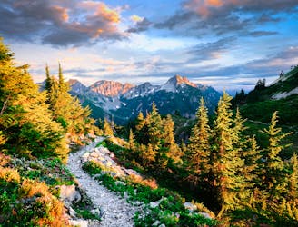
Miles 2393.2-2464.1 of the northbound PCT: Stunning views along a series of big ups and downs, between high mountain lakes and lush valley forest in the Alpine Lakes Wilderness.
Difficult Hiking
7 km away
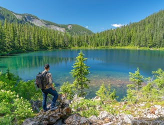
A spectacular alpine lake high above Snoqualmie Pass.
Difficult Hiking
8.7 km away
A mellow hike to two stunning alpine lakes, with the option to camp at either one.
Moderate Hiking
8.7 km away

A mellow hike to a stunning alpine lake.
Moderate Hiking

10 routes · Hiking

72 routes · Hiking

19 routes · Hiking