3.3 km away
Granite Lakes
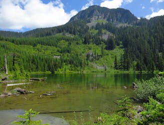
Escape the crowds on this isolated hike to Granite Lakes.
Difficult Hiking
- Distance
- 17 km
- Ascent
- 757 m
- Descent
- 756 m
Nice trail to Thompson lake.
Hiking Difficult

This is a popular hiking route which is generally considered to be difficult. It's very remote, it features medium exposure and is typically done between July and October. From a low point of 258 m to the maximum altitude of 1.3 km, the route covers 8.4 km, 1043 vertical metres of ascent and 190 vertical metres of descent.
Beautiful hike.
Difficult
Hiking trails where obstacles such as rocks or roots are prevalent. Some obstacles can require care to step over or around. At times, the trail can be worn and eroded. The grade of the trail is generally quite steep, and can often lead to strenuous hiking.

The trail contains some obstacles such as outcroppings and rock which could cause injury.

Little chance of being seen or helped in case of an accident.
3.3 km away
Escape the crowds on this isolated hike to Granite Lakes.
Difficult Hiking
6.3 km away
A popular climb to gorgeous views from the summit of Mount Si.
Severe Hiking
6.6 km away
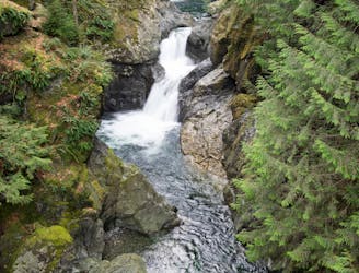
Hike to two incredible waterfalls in a narrow gorge.
Moderate Hiking

10 routes · Hiking

19 routes · Hiking