2.1 km away
Kendall Katwalk
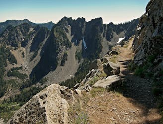
Hike to the stunning Kendall Katwalk section of the PCT.
Difficult Hiking
- Distance
- 18 km
- Ascent
- 935 m
- Descent
- 935 m
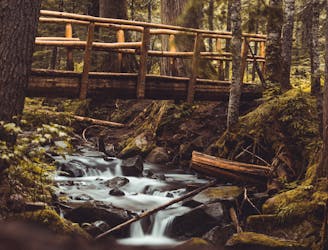
Overnight backpacking trip passing by many Alpine Lakes.
Hiking Severe

This is a popular hiking route which is generally considered to be severe. It's extremely remote, it features medium exposure and is typically done between May and September. From a low point of 955 m to the maximum altitude of 1.5 km, the route covers 11 km, 824 vertical metres of ascent and 495 vertical metres of descent.
Beautiful hike to not often explored lakes.
Severe
Hiking challenging trails where simple scrambling, with the occasional use of the hands, is a distinct possibility. The trails are often filled with all manner of obstacles both small and large, and the hills are very steep. Obstacles and challenges are often unexpected and can be unpredictable.

The trail contains some obstacles such as outcroppings and rock which could cause injury.

In the high mountains or remote conditions, all individuals must be completely autonomous in every situation.
2.1 km away
Hike to the stunning Kendall Katwalk section of the PCT.
Difficult Hiking
2.1 km away
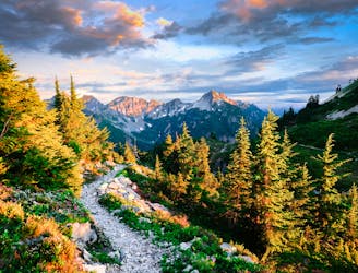
Miles 2393.2-2464.1 of the northbound PCT: Stunning views along a series of big ups and downs, between high mountain lakes and lush valley forest in the Alpine Lakes Wilderness.
Difficult Hiking
7 km away
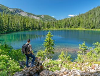
A spectacular alpine lake high above Snoqualmie Pass.
Difficult Hiking
8.7 km away
A mellow hike to two stunning alpine lakes, with the option to camp at either one.
Moderate Hiking
8.7 km away

A mellow hike to a stunning alpine lake.
Moderate Hiking

10 routes · Hiking

72 routes · Hiking

19 routes · Hiking