6.7 km away
Tokul East
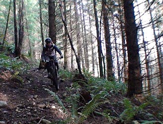
Tokul's enduro-oriented eastern side.
Difficult Mountain Biking
- Distance
- 13 km
- Ascent
- 422 m
- Descent
- 422 m
The newest bike-specific trail system in the Seattle area.
Mountain Biking Difficult

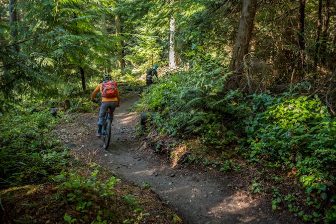
Raging River is one of the newest mountain bike trail systems in the Seattle Area, as of the time of this writing. In May 2018, the system opened with 17 miles of singletrack, and it’s continued to grow rapidly ever since. Eventually, the Raging River trail system will include 40 miles of singletrack mountain bike trail, and will even connect to the long-time classic Tiger Mountain and the community of North Bend. Future trail development is currently dependent on funding, with the final build-out of the entire system estimated to cost millions of dollars.
This trail system is located in a newly-designated state forest by the same name. "In 2009, DNR acquired 7,000 acres of forestland just to the south of Rattlesnake Mountain, which would become a core part of the new Raging River State Forest,” according to MTSGreenway.org. In addition, King County "provided critical funding through the Conservation Futures Program and holds a conservation easement on 4,000 acres.”
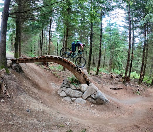
Mapped here is a recommended lollipop-style ride on the trails completed thus far in the Raging River system. The recommended route climbs Upward Mobility to Raging Ridge, and then makes a loop with the black diamond No Service descent and the intermediate-rated Return Policy. Alternatively, you could jump off of No Service and hit the double black diamond People’s Elbow jump line and the double black downhill tech trail known as Invictus. Either way, the remainder of the descent follows Raging Ridge back down the mountain and then splits off onto the downhill-specific trails of Poppin’ Tops and Flow State.
Overall, the route mapped here is an intermediate/advanced pedal through the Raging River system. The only black diamond-rated trails included in this route are No Service and Poppin’ Tops Upper, both of which can be bypassed with dirt roads and other trails if you prefer a slightly easier ride. Or, as mentioned above, ratchet up the difficulty with Invictus. The choice is yours!
Sources: https://mtsgreenway.org/blog/seventeen-miles-of-new-trail-built-in-the-raging-river-state-forest/ https://www.evergreenmtb.org/trails/raging-river
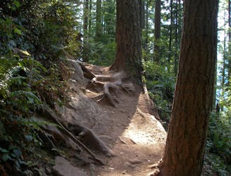
Difficult
Mostly stable trail tread with some variability featuring larger and more unavoidable obstacles that may include, but not be limited to: bigger stones, roots, steps, and narrow curves. Compared to lower intermediate, technical difficulty is more advanced and grades of slopes are steeper. Ideal for upper intermediate riders.

The trail contains some obstacles such as outcroppings and rock which could cause injury.
Away from help but easily accessed.
6.7 km away
Tokul's enduro-oriented eastern side.
Difficult Mountain Biking
8.3 km away
The gnarliest trail system near Seattle.
Severe Mountain Biking
8.3 km away

A gnarly double black diamond downhill line on Tiger Mountain.
Extreme Mountain Biking
8 routes · Mountain Biking

16 routes · Mountain Biking
5 routes · Mountain Biking