487 m away
Mount Baker via the Easton Glacier
A relatively easy climb to the crown of the North Cascades
Moderate Ski Touring
- Distance
- 21 km
- Ascent
- 2.4 km
- Descent
- 2.4 km
A direct climb up and possibly the best summer ski on Mount Baker
Ski Touring Moderate

The Squak Glacier route on Mount Baker is possibly the easiest way to make your way to the summit of this iconic peak. When most other volcano lines are past there prime this run still holds good snow on a typical season until August. Unlike most other lines this trip starts climbing right from the trailhead and offers fall line turns for over 4,000 feet before making your way down a relatively easy trail directly back to the parking lot.
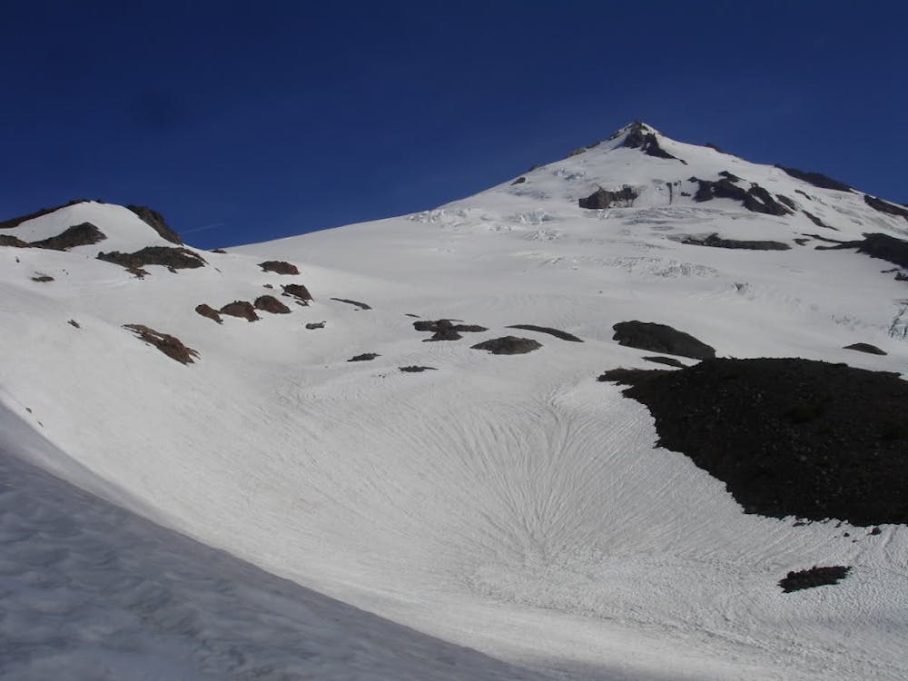
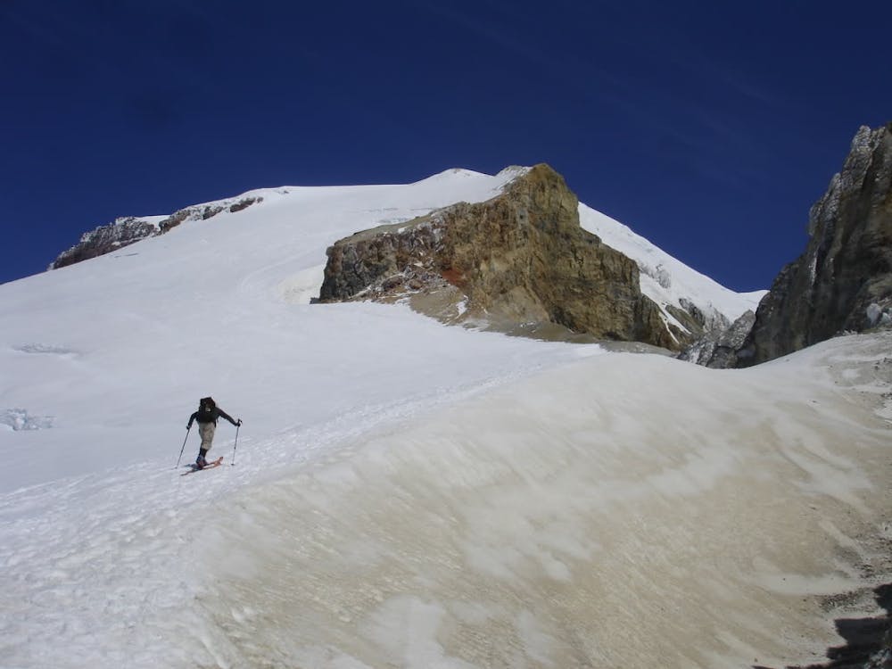
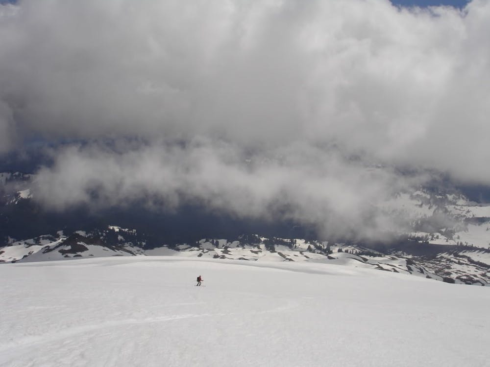
Starting at the Park Butte Trailhead make your make your way up the Scott Paul trail. Once nearing alpine at an open view point make your way up the lookers right trail known as the Squak Glacier Route. Hike the ridge trail up and once reaching the Squak Glacier Camp it is time to get onto the Glacier. Heading up is straightforward making your way north towards the Western most rock outcropping of the Sherman Crater. From here on this route is the same as the Easton.
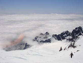
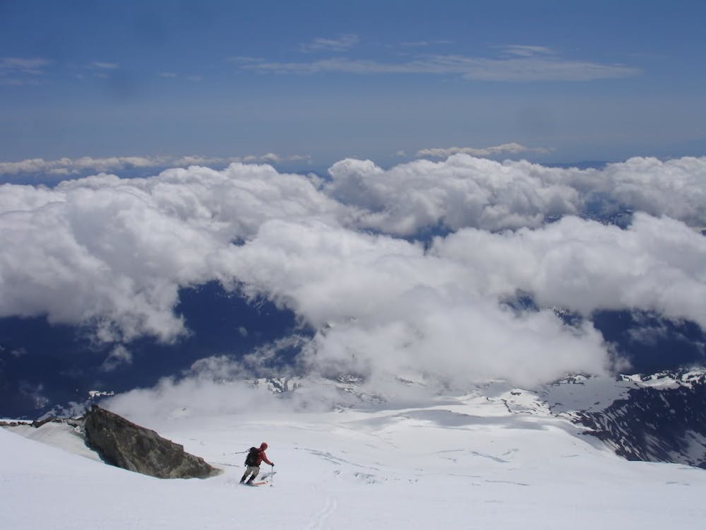
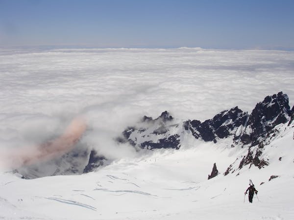
Wrapping around the Sherman Crater rim you will soon be at the base of the Roman Headwall where you should switch from skinning to cramponing for the final thousand feet. Making your way up is pretty easy but carefully make your way around the shrund before heading directly to the top flats. Once there you might as well head over to the true summit to take in one of the best views within the North Cascades.
Heading back down basically retrace your steps where you can make some nice fall line turns down the Roman Headwall before making a hard traverse skiers left towards the Sherman Crater rim. Once just south of the Sherman crater enjoy a nice and easy low angle run back down the Squak Glacier being cautious to reconnect with the Scott Paul trail. It is important to stay on the skiers right of the glacier and not descend directly into the basin below. If snow allows you can ride fall line but must start a hard traverse skiers right no lower than 5,800 feet. If all goes smooth then you will find yourself back on the trail and follow it back down to the Park Butte trailhead.
To see my trip in the area and more photos check out this link https://www.whereiskylemiller.com/highway-20/squak-glacier/
Moderate
Slopes become slightly steeper at around 25-30 degrees.

As well as the slope itself, there are some obstacles (such as rock outcrops) which could aggravate injury.
Away from help but easily accessed.
487 m away
A relatively easy climb to the crown of the North Cascades
Moderate Ski Touring
9 routes · Ski Touring