487 m away
Mount Baker via Squak Glacier
A direct climb up and possibly the best summer ski on Mount Baker
Moderate Ski Touring
- Distance
- 24 km
- Ascent
- 2.4 km
- Descent
- 2.4 km
A relatively easy climb to the crown of the North Cascades
Ski Touring Moderate

The Easton Glacier route on Mount Baker is a nice and consistent fall line run that holds late into the volcano season. While the Coleman Demmning route is a classic this line is much more straightforward both going up and coming down. Being that this is a south facing aspect it is much easier to get good corn condition late into the season. With that being said the issue with this line is that in early spring be prepared to share this area with snowmobiles as it is within the recreation zone and possibly the most popular snowmobile route within the North Cascades.
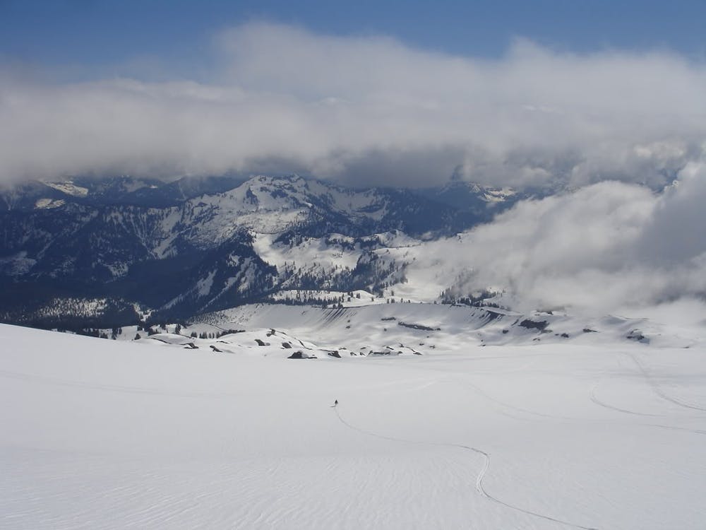
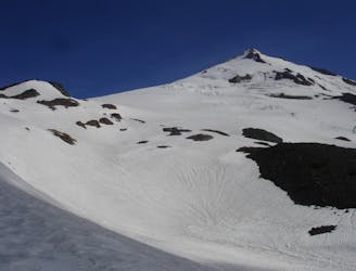
The trick with getting into the Easton Glacier is all about timing where you want the snowpack to be melting out but not too much as you need to start at around 3,500 feet. Leaving Schreiber's Meadow trailhead start heading west via a well laid out snowmobile track until arriving at Rocky Creek. If the snow is melted out make your way up to the Railroad Grade trail and start gaining elevation, but if snow allows you can just head directly up the gully. Around 6,100 feet both of these trails merge and by now you are standing on the Easton Glacier so be cautious of potential crevasses.
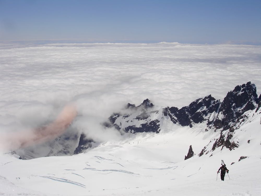
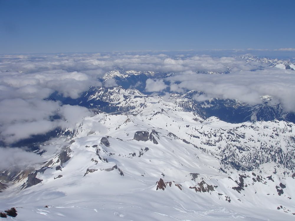
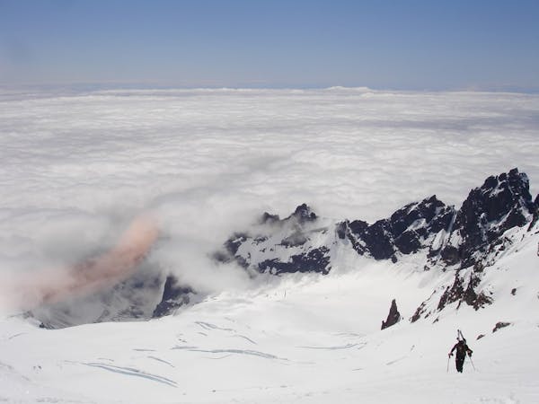
Heading up the Easton Glacier is a consistent climb making your way northeast until arriving just below the western rock outcropping of the Sherman Peak crater. From here head north towards the low col line until arriving at the base of the Roman Headwall. Now is a good time to put on crampons and make the final 1,000 climb all the way to the summit flats. Once there make your way over to the true summit and take in one of the best views of the North Cascades.
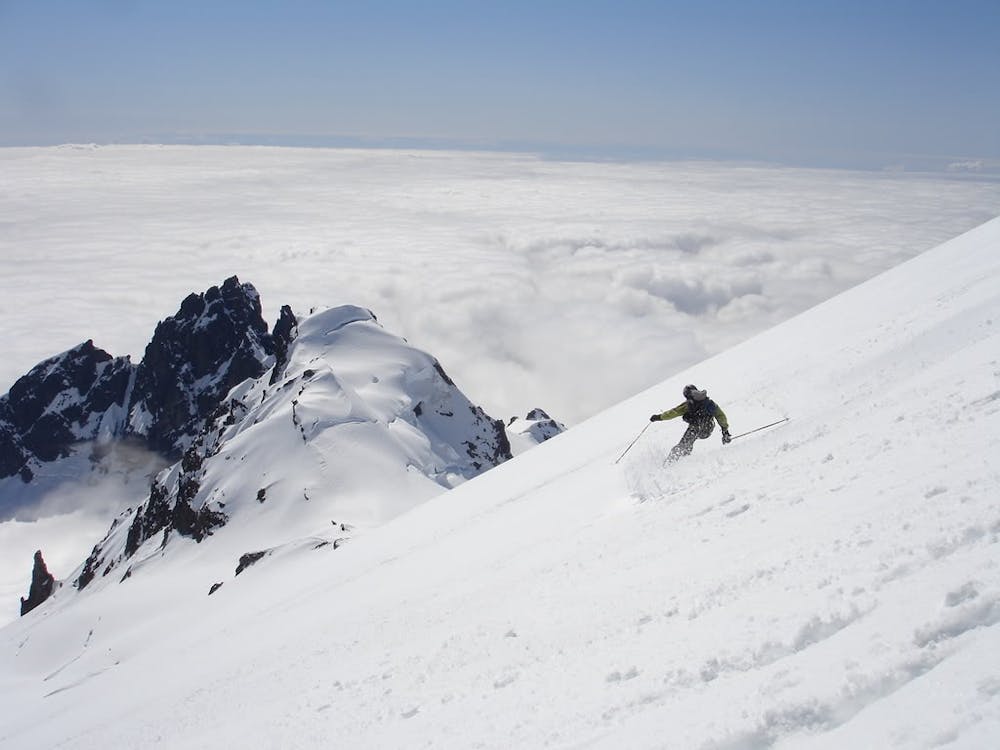
Descending back down is pretty much following your ascent route but dropping into the Roman Headwall you can do some nice fall line turns before traversing skiers left back over towards the Sherman Peak zone. From here on out it’s low angle turns all the way down the Easton Glacier but make sure to be cautious of any crevasses you passed while climbing. Drop down as far as snow allows until arriving back at the base of Rocky Creek and heading East back to the car.
To see my trip in the area and more photos check out this link https://www.whereiskylemiller.com/highway-20/easton-glacier/
Moderate
Slopes become slightly steeper at around 25-30 degrees.

As well as the slope itself, there are some obstacles (such as rock outcrops) which could aggravate injury.
Away from help but easily accessed.
487 m away
A direct climb up and possibly the best summer ski on Mount Baker
Moderate Ski Touring
9 routes · Ski Touring