26 m away
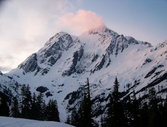
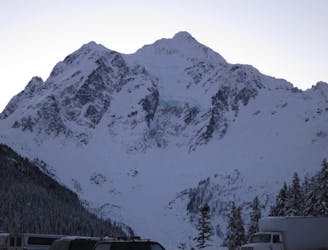
The White Salmon Glacier on Mount Shuksan
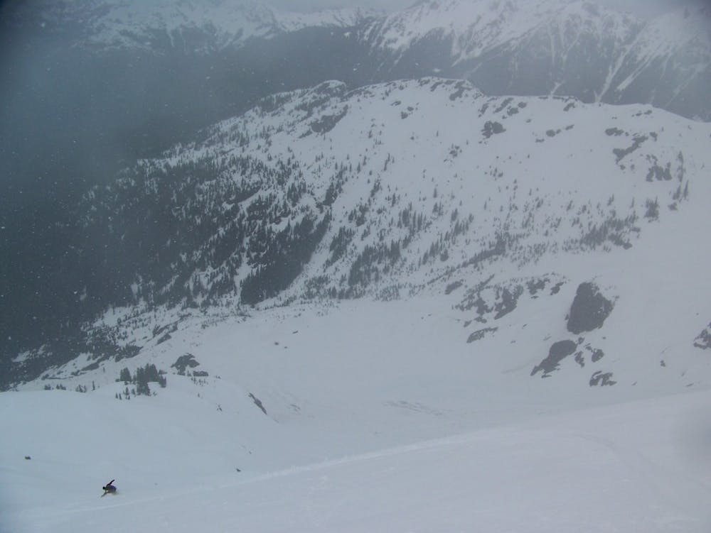
One of the best north facing lines in all of the Cascades
Moderate Ski Touring
- Distance
- 11 km
- Ascent
- 1.7 km
- Descent
- 1.7 km
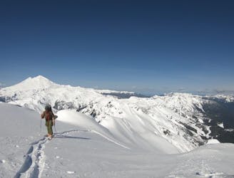
The easiest way to get to the summit of Mount Shuksan from the north
Ski Touring Difficult

Of all the mountains in Washington state one could say that Mount Shuksan holds a special place in most peoples hearts. Being one of only a handful of 9.000 foot peaks in Washington but being the only one easy for people to view you can only imagine how many people would love to climb it. Rising over 6,000 feet from the valley below, this massive tower of rock has so many different personalities on so many different aspects. One could spend an entire lifetime climbing Mount Shuksan and always find a new route to put in. The White Salmon Route is by far the least technical way to reach the summit via the northside and unlike the southside it also offers a great ski run.
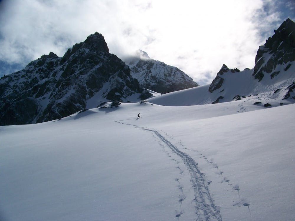
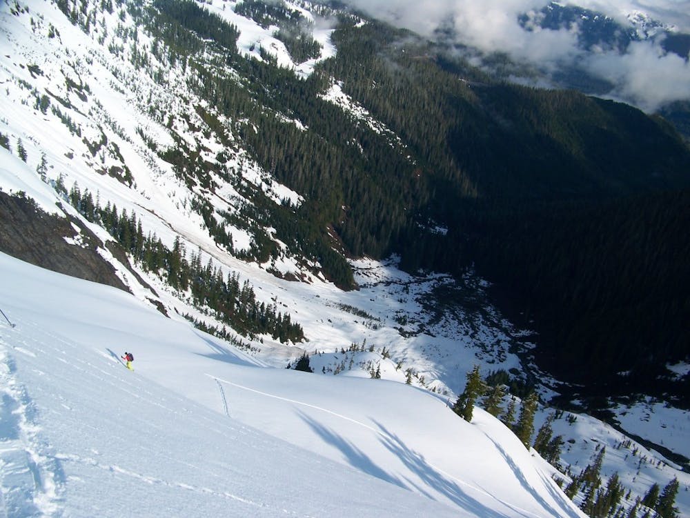
Leaving the White Salmon Parking lot at Mount Baker ski resort head East on the lowest ski trail before turning left just below chair 8. Once at the flats it is time to transition for your first ski run riding through the trees below into the White Salmon Valley. Start heading up the White River Basin passing by a huge debris field and just before reaching the base of the mountain head for a treed ridge. Being much safer then heading up the gut with a few well laid switchbacks it returns to the White Salmon Glacier a thousand feet higher.
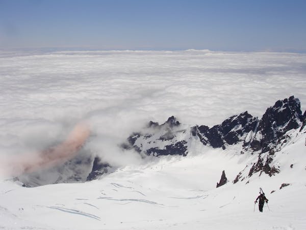
Now it is time to climb the White Salmon Glacier by laying switchbacks into the steep slopes. What first is quite steep soon mellows off as you head up the broad Northwest should reaching the high col. Stay on this ridge for a few minutes heading East before wrapping onto the Upper Curtis Glacier and keep gaining elevation until reaching a flat bench. From there start heading southwest towards the low col named Hells Highway which leads you over to the upper Sulphide Glacier. From here on out it is a long slog to get to the base of the summit pyramid.
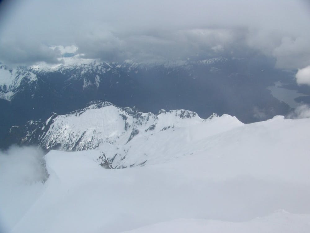
Standing just below the top switch over to crampons for the steep bootpack to the top, the earlier in the season the more mellow it is as it is covered in a deep snowpack. Soon enough you will reach the top and have a stunning view East into the North Cascades. Heading back down retrace your steps on the Sulphide Glacier down Hells Highway where as a snowboarder you will have to skin for a few minutes to make it back to the flats of the Upper Curtis Glacier. Putting the ski gear back on now it is time for the long ski run back down to the White Salmon Glacier and all the way to the base of the valley where you ended your first ski run.
By now you will be exhausted but use the last bit of your energy as you climb the 800 feet of steep and dense trees back to the base of Chair 8. From here you are merely minutes away from the car but keep your poles out as the exit is flat. Soon enough you will be back at the car and looking southeast towards Mount Shuksan with a smile.
To see my trip in the area and more photos check out this link https://www.whereiskylemiller.com/mt-baker-542/white-salmon-glacier/
Difficult
Serious gradient of 30-38 degrees where a real risk of slipping exists.

As well as the slope itself, there are some obstacles (such as rock outcrops) which could aggravate injury.
Away from help but easily accessed.
26 m away
One of the best north facing lines in all of the Cascades
Moderate Ski Touring
60 m away
Steep, demanding yet of so fun.....
Severe Ski Touring
91 m away
A stunning traverse set among some of the more technical terrain around Highway 542
Severe Ski Touring
9 routes · Ski Touring

11 routes · Ski Touring