26 m away
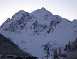
Mount Shuksan via the White Salmon Glacier
The easiest way to get to the summit of Mount Shuksan from the north
Difficult Ski Touring
- Distance
- 15 km
- Ascent
- 2.3 km
- Descent
- 2.3 km
One of the best north facing lines in all of the Cascades
Ski Touring Moderate

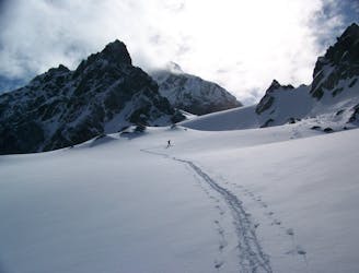
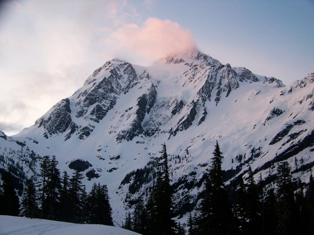
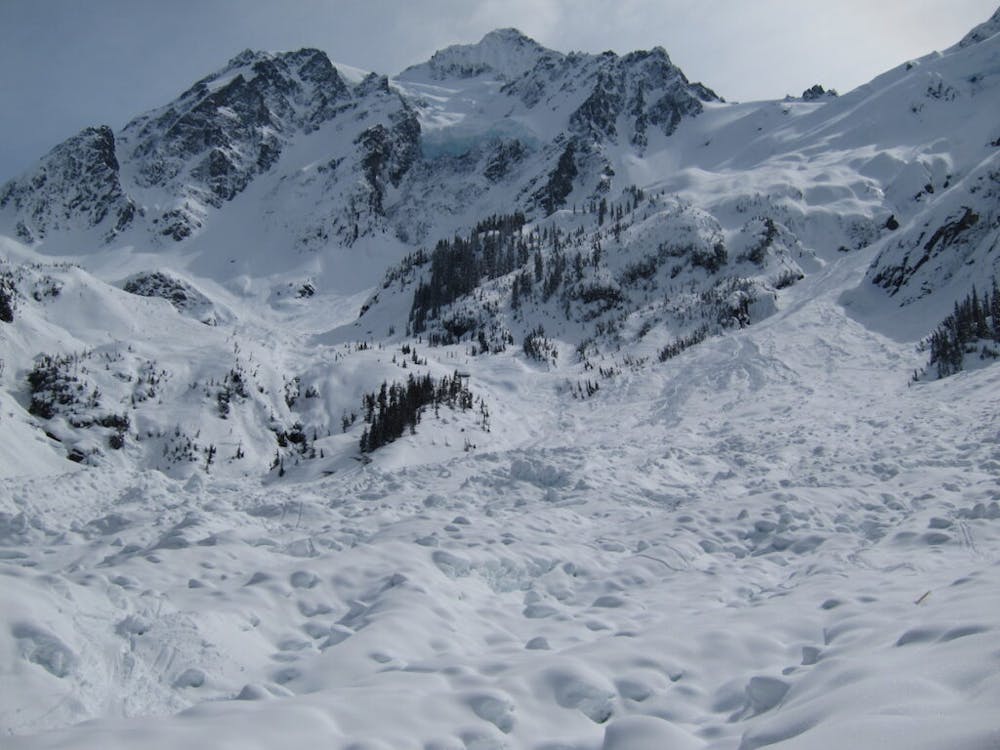
The White Salmon Glacier on Mount Shuksan is one of those lines you look at from the Mount Baker ski resort and dream of riding. Being that it is a wide open and semi steep north facing run it is the kind of line almost anyone can enjoy. Add to that the line having 3,000 vertical feet of alpine and 4,000 feet in total it is one of the bigger (semi) easy access lines within the Cascades. But before reading this and just heading out there you should know that it is dangerous for a few reasons. This route is mainly in alpine terrain so it needs to be a clear day. If there is any question about snowpack stability this is an incredibly dangerous run and lastly you are on Glacial terrain so crevasses are there so be cautious.
Leaving the White Salmon Parking lot of Mount Baker Ski Resort traverse east towards the base of Chair 8. Once almost there you will see a small turn off to the left where you need to head to before descending into the White Salmon Creek Valley. Descend down the Northeast slopes making sure to stay within the trees and before long you will be at the base and preparing for a long climb ahead of you.
Heading up the lookers right side of the White Salmon Creek you will find yourself within a large avalanche debris field, make your way across it fast before gaining elevation southeast. Just before arriving at the flats below the White Salmon Glacier debris field cut a hard lookers right into a small treed section. Work your way up through the north facing trees and once just below the top wrap southwest a bit and gain the ridge.
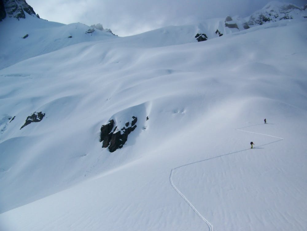
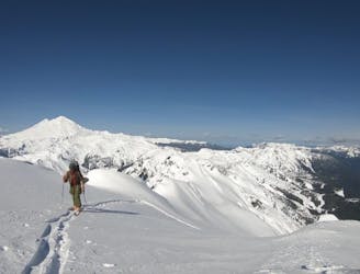
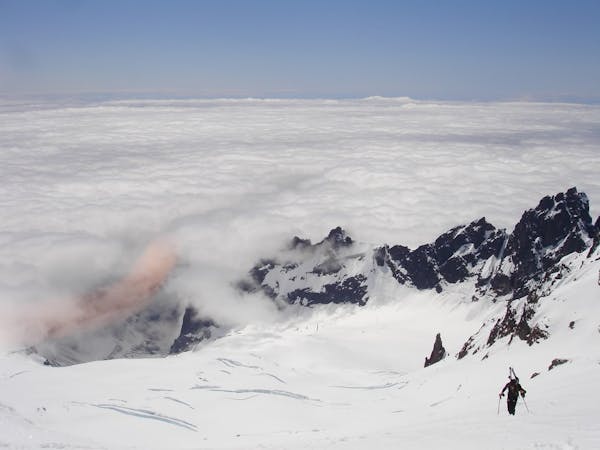
Now you have a perfect view of the White Salmon Glacier above you and it is time to either commit or turn around. Starting to climb you are already almost at the crux of the trip doing a steep traverse to the east a bit before wrapping back west onto the actual glacier, this is the steepest section of the climb and once past it the slope eases up. From here on out making your way up the Northwestern Shoulder which is easy skinning until the final 200 feet where you may need to boot pack.
Once on the ridge it is time for your descent laying tracks down an open canvas. Drop into the glacier and instead of heading for the tree island you climbed earlier you can stay in the gut riding fall line and with a bit of speed you will make it past the debris field and near where your first descent was. It is time to climb up through steep and dense trees back to the ski resort. Once back on your first transition point you can switch over to head back to the parking lot but if you’re a snowboarder make sure to keep your poles out as it is flat.
To see my trip in the area and a video of our check out this link https://www.whereiskylemiller.com/mt-baker-542/whitesalmon/
Moderate
Slopes become slightly steeper at around 25-30 degrees.

As well as the slope itself, there are some obstacles (such as rock outcrops) which could aggravate injury.
Away from help but easily accessed.
26 m away
The easiest way to get to the summit of Mount Shuksan from the north
Difficult Ski Touring
83 m away
Steep, demanding yet of so fun.....
Severe Ski Touring
117 m away
A stunning traverse set among some of the more technical terrain around Highway 542
Severe Ski Touring
9 routes · Ski Touring

11 routes · Ski Touring