5 routes · Ski Touring
A 4,2000 foot fall line run on the Crown of the Eastern Cascades
Ski Touring Difficult

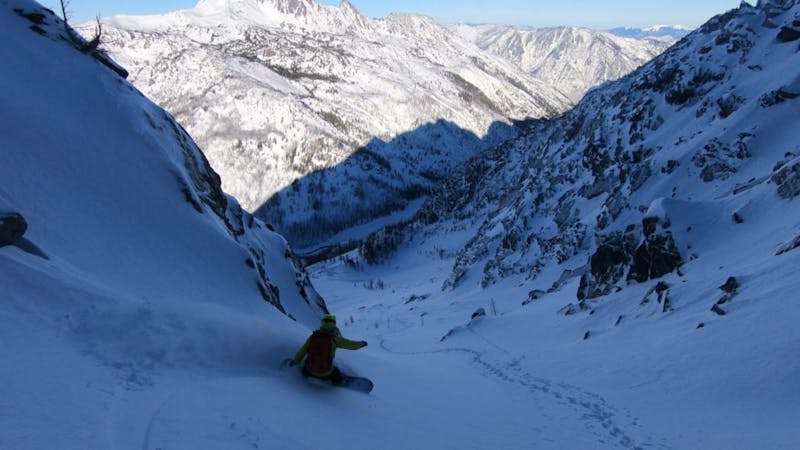
The Cascadian Couloir is a beautiful 4,200 foot fall line gully that runs down the Southern face of Mount Stuart. While this route is possible during winter it starts seeing crowds during the spring time…Why? This all comes down to access as just getting into it early in the season you will need to have a sled available. Being that it is South facing the moment the road is melted out you need to get into there as the slopes melt incredibly fast. But if you time your ski tour on a nice spring day it is hard to beat riding this line from top to bottom in perfect corn.


We did this tour in late April using a snowmobile heading up the North Fork of the Teneway River Road until arriving at the base of Longs Peak. Making our way northeast through the semi open forests we soon arrived up at Longs Pass and prepared for the first descent of the day. Dropping the East basin we rode all the way to the valley floor before finding a spot to cross Ingalls Creek and following the valley all the way down to the base of the Cascadian Couloir.
Once at the base of the Cascadian Couloir it was time to start making our way up the slope. While it is possible to skin up in powder conditions we were there for corn so the moment it started to get steep we just switched over to crampons and pushed directly up the gut. Being that there was a low avalanche danger and it was early in the morning it made for perfectly firm bootpacking until arriving on the sub summit.
Standing up top we waiting until around noon before the upper slopes were edgeable enough as we didn’t want the bottom to be slush. Dropping in around 1 p.m. we found perfect corn from top to bottom before getting a drink out of Ingalls Creek and retracing our descent route back up to Longs Pass and riding back down to the sleds.
There is an alternative route via Beverly Creek which I recommend if you are not using sleds. I’ve done this route before and it was quite straightforward but that trip may come a bit later.
To see my trip in the area and more photos check out this link https://www.whereiskylemiller.com/snoqualmie-pass/cascadian-couloir-mount-stuart/
Difficult
Serious gradient of 30-38 degrees where a real risk of slipping exists.

As well as the slope itself, there are some obstacles (such as rock outcrops) which could aggravate injury.

Little chance of being seen or helped in case of an accident.
5 routes · Ski Touring