36 m away
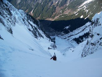
Doubtful Lake Gullies on Sahale Peak
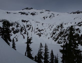
A great alternative to the standard decent on Sahale Peak
Moderate Ski Touring
- Distance
- 11 km
- Ascent
- 1.8 km
- Descent
- 1.8 km
A great way to get away from the crowds and link up some steep lines
Ski Touring Difficult

The Magic S Loop is a great day trip and alternative option to the more popular terrain based off of Cascade River Road. Being that this route goes in a circular manner each col and summit gives a different view and a greater perspective of the massiveness of the North Cascades. With nice ski descents off of Magic Mountain and Hurry Up Peak it is a great trip for both skiers and snowboarders. Being relatively straightforward as long as the weather is clear this is a simple route to follow. While it can be done in the winter time the longer days of spring and stable snowpack is the best time to do the Magic S Loop.

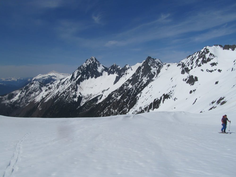
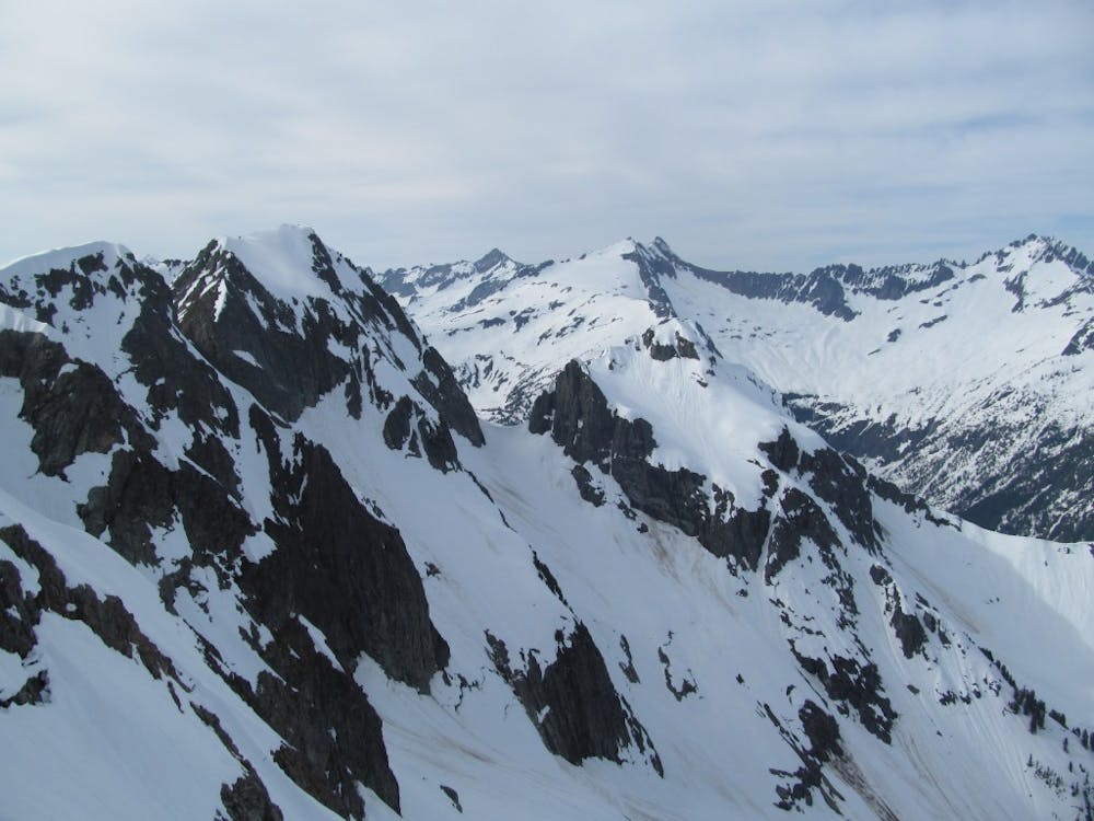
Leaving from the Cascade Pass Trailhead as long as there is still a semi thick snowpack you can drop into the main valley before heading up the lookers right side of the Cascade Pass before traversing hard left over to it. Being that we stayed the night in Pelton Basin we hiked up the slopes directly below the Cache Glacier but as a day trip there is a semi sketchy traverse that goes below the rock headwall of Mix Up Peak. Once on the Cache Glacier make your way up to the obvious col at its highest point. From here it is a long sidehilling traverse south arriving at the col just East of Arts Knol. Dropping into the Southeast basin after taking a few turns make a hard traverse skiers left where you will arrive at the base of the Plan B Couloir.
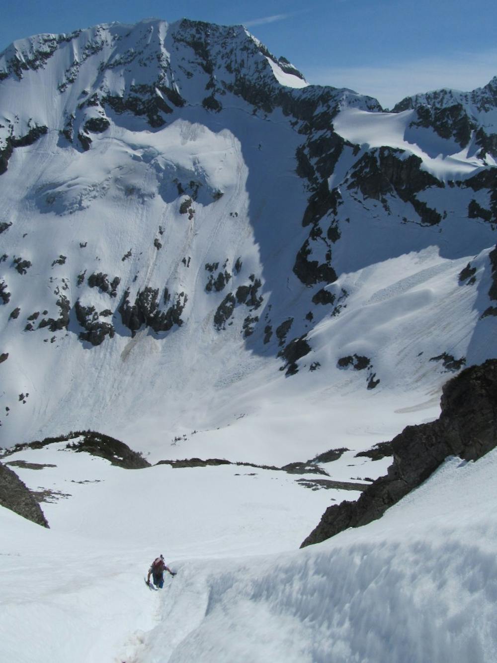
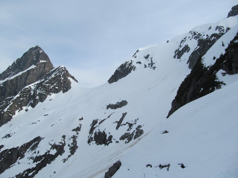
Climbing up the plan B couloir it is smart to use crampons as the slopes are steep but also direct, after around 800 feet you will be on the Eastern shoulder of Hurry Up Peak. From here ride down the skiers right side before riding fall line all the way down to the basin where it is time to transition again. Climb a bit back up the basin before making your way up the open ramp between Magic Mountain and Pelton Peak. Standing at the col ride down the Yawning Glacier which is fall line all the way into Pelton Basin. Once in the valley it is time to skin North back up and over Cascade Pass before descending down into the valley and walking back up to the road. This tour is both simple and complex at the same time.
To see my trip in the area and more photos check out this link https://www.whereiskylemiller.com/highway-20/magic-s-loop/
Difficult
Serious gradient of 30-38 degrees where a real risk of slipping exists.

In case of a fall, death is highly likely.
Little chance of being seen or helped in case of an accident.
36 m away
A great alternative to the standard decent on Sahale Peak
Moderate Ski Touring
1.1 km away
A rowdy and intense line on the Cascade River Road
Difficult Ski Touring