Wildcat Mound
Hike to stunning views of Central Wisconsin from the tallest cliffs in the Clark County Forest.
Hiking Difficult
- Distance
- 3.1 km
- Ascent
- 81 m
- Descent
- 81 m
- Duration
- 0-1 hrs
- Low Point
- 326 m
- High Point
- 374 m
- Gradient
- 5˚

The glacier-scraped landscape of Central Wisconsin is almost pancake flat, except for where it is interrupted by isolated hills that the glaciers somehow didn't completely flatten. In Clark County, the names assigned to these hills are much more honest than you'll find in other areas of the state. In other areas of Wisconsin, some of these hills will receive the name "mountain." In Clark County, they're more accurately called "mounds."
- •
- •
- •
- •
Description
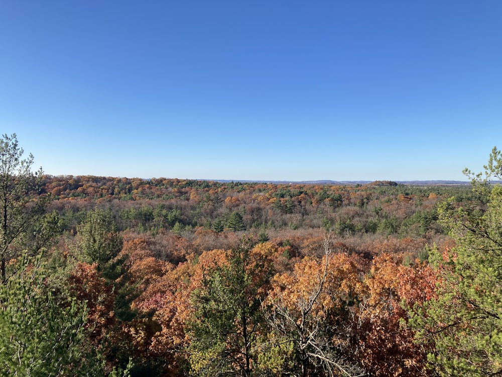
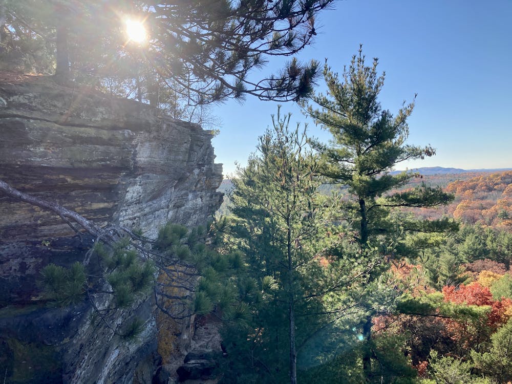
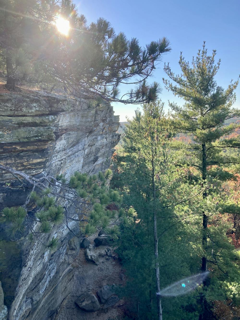
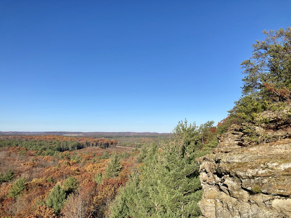
These Clark County mounds consist of upthrust sandstone cliffs with forested hillsides on some of their aspects. While they only rise a few hundred feet above the surrounding landscape, thanks to how flat the rest of the region is, gaining just a couple hundred feet of elevation provides surprisingly beautiful, expansive views of Central Wisconsin.
Three of the most famous Clark County mounds are Bruce Mound, Levis Mound, and the Trow Mounds. Bruce Mound is the tallest, and is home to the local ski hill. Levis and Trow Mounds are home to the local mountain bike trail system—one of the oldest purpose-built mountain bike trails in the world. Unfortunately, Bruce Mound doesn't have any true hiking or biking trails available—it's strictly a winter destination. Levis Mounds does offer fantastic singletrack trails, and while hikers are fully welcome, mountain bikers are the primary user group. But for a hiking-only area, head just a bit north from Levis to this route on Wildcat Mound.
Reaching a maximum height of just 1,241 feet above sea level, Wildcat Mound doesn't rise quite as high as the other mounds. But Wildcat does offer some of the most impressive cliffs in the region! From the top of those cliffs, you'll enjoy fantastic views of the aforementioned Bruce Mound, Levis Mound, and Trow Mounds, as well as the expansive Clark County Forest spreading out below you.
The trails can be steep and quite rocky in places, requiring the use of your hands to negotiate a few sections. Other sections of the trail are sandy and easy. The aerobic effort is easy, but the few sections that need to be scrambled elevate the rating of this hike to "Difficult."
The route shown here tries to make the most of the trails found at Wildcat Mound, taking you to several different viewpoints. Hitting all the viewpoints only adds up to 1.9 miles—an easy hike for most people. However, if you simply want to go straight from the parking lot and up to the viewpoint on top of the tallest cliff, that would only require 0.4 miles and 138 feet of elevation gain one-way for less than a mile round-trip. It's up to you how much distance you want to add.
Difficulty
Difficult
Hiking trails where obstacles such as rocks or roots are prevalent. Some obstacles can require care to step over or around. At times, the trail can be worn and eroded. The grade of the trail is generally quite steep, and can often lead to strenuous hiking.
High Exposure

Some trail sections have exposed ledges or steep ascents/descents where falling could cause serious injury.
Remoteness

Close to help in case of emergency.
Best time to visit
Features
- Picturesque
- Family friendly