5 routes · Alpine Climbing · Hiking
Wyoming’s highest peak via the Gooseneck Glacier route, approaching from the east via Glacier Trail.
Alpine Climbing Difficult

Gannett Peak is the tallest summit anywhere in the Rocky Mountains outside of Colorado, and thus makes the state highpoint of Wyoming. It’s among the toughest of all US state highpoints to climb, surpassed definitively by Denali only. Gannett Peak via Gooseneck Glacier route involves almost 3,000 feet of moderately technical glacier, snow, and rock climbing. However, the approach to this route is a large factor in the overall difficulty as well. Gannett is buried deep in the interior of the Wind River Range, with no roads for several miles in any direction.
There are multiple ways to approach Gannett Peak, and the one mapped here is considered the standard route from the east. This approach is altogether longer than the other popular option, which is from the west via Titcomb Basin, but allows for a shorter summit day with less total elevation gain. Most parties allow 3-5 days total for this route, taking 1-2 days for the 25 miles to the base of Gannett, one day to climb, then 1-2 days out.
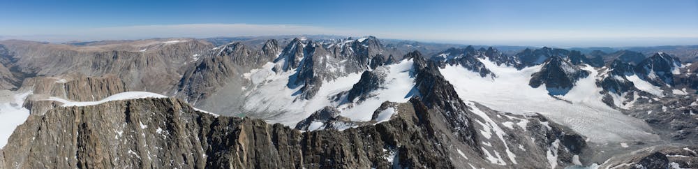
The approach follows Glacier Trail, which is a stunning hike in its own right, though the miles are just a means to an end for climbers bent on Gannett Peak. The trail rises through granite gorges and over treeless, grassy plateaus. It passes pure alpine lakes and goes through green river valleys, all in a wilderness about as remote and rugged as can be found in the Lower 48. Besides the distance, difficulty comes in a few stream crossings, which can be quite high in spring and early summer. The goal for climbers is to make it all the way into the basin beneath Dinwoody Glacier and Gannett Peak, to camp before summit day.
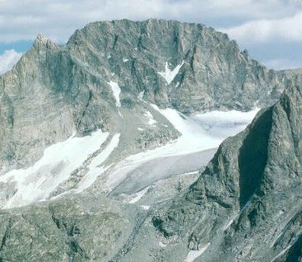
The ideal camp is near a tarn beneath the Dinwoody Glacier, or even higher in the boulder field if you can find a suitable spot with water. From camp, you’ll be staring straight up the spine of Pinnacle Ridge, which separates Dinwoody and Gooseneck Glaciers. To start the route, proceed up through the boulder field to the base of Pinnacle Ridge, then around the south side of the ridge to traverse over it and onto the Gooseneck Glacier.
Much of the glacier is straightforward snow walking, but the angle progressively steepens. Depending on snow conditions and on group comfort level, the glacier might be the place to rope up. Crevasses can exist, and they may or may not be hidden by snow bridges. The one obstacle you can almost certainly count on is a bergschrund which separates the glacier from upper snowfields and couloirs around the base of Gooseneck Pinnacle (the obvious feature crowning Pinnacle Ridge). The bergschrund is often bridged securely in early season (June to early July), but it becomes less stable as the season goes on. How to safely pass the bergschrund will always be up to party discretion and highly dependent on conditions.
Above this obstacle, steep snow leads up a couloir to 3rd class rock and eventually the spine of Pinnacle Ridge above Gooseneck Pinnacle. More Class 3 scrambling will gain Gannett’s summit ridge from there. Expect a mix of snow and bare talus along this ridgeline. Climbing here is generally straightforward, but exposure over the east face is big, so some parties choose to protect certain sections.
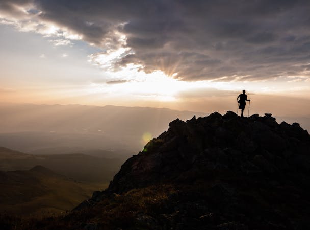
Hopefully, time and weather allow a chance to enjoy the summit of Gannett, at the highpoint of Wyoming and of all the Rockies north of Colorado. The return is by the same route. Many parties choose to rappel or downclimb with protection from Pinnacle Ridge and past the bergschrund. Snow conditions will hopefully allow easier downclimbing or glissading below there, and a swift return back to camp.
Sources: https://www.summitpost.org/gannett-peak/150362 https://www.summitpost.org/glacier-trail/530102 https://www.14ers.com/php14ers/tripreport.php?trip=13928
Difficult
The beginning of truly technical terrain which might involve pitched climbing on rock and/or ice, exposed terrain and complex route finding in ascent and descent. Equivalent to AD, AD+

Much of the route is difficult to protect and a fall could be disastrous at certain points.

In the high mountains or remote conditions, all individuals must be completely autonomous in every situation.
5 routes · Alpine Climbing · Hiking
10 routes · Alpine Climbing · Hiking