L'hortell's ridge line

A long walk line with some rough terrain suitable only for good skiers.
Extreme Freeride Skiing
- Distance
- 965 m
- Ascent
- 32 m
- Descent
- 287 m
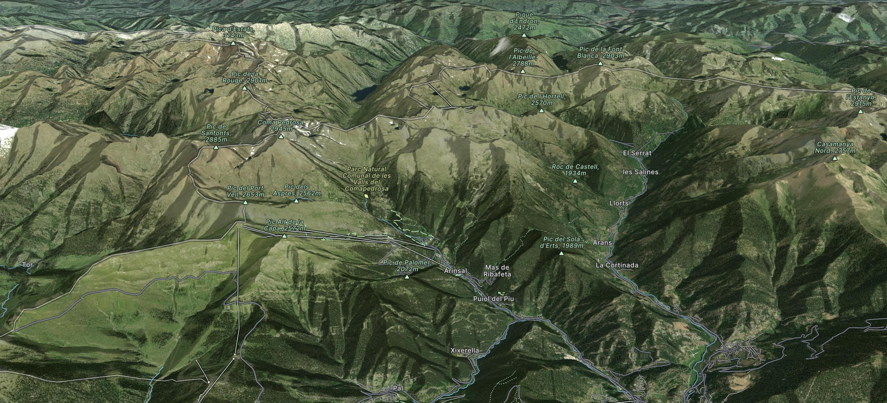
Vallnord consists of three ski areas which are Pal, Arinsal and Ordino-Arcalis with the latter being the most famous freeride hotspot in Andorra.
Explore Vallnord with curated guides of the best hiking trails, ski routes, and more. With over 53 3D trail maps in FATMAP, you can easily discover and navigate the best trails in Vallnord.
No matter what your next adventure has in store, you can find a guide on FATMAP to help you plan your next epic trip.
Get a top trail recommendation in Vallnord from one of our 1 guidebooks, or get inspired by the 53 local adventures uploaded by the FATMAP community. Start exploring now!
A long walk line with some rough terrain suitable only for good skiers.
Extreme Freeride Skiing

A line with a long approach and some steep sections.
Severe Freeride Skiing

A short and steep gully line where good skiing skills are required.
Extreme Freeride Skiing

A long and gentle line close some trees into a mellow area.
Moderate Freeride Skiing

A forest line with some really steep sections that feels like a piste in the lower section.
Extreme Freeride Skiing

A long traverse line close to the slopes, initially on top of a ridge before some steep and rocky skiing.
Extreme Freeride Skiing
Freeride World Tour 2nd stop Andorra
Extreme Freeride Skiing

La Coma Arcalis - Cataperdis - Tristaina - Font Blanca - Serrera - Estanyo - Casamanya - Ordino
Difficult Trail Running

Easy Hiking

Moderate Hiking

Easy Hiking

Extreme Hiking

Extreme Hiking

Difficult Hiking

Moderate Hiking

Moderate Hiking